
Memorials & monuments · North West England
Bignall Hill
In or near Chesterton, Staffordshire.
Bignall Hill, Staffordshire is a local landmark, and forms part of an escarpment ridge 4 miles (6.4 km) north-west of Newcastle-under-Lyme. It is classed as a sub HuMP. There is a large stone monument

Stephen Craven — CC BY-SA 2.0 via Wikimedia Commons licence

Plan your visit
- Typical visit
- 15 min–45 min
- Nearest railway station
- Apedale Road · 2.5 km
- Free entry
- Dog-friendly
Getting there & planning your visit
To visit Bignall Hill, you can take the train to Apedale Road station, which is 2.5 km away. The postcode for your sat-nav is ST5 7AG. Entry to the memorial is free.
About
Bignall Hill, Staffordshire is a local landmark, and forms part of an escarpment ridge 4 miles (6.4 km) north-west of Newcastle-under-Lyme. It is classed as a sub HuMP. There is a large stone monument on the summit which is dedicated to John Wedgwood (1760–1839), a former local employer and coal mine owner. Wedgwood's monument was initially an obelisk erected in 1850. Following storm damage in 1976 it was reduced to a quarter of its original size, although the base is still substantial. The monument is a Grade II listed building. The monument is today reachable by footpaths, and is the highest point in the area. It affords sweeping 360-degree views: south to Cannock Chase and the city of Stoke-on-Trent; north across the Cheshire Plains to Jodrell Bank radio telescope; east to Mow Cop Castle and the Peak District; and west to the mountains of North Wales and Snowdonia. Bignall Hill is in the parish of Audley Rural. Around the base of the hill are the hamlets of Bignall End, Red Street and Waterhayes.
Photo gallery
From the Wikipedia article
Bignall Hill, Staffordshire is a local landmark, and forms part of an escarpment ridge 4 miles (6.4 km) north-west of Newcastle-under-Lyme. It is classed as a sub HuMP. There is a large stone monument on the summit which is dedicated to John Wedgwood (1760–1839), a former local employer and coal mine owner. Wedgwood's monument was initially an obelisk erected in 1850. Following storm damage in 1976 it was reduced to a quarter of its original size, although the base is still substantial. The monument is a Grade II listed building. The monument is today reachable by footpaths, and is the highest point in the area. It affords sweeping 360-degree views: south to Cannock Chase and the city of Stoke-on-Trent; north across the Cheshire Plains to Jodrell Bank radio telescope; east to Mow Cop Castle and the Peak District; and west to the mountains of North Wales and Snowdonia. Bignall Hill is in the parish of Audley Rural. Around the base of the hill are the hamlets of Bignall End, Red Street and Waterhayes.
Excerpt from Wikipedia under CC BY-SA 4.0. See the source article linked in Sources below.
- Coordinates
- 53.0584, -2.2695
- County
- Staffordshire
- District
- Newcastle-under-Lyme
- Parish
- Newcastle-under-Lyme, unparished area
- Postcode
- ST5 7AG
- Parliamentary constituency
- Newcastle-under-Lyme
- Nearest railway station
- Apedale Road — 2.5 km
Sources
- wikipedia: Bignall Hill (CC BY-SA 4.0)
Other places nearby

Wedgwood's Monument
Memorials & monuments · 0.1 km

Bignall Hill
Mountains & hills · 0.1 km
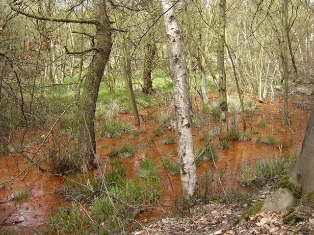
Parrot's Drumble
Wildlife reserves · 1.0 km

Harecastle
Villages · 1.6 km

Castle Hill Motte
Literary houses · 2.1 km

Audley Castle
Castles · 2.1 km

Audley Castle Hill
Castles · 2.1 km

Chesterton, Staffordshire
Towns & cities · 2.2 km

Audley Theatre
Theatres · 2.2 km

Audley War Memorial
Memorials & monuments · 2.2 km
Chesterton War Memorial
Memorials & monuments · 2.3 km

Audley, Staffordshire
Other places · 2.4 km
Nearby
📷 3Memorials & monuments · West Midlands
Wedgwood's Monument
Wedgwood's Monument is a memorial in the United Kingdom.
📷 5Mountains & hills · West Midlands
Bignall Hill
Bignall Hill — mountain in england west midlands. Elevation: 236 m.
📷 3Wildlife reserves · West Midlands
Parrot's Drumble
Parrot's Drumble — nature reserve in Staffordshire, UK.
📷 5📷 5Literary houses · West Midlands
Castle Hill Motte
Castle Hill Motte — a literary house museum in england west midlands.
📷 3Castles · West Midlands
Audley Castle
Audley Castle — a castle in england-west-midlands, United Kingdom.
Where to eat & stay near Bignall Hill
Places to stay
 📷 5
📷 5Hotels · West Midlands
Travelodge
Travelodge — a hotel in england west midlands.
 📷 5
📷 5Hotels · West Midlands
Courtyard by Marriott
Courtyard by Marriott — a hotel in england west midlands. 4-star. Brand: Marriott.
 📷 5
📷 5Hotels · West Midlands
Borough Arms Hotel
Borough Arms Hotel — a hotel in england west midlands.
 📷 5
📷 5Hotels · West Midlands
Hilton Garden Inn Stoke on Trent
Hilton Garden Inn Stoke on Trent — a hotel in england west midlands. 4-star. Brand: Hilton Garden Inn.
 📷 5
📷 5Caravan parks · West Midlands
Meadow Stile Caravan Park
Meadow Stile Caravan Park — a caravan park in england west midlands.
 📷 5
📷 5Places to eat & drink
 📷 5
📷 5Historic pubs · West Midlands
The Vine Public House
The Vine Public House in England North West, United Kingdom.
 📷 3
📷 3Historic pubs · West Midlands
Duke William
Duke William — Historic pub — listed building or notable heritage status.
 📷 5
📷 5Historic pubs · West Midlands
Leopard Public House
Leopard Public House in England North West, United Kingdom.
 📷 5
📷 5Historic pubs · North West England
The Wine Vaults Public House
The Wine Vaults Public House in England North West, United Kingdom.
 📷 5
📷 5 📷 5
📷 5Historic pubs · West Midlands
The Old Greyhound Public House
The Old Greyhound Public House in England North West, United Kingdom.
More memorials in this region
 📷 3
📷 3Memorials & monuments · North West England
3rd Duke of Bridgewater's monument
3rd Duke of Bridgewater's monument — Monument, dating to 1905.
 📷 3
📷 3Memorials & monuments · North West England
Airborne Forces Memorial
Airborne Forces Memorial is a memorial in the United Kingdom.
 📷 4
📷 4Memorials & monuments · North West England
Albert Memorial
Albert Memorial — Monument, dating to 1869.
 📷 3
📷 3Memorials & monuments · North West England
Armada Beacon
Armada Beacon is a memorial in the United Kingdom.
Frequently asked questions
- Where is Bignall Hill?
- Bignall Hill is in Staffordshire, North-West England, United Kingdom (postcode ST5 7AG), in the parish of Newcastle-under-Lyme, unparished area.
- What is Bignall Hill?
- Bignall Hill, Staffordshire is a local landmark, and forms part of an escarpment ridge 4 miles (6.4 km) north-west of Newcastle-under-Lyme. It is classed as a sub HuMP. There is a large stone monument
- How do I get to Bignall Hill?
- The nearest railway station is Apedale Road, about 2.5 km away. Drivers can use postcode ST5 7AG.
- Who owns Bignall Hill?
- Bignall Hill is owned by | designation =.
- Is Bignall Hill free to visit?
- Yes, Bignall Hill is free to enter.
- How do I get to Bignall Hill?
- The nearest railway station is Apedale Road, about 2.5 km away. Drivers can navigate to postcode ST5 7AG.