
Natural landmarks · Northern Ireland
Newry railway station
Also known as: Gorsaf reilffordd Newry, Stáisiún Traenach Iúr Cinn Trá
In or near Newry.
Newry railway station in Northern Ireland, United Kingdom.

Eric Jones — CC BY-SA 2.0 via Wikimedia Commons licence

Plan your visit
- Typical visit
- 1 h–2 h
- Nearest railway station
- Newry · 0.0 km
- Free entry
- Dog-friendly
- Wheelchair accessible
Getting there & planning your visit
To visit Newry railway station, the nearest railway station is Newry, located 0 km away. The postcode for the area is BT35 6FX, and entry is free.
About
Newry railway station is a place of interest in Northern Ireland, United Kingdom — drawn from open-data sources for visitor reference. See the linked Wikipedia article for the full description.
Photo gallery
360° viewimagery from 2025
Imagery © Mapillary contributors, CC BY-SA 4.0
Official information
Newry railway station is a key transport hub in Newry, providing access to various train services. It features facilities such as ticket purchasing options, step-free access, and public toilets for passenger convenience.
From the Wikipedia article
Newry railway station (Irish: Stáisiún Traenach Iúr Cinn Trá) serves the city of Newry and the village of Bessbrook in Northern Ireland. The station is located in the northwest of Newry, County Armagh on the Dublin-Belfast line close to the Craigmore Viaduct. It is the most southerly railway station in Northern Ireland. The current station building (constructed in 2009) features 2 platforms that are accessible by a footbridge with lifts and inside the station concourse there is a ticket office and ticket machines, as well as toilets, vending machines and seats. The entrance to the platforms from the station concourse is closed off by a gate which is only opened by staff members around 10 minutes before scheduled departures. Translink Ulsterbus operates a free of charge bus service from outside the station to Newry city centre for rail ticket holders.
Excerpt from Wikipedia under CC BY-SA 4.0. See the source article linked in Sources below.
Background
History
1910]]}} The port of Newry was already a transport hub by 1742 with the opening of the Newry Canal to Lough Neagh. By the start of the twentieth century Newry had become a railway hub, with the Belfast to Dublin line passing to the west of the town, while lines from the ports of Warrenpoint and Greenore either side of Carlingford Lough converged closer to the centre of town where stations were more conveniently situated. All converged at to the north of Newry where a line also diverged off to the north-west towards Armagh. The current Newry station originally opened in 1855 as Newry Main Line, renamed Bessbrook & Newry Main Line in 1866, renamed again as Bessbrook in 1880 before closing in…
Sourced from Wikipedia under CC BY-SA 4.0.
- Coordinates
- 54.1885, -6.3625
- District
- Newry, Mourne and Down
- Postcode
- BT35 6FX
- Parliamentary constituency
- Newry and Armagh
- Phone
- 02830 256 446
- Nearest railway station
- Newry — 0 km
- Official site
- www.translink.co.uk
Sources
- wikidata: Q2057783 (CC0)
- wikipedia: Newry railway station (CC BY-SA 4.0)
Other places nearby
.jpg?width=1200)
MacNeill's Egyptian Arch
Historic bridges · 0.3 km

Millvale
Natural landmarks · 1.0 km
Derrymore House
Historic houses · 1.0 km

Daisy Hill Hospital
Natural landmarks · 1.2 km
Newry Bosco GFC
Natural landmarks · 1.4 km

St Colman's College, Newry
Historic churches · 1.4 km

St. Joseph's Boys' High School, Newry
Historic churches · 1.5 km

Newry Fault
Natural landmarks · 1.6 km

Newry
Towns & cities · 1.7 km

Linenhall Arch
Memorials & monuments · 1.8 km

St. Paul's High School, Bessbrook
Historic churches · 1.8 km

Patrick Rankin
Memorials & monuments · 1.9 km
Nearby
📷 3Historic bridges · Northern Ireland
MacNeill's Egyptian Arch
MacNeill's Egyptian Arch is a historic bridge in the United Kingdom.
📷 3📷 3Historic houses · Northern Ireland
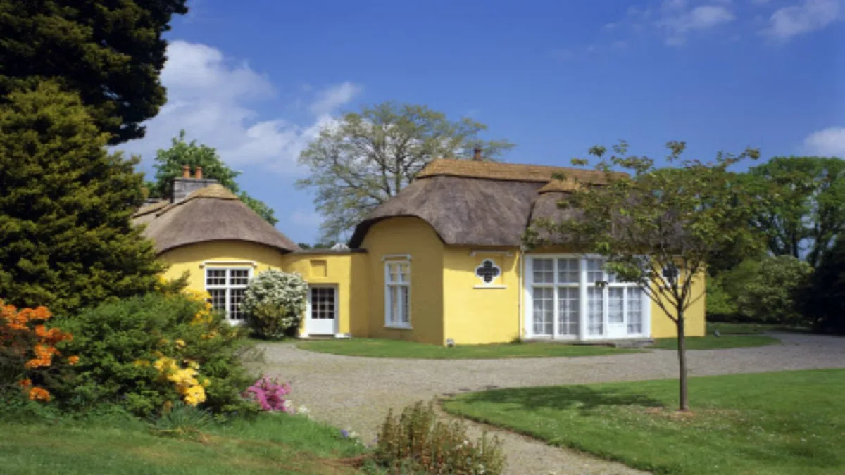
Derrymore House
Derrymore House — National Trust property.
📷 4Natural landmarks · Northern Ireland
Daisy Hill Hospital
Daisy Hill Hospital in Northern Ireland, United Kingdom.
📷 3Natural landmarks · Northern Ireland
Newry Bosco GFC
Newry Bosco GFC in Northern Ireland, United Kingdom.
📷 3Historic churches · Northern Ireland
St Colman's College, Newry
St Colman's College, Newry in Northern Ireland, United Kingdom.
Where to eat & stay near Newry railway station
Places to stay
 📷 5
📷 5Caravan parks · Northern Ireland
Slieve Gullion Getaways
Slieve Gullion Getaways — a caravan park in northern ireland.
 📷 5
📷 5Hostels · Northern Ireland
Kilbroney Youth Centre C.O.I
Kilbroney Youth Centre C.O.I — a hostel in northern ireland.
 📷 5
📷 5Caravan parks · Northern Ireland
Touring in the Trees - Kilbroney
Touring in the Trees - Kilbroney — a caravan park in northern ireland.
 📷 5
📷 5Caravan parks · Northern Ireland
Kilbroney Caravan Park
Kilbroney Caravan Park — a caravan park in northern ireland.
 📷 5
📷 5 📷 5
📷 5More natural landmarks in this region
 Flagship📷 4
Natural landmarks · Northern Ireland
Lough Erne
Lough Erne — lake in County Fermanagh, Northern Ireland, UK.
 Flagship📷 4
Natural landmarks · Northern Ireland
Lough Neagh
Lough Neagh — large lake in Northern Ireland.
 📷 3
📷 3Natural landmarks · Northern Ireland
Ballysaggart Lough
Ballysaggart Lough — lake in the United Kingdom.
 📷 5
📷 5Natural landmarks · Northern Ireland
Belmore Mountain
Belmore Mountain — mountain in the United Kingdom.
Frequently asked questions
- Where is Newry railway station?
- Newry railway station is in Northern Ireland, United Kingdom (postcode BT35 6FX).
- What is Newry railway station?
- Newry railway station in Northern Ireland, United Kingdom.
- How do I get to Newry railway station?
- The nearest railway station is Newry, about 0.0 km away. Drivers can use postcode BT35 6FX.
- Who owns Newry railway station?
- Newry railway station is owned by NI Railways.
- Is Newry railway station free to visit?
- Yes, Newry railway station is free to enter.
- How do I get to Newry railway station?
- The nearest railway station is Newry, about 0.0 km away. Drivers can navigate to postcode BT35 6FX.