
Memorials & monuments · South East England
Battle Abbey & Battlefield
Also known as: Battle of Hastings, Senlac Hill, Brwydr Hastings, Cath Hastings
In or near Whatlington.
The 1066 battlefield that ended Anglo-Saxon England.

Wikimedia Commons contributors — see linked file page for photographer and licence licence

Plan your visit
- Typical visit
- 15 min–45 min
- Nearest railway station
- Battle · 0.5 km
- Free entry
- Dog-friendly
Getting there & planning your visit
To visit Battle Abbey & Battlefield, the nearest railway station is Battle, which is 0.5 km away. Entry is free, and the postcode for sat-nav is TN33 0SP.
About
The Battle of Hastings was fought on 14 October 1066 — the most consequential single day in English history, ending Anglo-Saxon rule and beginning the Norman conquest. The high altar of the abbey William the Conqueror founded on the battlefield is reputed to mark the spot where Harold Godwinson was killed by an arrow in the eye. English Heritage runs the visitor centre at Battle (the town that grew up around the abbey).
Photo gallery
Summary from the official site
Battle Abbey & Battlefield is the historic site of the 1066 Battle of Hastings, where visitors can explore the abbey ruins and walk the battlefield. The site features interactive displays in the visitor centre and an audio tour, providing insights into the famous battle and its aftermath.
Read more on the official property page.
Protected designations
- Area of Outstanding Natural Beauty: High Weald
Designations sourced from Natural England open data under OGL v3.
From the Wikipedia article
The Battle of Hastings was fought on 14 October 1066 between the Norman-French army of William, Duke of Normandy, and an English army under the Anglo-Saxon King Harold Godwinson, beginning the Norman Conquest of England. It took place approximately 7 mi (11 km) northwest of Hastings, close to the present-day town of Battle, East Sussex, and was a decisive Norman victory. The background to the battle was the death of the childless King Edward the Confessor in January 1066, which set up a succession struggle between several claimants to his throne. Harold was crowned king shortly after Edward's death but faced invasions by William, his own brother Tostig, and the Norwegian king Harald Hardrada (Harold III of Norway). Hardrada and Tostig defeated a hastily gathered army of Englishmen at the Battle of Fulford on 20 September 1066. They were in turn defeated by Harold at the Battle of Stamford Bridge on 25 September. The deaths of Tostig and Hardrada at Stamford Bridge left William as Harold's only serious opponent. While Harold and his forces were recovering, William landed his invasion forces in the south of England at Pevensey on 28 September and established a beachhead for his conquest of the kingdom. Harold was forced to march south swiftly, gathering forces as he went. The numbers present at the battle are unknown as even modern estimates vary considerably. The composition of the forces is clearer: the English army was composed almost entirely of infantry and had few archers, whereas only about half of the invading force was infantry, the rest split equally between cavalry and archers. Harold appears to have tried to surprise William, but scouts found his army and reported its arrival to William, who marched from Hastings to the battlefield to confront Harold. The battle lasted from about 9 am to dusk. Early efforts of the invaders to break the English battle lines had little effect. Therefore, the Normans adopted the tactic of pretending to flee in panic and then…
Excerpt from Wikipedia under CC BY-SA 4.0. See the source article linked in Sources below.
Background
History
In 911, the Carolingian ruler Charles the Simple allowed a group of Vikings to settle in Normandy under their leader Rollo. Their settlement proved successful,}} and they quickly adapted to the indigenous culture, renouncing paganism, converting to Christianity, and intermarrying with the local population. Over time, the frontiers of the duchy expanded to the west. In 1002, King Æthelred II married Emma, the sister of Richard II, Duke of Normandy. Their son Edward the Confessor spent many years in exile in Normandy and succeeded to the English throne in 1042. This led to the establishment of a powerful Norman interest in English politics, as Edward drew heavily on his former hosts for…
Sourced from Wikipedia under CC BY-SA 4.0.
- Coordinates
- 50.9119, 0.4878
- County
- East Sussex
- District
- Rother
- Parish
- Battle
- Postcode
- TN33 0SP
- Parliamentary constituency
- Bexhill and Battle
- Nearest railway station
- Battle — 0.5 km
- Opening
- Daily 10am–5pm; last entry at 4pm
- Official site
- www.english-heritage.org.uk
Sources
- osm: n455631093 (ODbL)
- wikipedia: Battle of Hastings (CC BY-SA 4.0)
- commons: Bayeux Tapestry scene57 Harold death.jpg (CC BY-SA 4.0)
Featured in these 2 guides
Other places nearby

Battle Abbey Latrines
Abbeys & priories · 0.2 km

Battle Abbey Dormitory
Abbeys & priories · 0.2 km

Battle Abbey Inner Parlour
Abbeys & priories · 0.3 km
Battle Abbey Chapter House
Abbeys & priories · 0.3 km
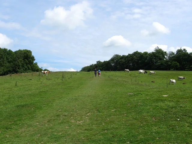
Senlac Hill
Mountains & hills · 0.3 km

Battle Abbey Chapel Crypt
Abbeys & priories · 0.3 km
The Harold Stone
Memorials & monuments · 0.3 km

Battle Abbey Church Site
Abbeys & priories · 0.3 km

Abbey Theatre
Theatres · 0.3 km

Battle War Memorial
Memorials & monuments · 0.3 km

Lake Field
Viewpoints · 0.4 km

Battle Abbey
Museums · 0.4 km
Nearby
📷 5Abbeys & priories · South East England
Battle Abbey Latrines
Battle Abbey Latrines — a abbey in england-south-east, United Kingdom.
📷 5Abbeys & priories · South East England
Battle Abbey Dormitory
Battle Abbey Dormitory — a abbey in england-south-east, United Kingdom.
📷 5Abbeys & priories · South East England
Battle Abbey Inner Parlour
Battle Abbey Inner Parlour — a abbey in england-south-east, United Kingdom.
📷 5Abbeys & priories · South East England
Battle Abbey Chapter House
Battle Abbey Chapter House — a abbey in england-south-east, United Kingdom.
📷 5Mountains & hills · South East England
Senlac Hill
Senlac Hill — Named summit at 84 m.
📷 5Abbeys & priories · South East England
Battle Abbey Chapel Crypt
Battle Abbey Chapel Crypt — a abbey in england-south-east, United Kingdom.
Where to eat & stay near Battle Abbey & Battlefield
Places to stay
 📷 5
📷 5Campsites · South East England
Uckham Lane Nurseries Caravan Site
Uckham Lane Nurseries Caravan Site — a campsite in england south east.
 📷 5
📷 5Campsites · South East England
Bluebell Coppice Park
Bluebell Coppice Park — a campsite in england south east.
 📷 5
📷 5Caravan parks · South East England
Crowhurst Park
Crowhurst Park — a caravan park in england south east.

Campsites · South East England
Senlac Wood Caravan & Camping
Senlac Wood Caravan & Camping — a campsite in england south east.
 📷 5
📷 5Caravan parks · South East England
Meadowview Park
Meadowview Park — a caravan park in england south east.
 📷 5
📷 5Campsites · South East England
Riverdale Cottage
Riverdale Cottage — a campsite in england south east.
Places to eat & drink
 📷 7
📷 7 📷 7
📷 7Historic pubs · South East England
John's Cross Public House
John's Cross Public House in England South East, United Kingdom.
 📷 5
📷 5Cafés · South East England
The Old Town Tea Room
The Old Town Tea Room — a café in england south east.
 📷 5
📷 5Historic pubs · South East England
The Red Lion Inn
The Red Lion Inn in England South East, United Kingdom.
 📷 5
📷 5 📷 5
📷 5Historic pubs · South East England
The Seven Stars Inn
The Seven Stars Inn is a 14th-century public house in Robertsbridge, East Sussex, a well-preserved example of a medieval building and a typical Sussex village pub. It is associated with historical eve
Other memorials from this era
 📷 5
📷 5Memorials & monuments · South East England
St Catherine's Oratory
St Catherine's Oratory is a memorial in the United Kingdom.
 ★ Iconic📷 5
Memorials & monuments · East Midlands
Bosworth Battlefield
Where Richard III fell to Henry Tudor on 22 August 1485.
 Flagship📷 4
Memorials & monuments · Central Scotland
Bannockburn Battlefield
Where Robert the Bruce broke Edward II in 1314.
More memorials in this region
 📷 5
📷 5Memorials & monuments · South East England
Air Forces Memorial
Air Forces Memorial is a memorial in the United Kingdom.
 📷 5
📷 5Memorials & monuments · South East England
All Saints Church
All Saints Church is a memorial in the United Kingdom.
 📷 5
📷 5Memorials & monuments · South East England
Bevans War Memorial
Bevans War Memorial is a memorial in the United Kingdom.
.jpg?width=1200) 📷 5
📷 5Memorials & monuments · South East England
Cumberland Obelisk
Cumberland Obelisk is a memorial in the United Kingdom.
Frequently asked questions
- Where is Battle Abbey & Battlefield?
- Battle Abbey & Battlefield is in East Sussex, South-East England, United Kingdom (postcode TN33 0SP), in the parish of Battle.
- What is Battle Abbey & Battlefield?
- The 1066 battlefield that ended Anglo-Saxon England.
- How do I get to Battle Abbey & Battlefield?
- The nearest railway station is Battle, about 0.5 km away. Drivers can use postcode TN33 0SP.
- When was Battle Abbey & Battlefield built?
- Dates from the medieval period.
- Is Battle Abbey & Battlefield a protected site?
- Yes — Battle Abbey & Battlefield is part of the High Weald National Landscape (AONB).
- Is Battle Abbey & Battlefield free to visit?
- Yes, Battle Abbey & Battlefield is free to enter.
- How do I get to Battle Abbey & Battlefield?
- The nearest railway station is Battle, about 0.5 km away. Drivers can navigate to postcode TN33 0SP.