
Memorials & monuments · Central Scotland
Bannockburn Battlefield
Also known as: Battle of Bannockburn, Brwydr Bannockburn, Cath Allt a' Bhonnaich, Blàr Allt a' Bhonnaich
In or near Stirling.
Where Robert the Bruce broke Edward II in 1314.

Daniel Stuart — CC BY-SA 2.0 via Wikimedia Commons licence

Plan your visit
- Typical visit
- 15 min–45 min
- Nearest railway station
- Stirling · 3.6 km
- Free entry
- Dog-friendly
Getting there & planning your visit
To visit Bannockburn Battlefield, the nearest railway station is Stirling, located 3.6 km away. The postcode for the site is FK7 8NL, and entry is free.
About
Bannockburn is the field south of Stirling where Robert the Bruce's Scottish army defeated Edward II of England on 23–24 June 1314, securing Scottish independence for the next four centuries. The visitor centre, jointly run by the National Trust for Scotland and Historic Environment Scotland, has a 3D battle simulation; the equestrian statue of Bruce by Pilkington Jackson stands on a low hill overlooking the actual battle area.
Photo gallery
From the Wikipedia article
The Battle of Bannockburn (Scottish Gaelic: Blàr Allt nam Bànag or Blàr Allt a' Bhonnaich) was fought on 23–24 June 1314, between the army of Robert the Bruce, King of Scots, and the army of King Edward II of England, during the First War of Scottish Independence. It was a decisive victory for Robert Bruce and formed a major turning point in the war, which ended 14 years later with the de jure restoration of Scottish independence under the Treaty of Edinburgh–Northampton. For this reason, the Battle of Bannockburn is widely considered a landmark moment in Scottish history. King Edward II invaded Scotland after Bruce demanded in 1313 that all supporters still loyal to ousted Scottish king John Balliol acknowledge Bruce as their king or lose their lands. Stirling Castle, a Scots royal fortress occupied by the English, was under siege by the Scottish army. King Edward assembled a formidable force of soldiers to relieve it—the largest army ever to invade Scotland. The English summoned 25,000 infantry soldiers and 2,000 horses from England, Ireland and Wales against 6,000 Scottish soldiers, that Bruce had divided into three different contingents. Edward's attempt to raise the siege failed when he found his path blocked by a smaller army commanded by Bruce. The Scottish army was divided into four divisions of schiltrons commanded by (1) Bruce, (2) his brother Edward Bruce, (3) his nephew, Thomas Randolph, the Earl of Moray, and (4) one jointly commanded by Sir James Douglas and the young Walter the Steward. Bruce's friend, Angus Og Macdonald, Lord of the Isles, brought thousands of Islesmen to Bannockburn, including galloglass warriors, and King Robert assigned them the place of honour at his side in his own schiltron with the men of Carrick and Argyll. After Robert Bruce killed Sir Henry de Bohun on the first day of the battle, the English withdrew for the day. That night, Sir Alexander Seton, a Scottish noble serving in Edward's army, defected to the Scottish side and…
Excerpt from Wikipedia under CC BY-SA 4.0. See the source article linked in Sources below.
Background
History
Edward I had wanted to expand England to prevent a foreign power such as France from capturing territories in the British Isles. But he needed Scotland's allegiance, which led to his campaign to capture Scotland. The Wars of Scottish Independence between England and Scotland began in 1296. Initially, the English were successful under the command of Edward I: they won victories at the Battle of Dunbar (1296) and at the Capture of Berwick (1296). The removal of John Balliol from the Scottish throne also contributed to the English success.
Sourced from Wikipedia under CC BY-SA 4.0.
- Coordinates
- 56.0884, -3.9200
- District
- Stirling
- Postcode
- FK7 8NL
- Parliamentary constituency
- Stirling and Strathallan
- Nearest railway station
- Stirling — 3.6 km
Sources
- manual: bannockburn (manual)
- wikipedia: Battle of Bannockburn (CC BY-SA 4.0)
Other places nearby

Site of the Battle of Bannock Burn on the first of two days of battle
Forts · 0.4 km

Old Bridge, Bannockburn
Historic bridges · 0.4 km

1A Main Street, Bannockburn
Historic churches · 0.5 km
Allan Church, Main Street, Bannockburn
Historic churches · 0.5 km
New Road Bridge, Bannockburn
Historic bridges · 0.5 km

Broomridge
Other places · 0.6 km

St Ninian's Roman Catholic Church, Quakerfield, Bannockburn
Historic churches · 0.7 km

Corbiewood Stadium
Stadiums · 0.7 km

Lower Greenyards
Vineyards · 1.0 km

Bannockburn House
Historic houses · 1.2 km

Bannockburn Monument
Memorials & monuments · 1.2 km
Bannockburn Cairn
Memorials & monuments · 1.2 km
Nearby
📷 3Forts · Central Scotland
Site of the Battle of Bannock Burn on the first of two days of battle
Site of the Battle of Bannock Burn on the first of two days of battle — Battlefield site, dating to 1314-06-23.
📷 5Historic bridges · Central Scotland
Old Bridge, Bannockburn
Old Bridge, Bannockburn — category B listed building-listed bridge in scotland-central, United Kingdom.
📷 5Historic churches · Central Scotland
1A Main Street, Bannockburn
1A Main Street, Bannockburn — category C listed building-listed church in scotland-central, United Kingdom.
📷 5Historic churches · Central Scotland
Allan Church, Main Street, Bannockburn
Allan Church, Main Street, Bannockburn — category B listed building-listed church in scotland-central, United Kingdom.
📷 5Historic bridges · Central Scotland
New Road Bridge, Bannockburn
New Road Bridge, Bannockburn — category B listed building-listed bridge in scotland-central, United Kingdom.
📷 4Where to eat & stay near Bannockburn Battlefield
Places to stay
 📷 5
📷 5Hostels · Central Scotland
William Wallace Hotel
William Wallace Hotel — a hostel in scotland central.
 📷 5
📷 5Hostels · Central Scotland
Stirling Youth Hostel
Stirling Youth Hostel — a hostel in scotland central.
 📷 5
📷 5Hotels · Central Scotland
Stirling Court Hotel
Stirling Court Hotel — a hotel in scotland central.
 📷 5
📷 5Campsites · Central Scotland
Witches Craig Caravan and Camping Park
Witches Craig Caravan and Camping Park — a campsite in scotland central.
 📷 5
📷 5Hotels · Central Scotland
Glenbervie House Hotel
Glenbervie House Hotel — a hotel in scotland central.
 📷 5
📷 5Places to eat & drink
 📷 6
📷 6Historic pubs · Central Scotland
The Gothenburg
The Gothenburg in Scotland Islands, United Kingdom.
 📷 6
📷 6Historic pubs · Central Scotland
Westerton Arms, 34 Henderson Street, Bridge of Allan
Westerton Arms, 34 Henderson Street, Bridge of Allan in Scotland Central, United Kingdom.
 📷 5
📷 5Historic pubs · Central Scotland
Dennyloanhead
Dennyloanhead in Scotland Islands, United Kingdom.
 📷 7
📷 7Historic pubs · Central Scotland
Johnstone Arms Hotel, 48 Stirling Street, Alva
Johnstone Arms Hotel, 48 Stirling Street, Alva in Scotland Central, United Kingdom.
 📷 7
📷 7Historic pubs · Central Scotland
Ye Olde House Inn, 25-26 Forth Street, Kincardine On Forth
Ye Olde House Inn, 25-26 Forth Street, Kincardine On Forth in Scotland Central, United Kingdom.
 📷 5
📷 5Historic pubs · Central Scotland
The Masonic Arms, 62 Main Street, Cumbernauld Village
The Masonic Arms, 62 Main Street, Cumbernauld Village in Scotland Central, United Kingdom.
Other memorials from this era
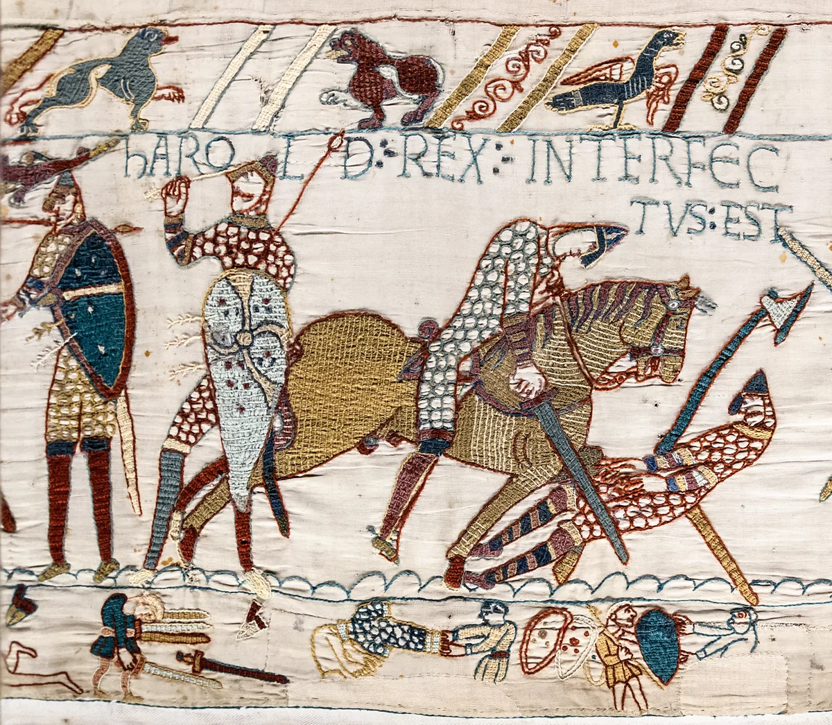 ★ Iconic📷 10
Memorials & monuments · South East England
Battle Abbey & Battlefield
The 1066 battlefield that ended Anglo-Saxon England.
 📷 5
📷 5Memorials & monuments · South East England
St Catherine's Oratory
St Catherine's Oratory is a memorial in the United Kingdom.
 ★ Iconic📷 5
Memorials & monuments · East Midlands
Bosworth Battlefield
Where Richard III fell to Henry Tudor on 22 August 1485.
More memorials in this region
 📷 3
📷 3Memorials & monuments · Central Scotland
Mutiny Stones
Mutiny Stones in England North East, United Kingdom.
 📷 3
📷 3Memorials & monuments · Central Scotland
Augusta, Princess Dowager of Wales Monument
Augusta, Princess Dowager of Wales Monument is a memorial in the United Kingdom.
 📷 3
📷 3Memorials & monuments · Central Scotland
Battle of Largs Monument
Battle of Largs Monument — Monument, dating to 1912.
 📷 3
📷 3Memorials & monuments · Central Scotland
Declaration of Arbroath Monument
Declaration of Arbroath Monument is a memorial in the United Kingdom.
Frequently asked questions
- Where is Bannockburn Battlefield?
- Bannockburn Battlefield is in central Scotland, United Kingdom (postcode FK7 8NL).
- What is Bannockburn Battlefield?
- Where Robert the Bruce broke Edward II in 1314.
- How do I get to Bannockburn Battlefield?
- The nearest railway station is Stirling, about 3.6 km away. Drivers can use postcode FK7 8NL.
- When was Bannockburn Battlefield built?
- Dates from the medieval period.
- Is Bannockburn Battlefield free to visit?
- Yes, Bannockburn Battlefield is free to enter.
- How do I get to Bannockburn Battlefield?
- The nearest railway station is Stirling, about 3.6 km away. Drivers can navigate to postcode FK7 8NL.