
Historic houses · London
Battle of Britain House
In or near Batchworth.
Battle of Britain House — building in Greater London, England.

Wikimedia Commons licence
Plan your visit
- Typical visit
- 1 h–2 h
- Nearest railway station
- Willow Lawn · 0.4 km
- Family-friendly
Getting there & planning your visit
To visit the Battle of Britain House, the nearest railway station is Willow Lawn, located 0.4 km away. The postcode for sat-nav is HA4 7TS. Please note that the venue is not wheelchair accessible.
About
Battle of Britain House is a historic house in the United Kingdom — typically a country seat, manor, or town house with notable architecture or history. Records date its origin to 1905. Wikidata describes it as: "building in Greater London, England". Coordinates: 51.5942°, -0.4372°.
Photo gallery
Protected designations
- Site of Special Scientific Interest: Ruislip Woods SSSI
- National Nature Reserve: RUISLIP WOODS
- Area of Outstanding Natural Beauty: Chilterns
Designations sourced from Natural England open data under OGL v3.
From the Wikipedia article
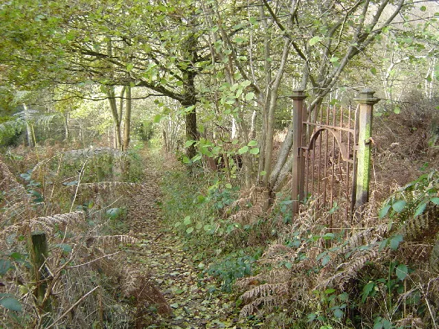
Battle of Britain House, also known over time as Franklin House and Kokyo, was a private mansion in Ruislip. It was used by the United States military to train agents for undercover missions in occupied France during the Second World War. After the war, the house was dedicated as a memorial to the Royal Air Force squadrons involved in the Battle of Britain. It also became a residential college and headquarters to the Ruislip & District Natural History Society. The house was destroyed by fire in 1984 and demolished; in 1993 the site was cleared to allow it to be reclaimed by nature.
Excerpt from Wikipedia under CC BY-SA 4.0. See the source article linked in Sources below.
Background
History
The house was built by Josef Conn in 1905, after he had received a lease from King's College, Cambridge, the owners of much of the land in Ruislip, to build within Copse Wood. At the time of building, it was possible to view the reservoir of what would become Ruislip Lido, and the church of Harrow on the Hill, St. Mary's. Meyer Franklin Kline, an American shipping magnate, took over the lease from Conn in 1920. He first renamed the house "Kokyo" to reflect his company's presence in Asia, followed by "Franklin House", after President Franklin D. Roosevelt. During his ownership, Kline had various ornaments from the Far East placed around the gardens, and had furniture built for the house…
Sourced from Wikipedia under CC BY-SA 4.0.
- Coordinates
- 51.5942, -0.4372
- District
- Hillingdon
- Parish
- Hillingdon, unparished area
- Postcode
- HA4 7TS
- Parliamentary constituency
- Ruislip, Northwood and Pinner
- Established
- 1905
- Nearest railway station
- Willow Lawn — 0.4 km
- Opening
- 24/7
Sources
- wikidata: Q4870557 (CC0)
- wikipedia: Battle of Britain House (CC BY-SA 4.0)
Other places nearby

Water treatment
Historic houses · 0.2 km
Ruislip Lido Railway
Miniature railways · 0.4 km
Ruislip Woods
Archaeological sites · 0.5 km

Ruislip Lido
Reservoirs & lochs · 0.6 km

Breakspear Crematorium
Cemeteries · 0.7 km

The Willow Tree Centre
Campsites · 1.0 km

Northwood Cemetery
Cemeteries · 1.5 km

Northwood
Chapels · 1.6 km

Commonwealth War Memorial
Memorials & monuments · 1.6 km

Winston Churchilll Hall
Theatres · 1.8 km

Manor Farm Complex
Museums · 1.8 km
Manor Farm House
Museums · 1.8 km
Nearby
📷 5Historic houses · London
Water treatment
Water treatment — a historic house in england-london, United Kingdom.
📷 5Miniature railways · London
Ruislip Lido Railway
Ruislip Lido Railway — a miniature railway in england-london, United Kingdom.
📷 5📷 5Reservoirs & lochs · London
Ruislip Lido
Ruislip Lido — reservoir and artificial beach in London.
📷 5Cemeteries · London
Breakspear Crematorium
Breakspear Crematorium is a cemetery in the United Kingdom.
📷 5Where to eat & stay near Battle of Britain House
Places to stay
📷 5 📷 5
📷 5 📷 5
📷 5Caravan parks · London
Wyatt's Covert Caravan Site
Wyatt's Covert Caravan Site — a caravan park in england london.
 📷 5
📷 5 📷 5
📷 5 📷 5
📷 5Campsites · East of England
Diogenes Sun Club
Diogenes Sun Club — a campsite in england west midlands.
Places to eat & drink
 📷 5
📷 5 📷 5
📷 5 📷 5
📷 5 📷 7
📷 7Restaurants · London
The White Bear
The White Bear — a restaurant in england london.
 📷 5
📷 5Historic pubs · London
Ye Old Greene Manne Public House
Ye Old Greene Manne Public House in England London, United Kingdom.
 📷 5
📷 5Historic pubs · London
The Hand In Hand Public House
The Hand In Hand Public House in England London, United Kingdom.
Other historic houses from this era
 📷 5
📷 5Historic houses · London
10, Palace Green W8
10, Palace Green W8 — building in Kensington and Chelsea, London, England, UK.
 📷 5
📷 5Historic houses · London
15 Church Row
15 Church Row — 20th-century house in Hampstead, London NW3.
 📷 5
📷 5Historic houses · London
22 Weymouth Street
22 Weymouth Street — grade II listed house in City of Westminster, United Kingdom.
.jpg?width=1200) 📷 5
📷 5More historic houses in this region
 Flagship📷 10
Historic houses · London
Strawberry Hill House
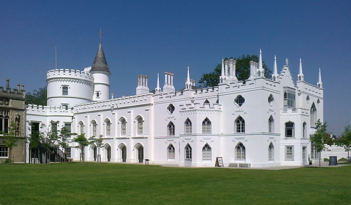
Strawberry Hill House — villa and house museum in Twickenham, London, United Kingdom.
 📷 5
📷 5Historic houses · London
1 Old Palace Terrace
1 Old Palace Terrace — house in Richmond upon Thames, London, United Kingdom.
 📷 5
📷 5Historic houses · London
1 Palace Green
1 Palace Green — house on Palace Green, Kensington, London.
 📷 5
📷 5Historic houses · London
1–2 Orme Square
1–2 Orme Square — pair of houses in Orme Square, Bayswater, London.
Frequently asked questions
- Where is Battle of Britain House?
- Battle of Britain House is in London, United Kingdom (postcode HA4 7TS), in the parish of Hillingdon, unparished area.
- What is Battle of Britain House?
- Battle of Britain House — building in Greater London, England.
- How do I get to Battle of Britain House?
- The nearest railway station is Willow Lawn, about 0.4 km away. The nearest town is Batchworth. Drivers can use postcode HA4 7TS.
- When was Battle of Britain House built?
- Built or established in 1905.
- Is Battle of Britain House a protected site?
- Yes — Battle of Britain House is part of the Ruislip Woods SSSI Site of Special Scientific Interest and the RUISLIP WOODS National Nature Reserve.
- How do I get to Battle of Britain House?
- The nearest railway station is Willow Lawn, about 0.4 km away. Drivers can navigate to postcode HA4 7TS.