
Museums · South East England
Battle, East Sussex
In or near Whatlington.
Battle is a town and civil parish in the district of Rother in East Sussex, England. It lies 50 miles (80 km) south-east of London, 27 miles (43 km) east of Brighton and 20 miles (32 km) east of Lewes

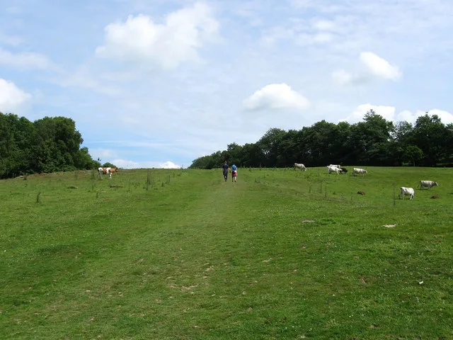
Simon Carey — CC BY-SA 2.0 via Wikimedia Commons licence

Plan your visit
- Typical visit
- 1.5 h–3 h
- Best time of year
- Year-round
- Nearest railway station
- Battle · 1.3 km
- Family-friendly
- Limited wheelchair access
Getting there & planning your visit
To visit the museum in Battle, East Sussex, the nearest railway station is Battle, located 1.3 km away. The postcode for sat-nav is TN33 0YD. Please note that wheelchair accessibility is limited.
About
Battle is a town and civil parish in the district of Rother in East Sussex, England. It lies 50 miles (80 km) south-east of London, 27 miles (43 km) east of Brighton and 20 miles (32 km) east of Lewes. Hastings is to the south-east and Bexhill-on-Sea to the south. Battle is in the designated High Weald National Landscape. The parish population was 6,673 according to the 2011 Census and 6,800 in the 2021 census. Battle contains the site of, and is named after, the Battle of Hastings, where William, Duke of Normandy, defeated King Harold II to become William I of England in 1066. For some 250 years after 1066, official documents referred to the town as (Latin) Bellum or (French) Bataille.
Photo gallery
Summary from the official site
Battle is historically significant as the site where King Harold fell during the Battle of Hastings, a pivotal event in English history. Visitors can explore the town and learn about its rich heritage related to the 1066 battle.
Read more on the official property page.
Protected designations
- Area of Outstanding Natural Beauty: High Weald
Designations sourced from Natural England open data under OGL v3.
From the Wikipedia article
Battle is a town and civil parish in the district of Rother in East Sussex, England. It lies 50 miles (80 km) south-east of London, 27 miles (43 km) east of Brighton and 20 miles (32 km) east of Lewes. Hastings is to the south-east and Bexhill-on-Sea to the south. Battle is in the designated High Weald National Landscape. The parish population was 6,673 according to the 2011 Census and 6,800 in the 2021 census. Battle contains the site of, and is named after, the Battle of Hastings, where William, Duke of Normandy, defeated King Harold II to become William I of England in 1066. For some 250 years after 1066, official documents referred to the town as (Latin) Bellum or (French) Bataille.
Excerpt from Wikipedia under CC BY-SA 4.0. See the source article linked in Sources below.
Background
History
Prior to 1066, the area had been relatively empty and unpopulated. The nearest settlement was probably located in today's Netherfield ward, within a large, wealthy, ancient hundred called Hailesaltede. The town of Battle grew around an abbey, which was constructed on the orders of King William to commemorate the battle and atone for the resulting slaughter; a settlement probably already existed outside the abbey gates by 1110. The Abbey provided sufficient trade to survive in an otherwise improbable location for a new town and there remain some fine examples of Medieval domestic architecture, for example the Wealden-style hall-houses in Upper Lake, Pilgrim's Rest and others in the High…
Visiting
Tourism in Battle is centered on the town’s association with the Battle of Hastings. Battle forms part of 1066 Country, the destination brand used to promote the eastern part of East Sussex. Its 2024–27 business plan identifies Battle as one of the area’s principal settlements and describes Battle Abbey and battlefield as a major heritage attraction and a central part of the destination’s historical identity. The abbey and battlefield are managed as a visitor attraction by English Heritage. The site includes the battlefield, abbey ruins, medieval gatehouse, a visitor center and exhibitions. English Heritage also stages a Battle of Hastings re-enactment at the site, involving Norman and…
Sourced from Wikipedia under CC BY-SA 4.0.
- Coordinates
- 50.9200, 0.4800
- County
- East Sussex
- District
- Rother
- Parish
- Battle
- Postcode
- TN33 0YD
- Parliamentary constituency
- Bexhill and Battle
- Nearest railway station
- Battle — 1.3 km
- Official site
- www.battletowncouncil.gov.uk
Sources
- wikipedia: Battle, East Sussex (CC BY-SA 4.0)
Other places nearby

Battle Museum of Local History
Museums · 0.3 km
.jpg?width=1200)
The Almonry
Historic houses · 0.3 km

King's Head Mill
Windmills · 0.4 km

Bonney's
Cafés · 0.6 km

Battle Abbey
Museums · 0.7 km

Battle Abbey
Castles · 0.7 km

Bound Division
Public art & sculpture · 0.7 km

Battle War Memorial
Memorials & monuments · 0.8 km
Senlac Hill
Mountains & hills · 0.8 km

Battle Abbey Church Site
Abbeys & priories · 0.8 km

The Harold Stone
Memorials & monuments · 0.8 km

Battle Abbey Chapter House
Abbeys & priories · 0.8 km
Nearby
📷 5Museums · South East England
Battle Museum of Local History
Battle Museum of Local History — a museum in england-south-east, United Kingdom.
📷 5Historic houses · South East England
The Almonry
The Almonry — house in Battle, Rother, England, UK.
📷 5📷 7📷 5Museums · South East England
Battle Abbey
Battle Abbey — a museum in england-south-east, United Kingdom.
📷 5Castles · South East England
Battle Abbey
Battle Abbey — castle in england south east. Operated by English Heritage Trust.
Where to eat & stay near Battle, East Sussex
Places to stay
 📷 5
📷 5Campsites · South East England
Uckham Lane Nurseries Caravan Site
Uckham Lane Nurseries Caravan Site — a campsite in england south east.

Campsites · South East England
Senlac Wood Caravan & Camping
Senlac Wood Caravan & Camping — a campsite in england south east.
 📷 5
📷 5Campsites · South East England
Beech Estate Campsite
Beech Estate Campsite — a campsite in england south east.
 📷 5
📷 5Campsites · South East England
Netherfield Place Farm
Netherfield Place Farm — a campsite in england south east.
 📷 5
📷 5Campsites · South East England
Beech Estate Campsite
Beech Estate Campsite — a campsite in england south east.
 📷 5
📷 5Campsites · South East England
Battle Normanhurst Court
Battle Normanhurst Court — a campsite in england south east.
Places to eat & drink
📷 7 📷 7
📷 7Historic pubs · South East England
John's Cross Public House
John's Cross Public House in England South East, United Kingdom.
 📷 5
📷 5 📷 5
📷 5Historic pubs · South East England
The Seven Stars Inn
The Seven Stars Inn is a 14th-century public house in Robertsbridge, East Sussex, a well-preserved example of a medieval building and a typical Sussex village pub. It is associated with historical eve
 📷 5
📷 5Historic pubs · South East England
The Red Lion Inn
The Red Lion Inn in England South East, United Kingdom.
 📷 5
📷 5Historic pubs · South East England
The Salehurst Halt Public House
The Salehurst Halt Public House in England South East, United Kingdom.
More museums in this region
 📷 5
📷 5Museums · South East England
Coldrum Long Barrow
Coldrum Long Barrow — neolithic chambered long barrow near Trottiscliffe, Kent, England, UK.
 📷 5
📷 5Museums · South East England
Guildford House
Guildford House — house in Guildford, Surrey, England, UK.
 📷 5
📷 5Museums · South East England
Huguenot Museum
Huguenot Museum — museum in Rochester, England, UK.
 📷 5
📷 5Museums · South East England
Medway megaliths
Medway megaliths — group of long barrows in Kent, England.
Frequently asked questions
- Where is Battle, East Sussex?
- Battle, East Sussex is in East Sussex, South-East England, United Kingdom (postcode TN33 0YD), in the parish of Battle.
- What is Battle, East Sussex?
- Battle is a town and civil parish in the district of Rother in East Sussex, England. It lies 50 miles (80 km) south-east of London, 27 miles (43 km) east of Brighton and 20 miles (32 km) east of Lewes
- How do I get to Battle, East Sussex?
- The nearest railway station is Battle, about 1.3 km away. Drivers can use postcode TN33 0YD.
- Is Battle, East Sussex a protected site?
- Yes — Battle, East Sussex is part of the High Weald National Landscape (AONB).
- How do I get to Battle, East Sussex?
- The nearest railway station is Battle, about 1.3 km away. Drivers can navigate to postcode TN33 0YD.