
Historic houses · South East England
The Almonry
In or near Whatlington.
The Almonry — house in Battle, Rother, England, UK.
.jpg?width=1200)
Wikimedia Commons contributors — see linked file page for photographer and licence licence
.jpg)
Plan your visit
- Typical visit
- 1 h–2 h
- Nearest railway station
- Battle · 1.0 km
- Free entry
- Family-friendly
- Wheelchair accessible
About
The Almonry is a historic house in East Sussex, South-East England. Officially recognised as Grade II* listed building. The site is within the High Weald National Landscape (AONB). It sits within the Bexhill and Battle parliamentary constituency. The nearest railway station is Battle, about 1.0 km away. Postcode area TN33.
Photo gallery
See it from the streetimagery from 2020
Imagery © Mapillary contributors, CC BY-SA 4.0
Official information
The Battle Museum of Local History showcases the rich historical heritage of Battle, East Sussex, particularly focusing on the Battle of Hastings. Visitors can explore various collections and exhibitions that highlight the town's development and significance over the centuries.
Protected designations
- Area of Outstanding Natural Beauty: High Weald
Designations sourced from Natural England open data under OGL v3.
Place summary
The Almonry is a Grade II* listed historic house located in Battle, East Sussex, within the High Weald Area of Outstanding Natural Beauty. This notable structure contributes to the region's architectural heritage and is situated in a parish rich in history.
AI-generated from the structured facts on this page (operator, designation, listing, era). Not a substitute for visiting.
- Coordinates
- 50.9177, 0.4833
- County
- East Sussex
- District
- Rother
- Parish
- Battle
- Postcode
- TN33 0EE
- Parliamentary constituency
- Bexhill and Battle
- Nearest railway station
- Battle — 1 km
- Opening
- Tu-Th 10:00-16:00
- Official site
- www.battlelocalhistory.com
Sources
- wikidata: Q17555897 (CC0)
- commons: The Almonry (geograph 2750971).jpg (CC BY-SA 4.0)
Other places nearby

Battle Museum of Local History
Museums · 0.0 km

Bonney's
Cafés · 0.2 km

Battle, East Sussex
Museums · 0.3 km

Battle Abbey
Museums · 0.4 km

Battle Abbey
Castles · 0.4 km

Battle War Memorial
Memorials & monuments · 0.4 km
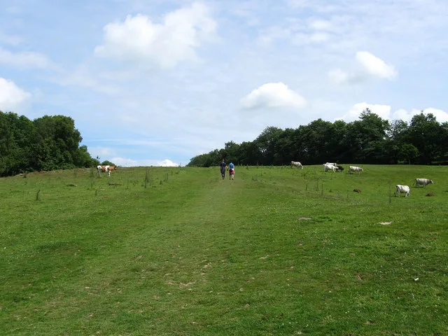
Senlac Hill
Mountains & hills · 0.5 km

Battle Abbey Church Site
Abbeys & priories · 0.5 km

The Harold Stone
Memorials & monuments · 0.5 km

Battle Abbey Chapter House
Abbeys & priories · 0.5 km
Battle Abbey Inner Parlour
Abbeys & priories · 0.5 km
Battle Abbey Chapel Crypt
Abbeys & priories · 0.5 km
Nearby
📷 5Museums · South East England
Battle Museum of Local History
Battle Museum of Local History — a museum in england-south-east, United Kingdom.
📷 7📷 5Museums · South East England
Battle, East Sussex
Battle is a town and civil parish in the district of Rother in East Sussex, England. It lies 50 miles (80 km) south-east of London, 27 miles (43 km) east of Brighton and 20 miles (32 km) east of Lewes
📷 5Museums · South East England
Battle Abbey
Battle Abbey — a museum in england-south-east, United Kingdom.
📷 5Castles · South East England
Battle Abbey
Battle Abbey — castle in england south east. Operated by English Heritage Trust.
📷 5Memorials & monuments · South East England
Battle War Memorial
Battle War Memorial — Grade II listed building-listed memorial in england-south-east, United Kingdom.
Where to eat & stay near The Almonry
Places to stay
 📷 5
📷 5Campsites · South East England
Uckham Lane Nurseries Caravan Site
Uckham Lane Nurseries Caravan Site — a campsite in england south east.
 📷 5
📷 5Campsites · South East England
Senlac Wood Caravan & Camping
Senlac Wood Caravan & Camping — a campsite in england south east.
 📷 5
📷 5Campsites · South East England
Beech Estate Campsite
Beech Estate Campsite — a campsite in england south east.
 📷 5
📷 5Campsites · South East England
Beech Estate Campsite
Beech Estate Campsite — a campsite in england south east.
 📷 5
📷 5Campsites · South East England
Netherfield Place Farm
Netherfield Place Farm — a campsite in england south east.
 📷 5
📷 5Caravan parks · South East England
Crowhurst Park
Crowhurst Park — a caravan park in england south east.
Places to eat & drink
📷 7 📷 7
📷 7Historic pubs · South East England
John's Cross Public House
John's Cross Public House in England South East, United Kingdom.
 📷 5
📷 5Historic pubs · South East England
The Cross Inn
The Cross Inn in England South East, United Kingdom.
 📷 5
📷 5Historic pubs · South East England
The Seven Stars Inn
The Seven Stars Inn is a 14th-century public house in Robertsbridge, East Sussex, a well-preserved example of a medieval building and a typical Sussex village pub. It is associated with historical eve
 📷 5
📷 5Historic pubs · South East England
The Red Lion Inn
The Red Lion Inn in England South East, United Kingdom.
 📷 5
📷 5Cafés · South East England
The Old Town Tea Room
The Old Town Tea Room — a café in england south east.
More historic houses in this region
 📷 5
📷 5Historic houses · South East England
12 and 14 High Street, Rochester
12 and 14 High Street, Rochester — building in Rochester, Kent, England, UK.
 📷 5
📷 5Historic houses · South East England
Berkeley House
Berkeley House — house in Rochester, Kent, England, UK.
.jpg?width=1200) 📷 5
📷 5Historic houses · South East England
Betchworth House
Betchworth House — house in Betchworth, Mole Valley, England, UK.
 📷 5
📷 5Historic houses · South East England
Bookham Grove
Bookham Grove — building in Mole Valley, Surrey, England, UK.
Frequently asked questions
- Where is The Almonry?
- The Almonry is in East Sussex, South-East England, United Kingdom (postcode TN33 0EE), in the parish of Battle.
- What is The Almonry?
- The Almonry — house in Battle, Rother, England, UK.
- How do I get to The Almonry?
- The nearest railway station is Battle, about 1.0 km away. The nearest town is Whatlington. Drivers can use postcode TN33 0EE.
- Is The Almonry a listed building?
- The Almonry is officially recognised as Grade II* listed building listed.
- Is The Almonry a protected site?
- Yes — The Almonry is part of the High Weald National Landscape (AONB).
- Is The Almonry free to visit?
- Yes, The Almonry is free to enter.
- How do I get to The Almonry?
- The nearest railway station is Battle, about 1.0 km away. Drivers can navigate to postcode TN33 0EE.