Mountains & hills · North West England
Base Brown
Base Brown — Named summit at 646 m.

Wikimedia Commons contributors — see linked file page for photographer and licence licence
Plan your visit
- Typical visit
- 3 h–8 h
- Best time of year
- Late spring – early autumn (May–Oct)
- Free entry
- Dog-friendly
About
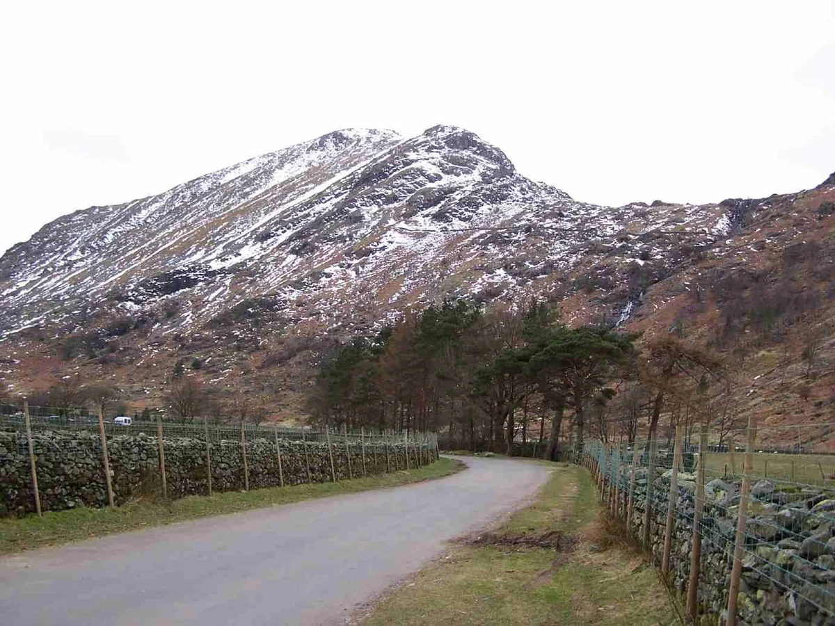
Base Brown is a named summit in the United Kingdom. Wikidata describes it as: "Named summit at 646 m.". Coordinates: 54.4926°, -3.1978°.
Photo gallery
Protected designations
- Site of Special Scientific Interest: River Derwent and Tributaries SSSI
Designations sourced from Natural England open data under OGL v3.
From the Wikipedia article
Base Brown is a fell in England's Lake District, near the head of the Borrowdale Valley. It forms one side of the Seathwaite Valley, and on the western side it is flanked by the hanging valley of Gillercomb.
Excerpt from Wikipedia under CC BY-SA 4.0. See the source article linked in Sources below.
- Coordinates
- 54.4926, -3.1978
- District
- Cumberland
- Parish
- Borrowdale
- Postcode
- CA12 5XJ
- Parliamentary constituency
- Penrith and Solway
Sources
- osm: n5039390733 (ODbL)
- wikipedia: Base Brown (CC BY-SA 4.0)
- commons: Base Brown from Seathwaite.jpg (CC BY-SA 4.0)
Other places nearby
Loading nearby places…
Nearby
 📷 5
📷 5Natural landmarks · North West England
Base Brown
Base Brown — mountain in United Kingdom.
 📷 5
📷 5Natural landmarks · North West England
Brandreth
Brandreth — mountain in United Kingdom.
 📷 5
📷 5Mountains & hills · North West England
Brandreth
Brandreth — Named summit at 715 m.
Climbing & bouldering crags · North East England
Raven Crag
Raven Crag — a climbing crag in england north east.
Campsites · North West England
Seathwaite Farm Campsite
Seathwaite Farm Campsite — a campsite in england north west.
 📷 3
📷 3Mountains & hills · North West England
Green Gable
Green Gable — Named summit at 801 m.
More mountains in this region
 📷 3
📷 3Mountains & hills · North West England
Allen Crags
Allen Crags — Named summit at 785 m.
 📷 3
📷 3Mountains & hills · North West England
Alum Pot
Alum Pot — Open shaft pothole in North Yorkshire.
 📷 3
📷 3Mountains & hills · North West England
Arnside Knott
Arnside Knott — Named summit at 159 m.
 📷 3
📷 3Mountains & hills · North West England
Aye Gill Pike
Aye Gill Pike — Named summit at 556.3 m.
Frequently asked questions
- Where is Base Brown?
- Base Brown is in North-West England, United Kingdom (postcode CA12 5XJ), in the parish of Borrowdale.
- Is Base Brown a protected site?
- Yes — Base Brown is part of the River Derwent and Tributaries SSSI Site of Special Scientific Interest.
- Is Base Brown free to visit?
- Yes, Base Brown is free to enter.
- How do I get to Base Brown?
- Drivers can navigate to postcode CA12 5XJ. It sits within the Penrith and Solway parliamentary constituency.