Mountains & hills · North West England
Green Gable
Green Gable — Named summit at 801 m.

Wikimedia Commons contributors — see linked file page for photographer and licence licence
Plan your visit
- Typical visit
- 3 h–8 h
- Best time of year
- Late spring – early autumn (May–Oct)
- Free entry
- Dog-friendly
About
Green Gable is a named summit in the United Kingdom. Wikidata describes it as: "Named summit at 801 m.". Coordinates: 54.4857°, -3.2138°.
Photo gallery
Protected designations
- Site of Special Scientific Interest: River Derwent and Tributaries SSSI
Designations sourced from Natural England open data under OGL v3.
From the Wikipedia article
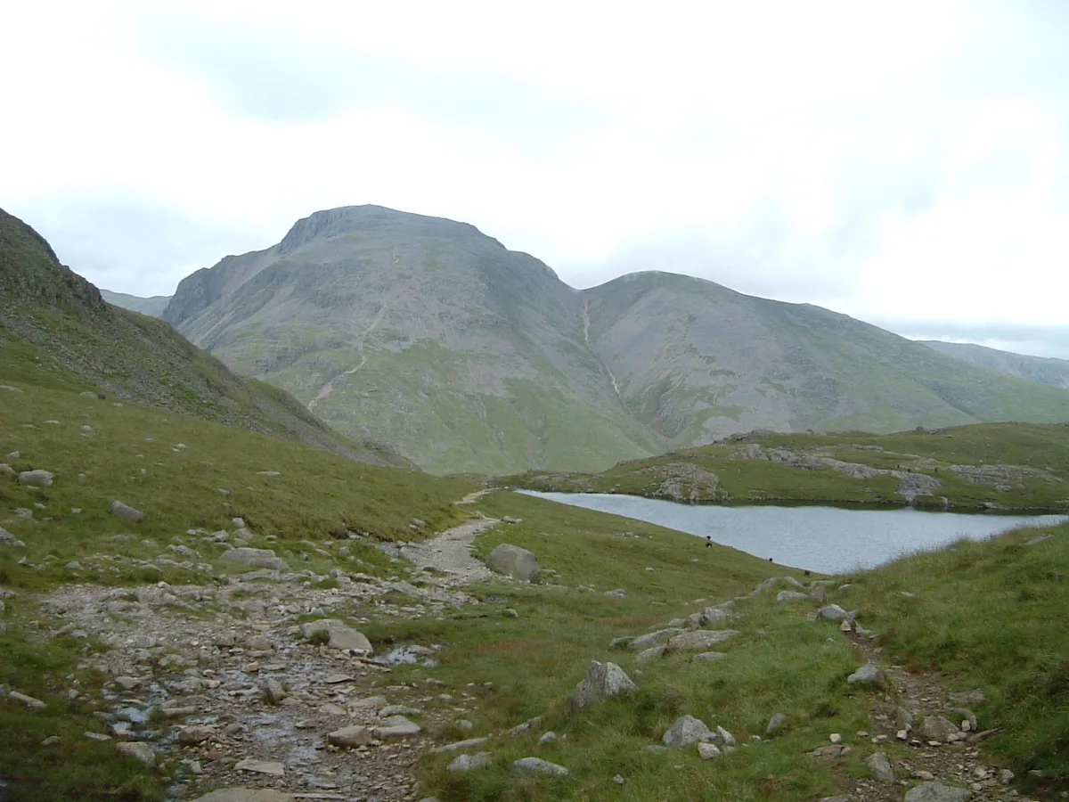
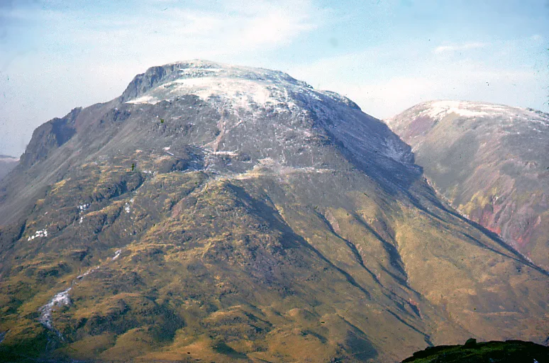
Green Gable is a fell in the English Lake District often traversed by walkers en route to its more famous neighbour Great Gable. It can be ascended from Honister Pass, Seathwaite in Borrowdale, or Ennerdale. There are good views of Gable Crag, Scafell Pike and the Buttermere valley from the summit.
Excerpt from Wikipedia under CC BY-SA 4.0. See the source article linked in Sources below.
- Coordinates
- 54.4857, -3.2138
- Address
- Cumbria, England
Sources
- osm: n3625447300 (ODbL)
- wikipedia: Green Gable (CC BY-SA 4.0)
- commons: GreatAndGreenGables.jpg (CC BY-SA 4.0)
Other places nearby
Loading nearby places…
Nearby
 📷 3
📷 3Natural landmarks · North West England
Green Gable
Green Gable — mountain in United Kingdom.
Climbing & bouldering crags · North West England
Gable Crag
Gable Crag — a climbing crag in england north west.
 📷 3
📷 3Memorials & monuments · North West England
Fell and Rock Climbing Club War Memorial
Fell and Rock Climbing Club War Memorial is a memorial in the United Kingdom.
 📷 3
📷 3Natural landmarks · North West England
Great Gable
Great Gable — mountain in the United Kingdom.
 📷 3
📷 3Mountains & hills · North West England
Great Gable
Great Gable — Named summit at 898.8 m.
Climbing & bouldering crags · North West England
Great Napes
Great Napes — a climbing crag in england north west.
More mountains in this region
 📷 3
📷 3Mountains & hills · North West England
Allen Crags
Allen Crags — Named summit at 785 m.
 📷 3
📷 3Mountains & hills · North West England
Alum Pot
Alum Pot — Open shaft pothole in North Yorkshire.
 📷 3
📷 3Mountains & hills · North West England
Arnside Knott
Arnside Knott — Named summit at 159 m.
 📷 3
📷 3Mountains & hills · North West England
Aye Gill Pike
Aye Gill Pike — Named summit at 556.3 m.
Frequently asked questions
- Where is Green Gable?
- Green Gable is in North-West England, United Kingdom.
- Is Green Gable a protected site?
- Yes — Green Gable is part of the River Derwent and Tributaries SSSI Site of Special Scientific Interest.
- Is Green Gable free to visit?
- Yes, Green Gable is free to enter.