
Mountains & hills · North West England
Bar Pot
In or near Clapham.
Bar Pot is a mountain or hill in the United Kingdom.

Wikimedia Commons contributors — see linked file page for photographer and licence licence

Plan your visit
- Typical visit
- 3 h–8 h
- Best time of year
- Late spring – early autumn (May–Oct)
- Nearest railway station
- Clapham · 4.9 km
- Free entry
- Dog-friendly
About
Bar Pot is a named summit in the United Kingdom. Coordinates: 54.1463°, -2.3816°. This entry is part of The Great Britain Guide, a free, ad-free, open-data tourist directory.
Photo gallery
Protected designations
- Site of Special Scientific Interest: Ingleborough SSSI
- National Nature Reserve: INGLEBOROUGH
Designations sourced from Natural England open data under OGL v3.
From the Wikipedia article
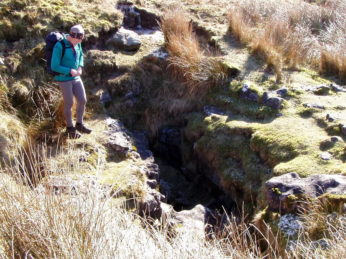
Bar Pot is one of the entrances to the Gaping Gill cave system being located about 340 metres (370 yd) south of Gaping Gill Main Shaft, on Ingleborough in the Yorkshire Dales. It is a popular entrance into the system, being one of the easiest, driest, and having just two vertical pitches to contend with. It lies within the designated Ingleborough Site of Special Scientific Interest.
Excerpt from Wikipedia under CC BY-SA 4.0. See the source article linked in Sources below.
Background
History
The cave was first entered in 1949 by members of the British Speleological Association, who moved a few boulders at the bottom of the shakehole. The original route to the Big Pitch was through the bedding below the entrance pitch, down the 10 m pitch, and through Whitehall. Bob Leakey then discovered the route from Bridge Hall to Whitehall, and Ken Horrocks discovered the passage named after him which is now the voie normale. Wild Cat Rift was explored by members of the Northern Cave Club from below in 1969. Small Mammal House and the Graveyard Inlet was discovered by members of Lancaster University Speleological Society in the late 1970s, The alternative entrance of Small Mammal Pot was…
Description
A descending passage at the base of the large rocky shakehole leads to a 13 m pitch, which is restricted at the top. Below the pitch a step down leads to the top of the Greasy Slab, a 4 m slab normally negotiated with a handline. This drops into Bridge Hall. At the bottom of the boulder slope Horrocks' Way on the left leads into a further set of descending chambers. At the bottom of these are the two pitches into South-East Passage of Gaping Gill. The main pitch (30 m) is straight ahead and can be reached by traversing round the ledge on the left, or by crawling forward from the bottom of the slope. An alternative (and the original) route to the Big Pitch is also accessed from the bottom of…
Sourced from Wikipedia under CC BY-SA 4.0.
- Coordinates
- 54.1463, -2.3816
- District
- North Yorkshire
- Parish
- Clapham cum Newby
- Postcode
- LA2 8EE
- Parliamentary constituency
- Skipton and Ripon
- Nearest railway station
- Clapham — 4.9 km
- Official site
- www.cncc.org.uk
Sources
- wikidata: Q16245912 (CC0)
- wikipedia: Bar Pot (CC BY-SA 4.0)
- commons: Bar Pot - geograph.org.uk - 546909.jpg (CC BY-SA 4.0)
Other places nearby

Bar Pot
Caves · 0.0 km

Small Mammal Pot
Caves · 0.0 km

Stile Pot
Caves · 0.1 km
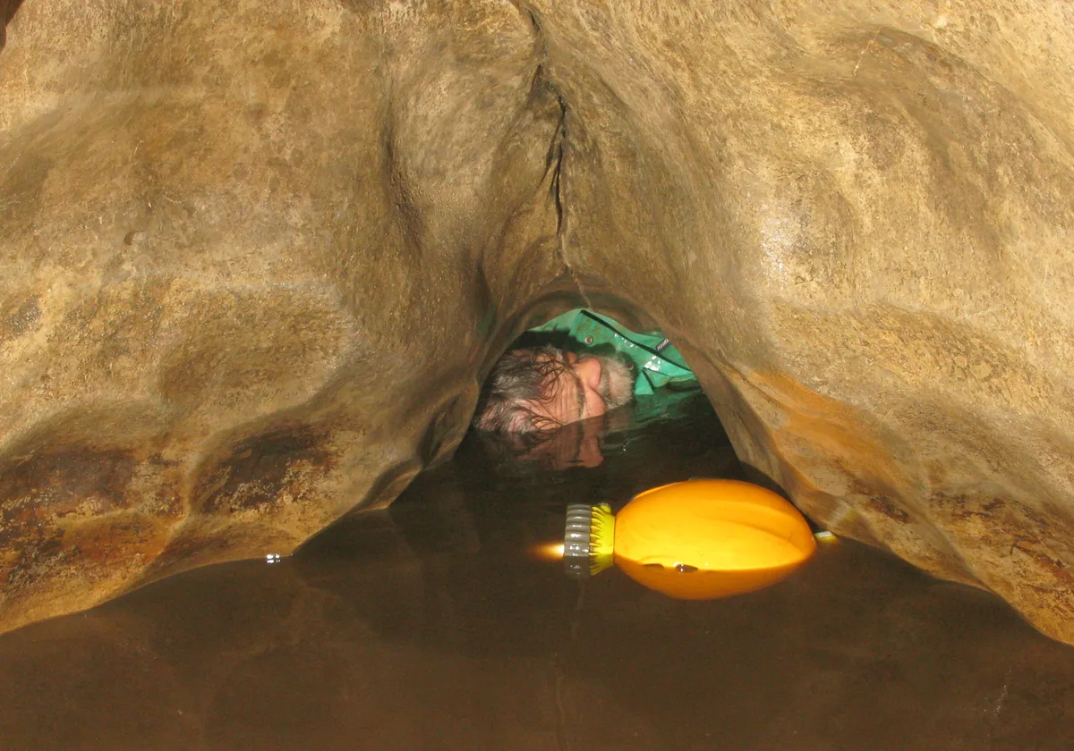
Flood Entrance Pot
Mountains & hills · 0.1 km

Flood Entrance Pot
Caves · 0.1 km
Disappointment Pot
Mountains & hills · 0.1 km
Marilyn
Caves · 0.1 km
Wades Entrance
Caves · 0.1 km

Henslers Pot
Caves · 0.2 km

Disappointment Pot
Caves · 0.3 km

Corkys Pot
Caves · 0.3 km

Gaping Gill
Caves · 0.4 km
Nearby
📷 3📷 3Caves · North West England
Small Mammal Pot
Small Mammal Pot is a cave in the United Kingdom.
📷 5📷 3Mountains & hills · North West England
Flood Entrance Pot
Flood Entrance Pot is a mountain or hill in the United Kingdom.
📷 3Caves · North West England
Flood Entrance Pot
Flood Entrance Pot is a cave in the United Kingdom.
📷 3Mountains & hills · North West England
Disappointment Pot
Disappointment Pot is a mountain or hill in the United Kingdom.
Where to eat & stay near Bar Pot
Places to stay
 📷 5
📷 5 📷 5
📷 5Campsites · North West England
Silloth House Campsite
Silloth House Campsite — a campsite in england north west.
 📷 5
📷 5Hotels · North West England
The Traddock
The Traddock — a hotel in england north west.
 📷 5
📷 5Campsites · North West England
The Dalesbridge
The Dalesbridge — a campsite in england north west.
 📷 5
📷 5 📷 5
📷 5Caravan parks · North West England
Orcaber Farm Camping
Orcaber Farm Camping — a caravan park in england north west.
Places to eat & drink
 📷 5
📷 5Cafés · North West England
Lakehouse Food & Drink
Lakehouse Food & Drink — a café in england north west.
 📷 5
📷 5Restaurants · North West England
The Game Cock Inn
The Game Cock Inn — a restaurant in england north west. Cuisine: french;english.
 📷 5
📷 5Historic pubs · North West England
Horse And Farrier Inn
Horse And Farrier Inn in England North West, United Kingdom.
 📷 5
📷 5Historic pubs · North West England
Punch Bowl Hotel
Punch Bowl Hotel in England North West, United Kingdom.
 📷 5
📷 5 📷 6
📷 6Historic pubs · North West England
Falcon Manor Hotel
Falcon Manor Hotel in England North West, United Kingdom.
More mountains in this region
 📷 5
📷 5Mountains & hills · North West England
Appleton Park
Appleton Park — a hill or mountain in england west midlands.
 📷 5
📷 5Mountains & hills · North West England
High Warren
High Warren — mountain in england west midlands. Elevation: 105 m.
 📷 5
📷 5Mountains & hills · North West England
Alderley Edge
Alderley Edge — mountain in england west midlands. Elevation: 194 m.
 📷 3
📷 3Frequently asked questions
- Where is Bar Pot?
- Bar Pot is in North-West England, United Kingdom (postcode LA2 8EE), in the parish of Clapham cum Newby.
- What is Bar Pot?
- Bar Pot is a mountain or hill in the United Kingdom.
- How do I get to Bar Pot?
- The nearest railway station is Clapham, about 4.9 km away. Drivers can use postcode LA2 8EE.
- Is Bar Pot a protected site?
- Yes — Bar Pot is part of the Ingleborough SSSI Site of Special Scientific Interest and the INGLEBOROUGH National Nature Reserve.
- Is Bar Pot free to visit?
- Yes, Bar Pot is free to enter.
- How do I get to Bar Pot?
- The nearest railway station is Clapham, about 4.9 km away. Drivers can navigate to postcode LA2 8EE.