
Other places · Central Scotland
Auchterhouse
In or near Newtyle.
Auchterhouse in Scotland Islands, United Kingdom.

James Allan — CC BY-SA 2.0 via Wikimedia Commons licence

Plan your visit
- Typical visit
- 1 h–2 h
- Nearest railway station
- Invergowrie · 7.9 km
Getting there & planning your visit
To visit Auchterhouse in the Scottish Highlands, the nearest railway station is Invergowrie, which is 7.9 km away. The postcode for sat-nav is DD3 0QN. Entry information is not provided, so please check ahead for details on accessibility.
About
Auchterhouse is a place of interest in Scotland Islands, United Kingdom — drawn from open-data sources for visitor reference. See the linked Wikipedia article for the full description.
Photo gallery
From the Wikipedia article
Auchterhouse (Scots pronunciation: [ˈɑːxtərhus]; Scottish Gaelic: Uachdaras) is a village, community, and civil parish in the Scottish council area of Angus, located 7.3 miles (11.7 km) north west of Dundee, 9.5 miles (15.3 km) south east of Alyth and 14.9 miles (24.0 km) south west of Forfar. It lies on the southern edge of the Sidlaw Hills, below Auchterhouse Hill, 1,398 feet (426 m) high. The parish, which is coterminous with the community, had a population of 520 in 2001. The village, formerly known as Milltown of Auchterhouse, straddles the B954 Muirhead to Newtyle road. About 1.0 mile (1.6 km) east lies the larger village of Kirkton of Auchterhouse, where the church and school are located. Singer Billy MacKenzie lived in the village from 1991 until his death in 1997. Kirkton, in Auchterhouse, was the subject of the painting 'Sidlaw Village, Winter' by James MacIntosh Patrick.
Excerpt from Wikipedia under CC BY-SA 4.0. See the source article linked in Sources below.
Background
History
The earliest human settlement discovered around Auchterhouse dates from 3500 to 1000 BC, in the form of stone and bronze tools used by the first farmers to clear woodland. Wheat and barley were grown, and cattle and sheep kept, while a decorated sandstone spindle whorl found at Bonnyton, north of the village, and now kept at the McManus Galleries in Dundee, indicates that wool was spun into thread. A possible henge in Dronley Wood has been revealed by aerial photography, and a stone circle at Templelands was destroyed during railway construction in the 19th century. A stone cairn on West Mains Hill, excavated in 1897, was found to conceal a double burial cist, typical of the period around…
Sourced from Wikipedia under CC BY-SA 4.0.
- Coordinates
- 56.5250, -3.0870
- District
- Angus
- Postcode
- DD3 0QN
- Parliamentary constituency
- Angus and Perthshire Glens
- Nearest railway station
- Invergowrie — 7.9 km
Sources
- wikidata: Q4819471 (CC0)
- wikipedia: Auchterhouse (CC BY-SA 4.0)
Other places nearby
Auchterhouse railway station
Heritage railway stations · 0.1 km
Auchterhouse Bridge
Historic bridges · 0.1 km
Wallace Tower
Memorials & monuments · 0.3 km
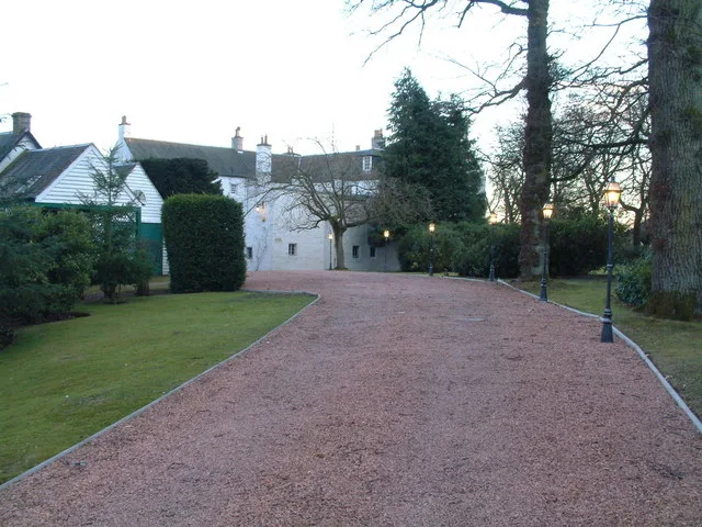
Auchterhouse Castle
Castles · 0.3 km

Newtyle Railway Bridge, Eastfield
Historic bridges · 0.8 km

Parish Church of St Mary and Churchyard, Kirkton of Auchterhouse
Historic churches · 1.2 km

Bridge, Denhead
Historic bridges · 1.2 km

Kirkton of Auchterhouse
Villages · 1.2 km
Kirkton of Auchterhouse War Memorial
Memorials & monuments · 1.4 km
War Memorial, Kirkton Of Auchterhouse
Memorials & monuments · 1.4 km

Dronley Burn
Vineyards · 1.6 km

Bonnyton Bridge
Historic bridges · 1.6 km
Nearby
📷 3Heritage railway stations · Central Scotland
Auchterhouse railway station
Auchterhouse railway station in Scotland Islands, United Kingdom.
📷 5Historic bridges · Central Scotland
Auchterhouse Bridge
Auchterhouse Bridge — category B listed building-listed bridge in scotland-highlands, United Kingdom.
📷 5Memorials & monuments · Central Scotland
Wallace Tower
Wallace Tower — scheduled monument-listed memorial in scotland-highlands, United Kingdom.
📷 3Castles · Central Scotland
Auchterhouse Castle
Auchterhouse Castle — mansion house used as a hotel in Angus, Scotland, UK.
📷 5Historic bridges · Central Scotland
Newtyle Railway Bridge, Eastfield
Newtyle Railway Bridge, Eastfield — category B listed building-listed bridge in scotland-highlands, United Kingdom.
📷 5Historic churches · Central Scotland
Parish Church of St Mary and Churchyard, Kirkton of Auchterhouse
Parish Church of St Mary and Churchyard, Kirkton of Auchterhouse — category B listed building-listed church in scotland-highlands, United Kingdom.
Where to eat & stay near Auchterhouse
Places to stay

Caravan parks · Central Scotland
Greenacres
Greenacres — a caravan park in scotland highlands.
Caravan parks · Central Scotland
Caravan Storage Compound
Caravan Storage Compound — a caravan park in scotland highlands.
 📷 7
📷 7Hotels · Central Scotland
Hampton by Hilton Dundee City Centre
Hampton by Hilton Dundee City Centre — a hotel in scotland central. Brand: Hampton.
 📷 5
📷 5Hostels · Central Scotland
Dundee Backpackers Hostel
Dundee Backpackers Hostel — a hostel in scotland central.
 📷 7
📷 7Hotels · Central Scotland
Four Points Flex by Sheraton
Four Points Flex by Sheraton — a hotel in scotland central. Brand: Four Points by Sheraton.
 📷 5
📷 5Hotels · Scottish Highlands
Strathmore Arms
Strathmore Arms — a hotel in scotland highlands.
Places to eat & drink
 📷 5
📷 5Historic pubs · Central Scotland
'The Clep' Public House, 96-98 Clepington Road, Dundee
'The Clep' Public House, 96-98 Clepington Road, Dundee in Scotland Central, United Kingdom.
 📷 7
📷 7Historic pubs · Central Scotland
Windmill Bar, 113 Hilltown, Dundee
Windmill Bar, 113 Hilltown, Dundee in Scotland Central, United Kingdom.
 📷 7
📷 7Historic pubs · Central Scotland
Ladywell Tavern, 16 Victoria Road, Dundee
Ladywell Tavern, 16 Victoria Road, Dundee in Scotland Central, United Kingdom.
 📷 5
📷 5Historic pubs · Central Scotland
57, 59, 61 West Port, Dundee
57, 59, 61 West Port, Dundee in Scotland Central, United Kingdom.
 📷 5
📷 5Historic pubs · Central Scotland
Public House, 51, 53 Meadowside, Dundee
Public House, 51, 53 Meadowside, Dundee in Scotland Central, United Kingdom.
 📷 7
📷 7Historic pubs · Central Scotland
The Counting House
The Counting House in Scotland Central, United Kingdom.
More places in this region
 📷 3
📷 3 📷 3
📷 3 📷 5
📷 5 📷 5
📷 5Frequently asked questions
- Where is Auchterhouse?
- Auchterhouse is in the Scottish Highlands, United Kingdom (postcode DD3 0QN).
- What is Auchterhouse?
- Auchterhouse in Scotland Islands, United Kingdom.
- How do I get to Auchterhouse?
- The nearest railway station is Invergowrie, about 7.9 km away. Drivers can use postcode DD3 0QN.
- How do I get to Auchterhouse?
- The nearest railway station is Invergowrie, about 7.9 km away. Drivers can navigate to postcode DD3 0QN.