
Wildlife reserves · London
Arkley Lane and Pastures
In or near Elstree.
Arkley Lane and Pastures — nature reserve in Arkley.

Wikimedia Commons licence
Plan your visit
- Typical visit
- 2 h–4 h
- Best time of year
- Autumn & winter (migration & wildfowl)
- Nearest railway station
- High Barnet · 2.5 km
- Free entry
- Dog-friendly
Getting there & planning your visit
To visit Arkley Lane and Pastures, the nearest railway station is High Barnet, located 2.5 km away. The postcode for sat-nav is EN5 4AL, and entry to the wildlife reserve is free.
About
Arkley Lane and Pastures is a wildlife reserve in the United Kingdom. Wikidata describes it as: "nature reserve in Arkley". Coordinates: 51.6550°, -0.2300°.
Photo gallery
From the Wikipedia article
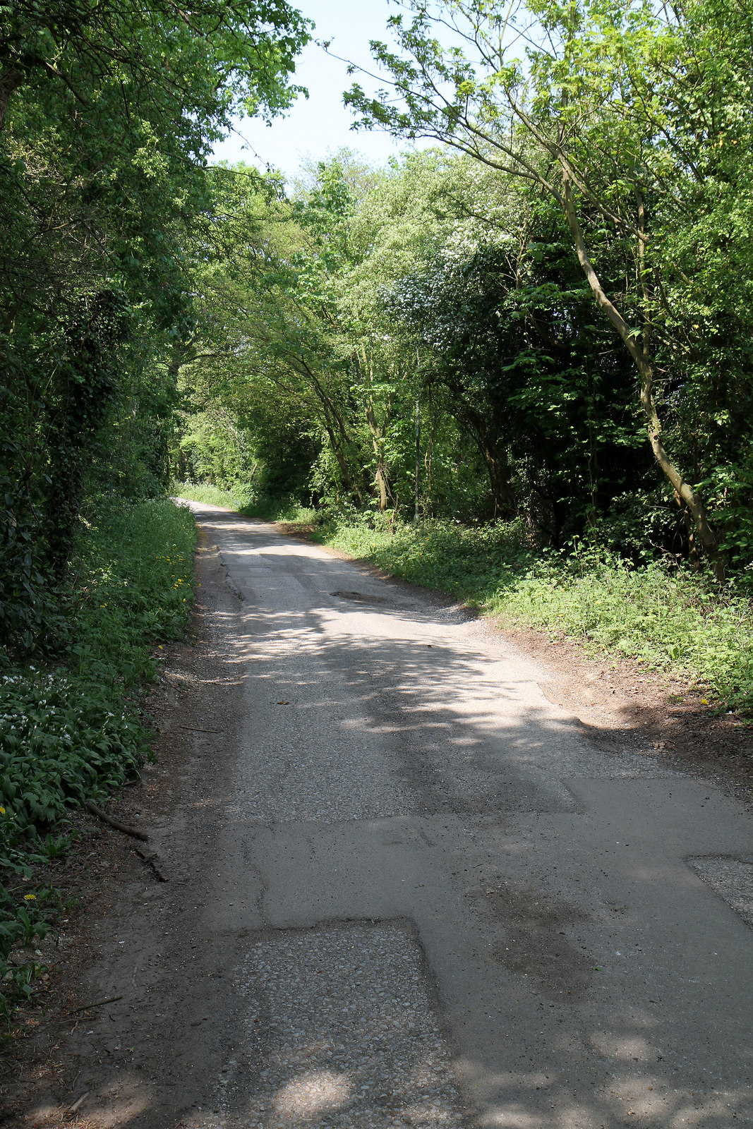
Arkley Lane and Pastures is a 50-hectare (120-acre) Site of Borough Importance for Nature Conservation, Grade II, in Arkley in the London Borough of Barnet. Arkley Lane, off Barnet Road, is an old drovers' road. Located on the Barnet Plateau, it is now a quiet country lane with a traditional bank and ditch. The thick hedges are composed of beech and hornbeam, ash, field maple and magnificent old pedunculate oaks. The hedge flora are dominated by cow parsley, and the ditches have wetland flowers including water figwort and wild angelica. A small adjacent woodland, which is probably ancient, has nesting birds, including sparrowhawks, willow warblers and stock doves. Muntjac deer are often seen there. The fields on either side of the lane are traditionally managed, some grazed by horses and others managed as hay meadows. Three fields which have escaped agricultural improvement support wild flowers typical of old grassland, such as sneezewort and pignut. There is only public access to the lane itself. The tarmacked road continues as a bridleway beyond the Barnet boundary to Saffron Green Meadows in Hertfordshire and to the A1 road.
Excerpt from Wikipedia under CC BY-SA 4.0. See the source article linked in Sources below.
- Coordinates
- 51.6550, -0.2300
- District
- Barnet
- Parish
- Barnet, unparished area
- Postcode
- EN5 4AL
- Parliamentary constituency
- Chipping Barnet
- Nearest railway station
- High Barnet — 2.5 km
Sources
- wikidata: Q4792021 (CC0)
- wikipedia: Arkley Lane and Pastures (CC BY-SA 4.0)
Other places nearby

Arkley
Chapels · 0.8 km

Arkley War Memorial
Memorials & monuments · 0.8 km

Moo-land
Natural landmarks · 0.9 km

Barnet Countryside Centre
Wildlife reserves · 1.0 km

Whalebones Park
Gardens · 1.1 km

Glebe Lane Pastures
Wildlife reserves · 1.1 km

Bells Hill Cemetery
Cemeteries · 1.2 km

Rowley Lodge Field
Wildlife reserves · 1.3 km

Whitings Hill Open Space
Parks · 1.3 km

DoubleTree by Hilton London Elstree
Hotels · 1.4 km

High Barnet
Chapels · 1.5 km

Barnet Gate Mill
Windmills · 1.6 km
Nearby
📷 5📷 5Memorials & monuments · London
Arkley War Memorial
Arkley War Memorial is a memorial in the United Kingdom.
📷 5📷 5Wildlife reserves · London
Barnet Countryside Centre
Barnet Countryside Centre is a wildlife reserve in the United Kingdom.
📷 5📷 5Wildlife reserves · London
Glebe Lane Pastures
Glebe Lane Pastures is a wildlife reserve in the United Kingdom.
Where to eat & stay near Arkley Lane and Pastures
Places to stay
📷 7Hotels · London
DoubleTree by Hilton London Elstree
DoubleTree by Hilton London Elstree — a hotel in england london. 4-star. Brand: DoubleTree.
 📷 5
📷 5 📷 5
📷 5Caravan parks · London
The Mimms Caravan Park
The Mimms Caravan Park — a caravan park in england london.
 📷 5
📷 5 📷 5
📷 5Campsites · London
Home Farm Glamping
Home Farm Glamping — a campsite in england london.
 📷 5
📷 5Places to eat & drink
 📷 5
📷 5Historic pubs · London
Mitre Inn, Chipping Barnet
Mitre Inn, Chipping Barnet in England London, United Kingdom.
 📷 5
📷 5Historic pubs · London
The Green Dragon Public House
The Green Dragon Public House in England London, United Kingdom.
 📷 5
📷 5 📷 5
📷 5 📷 5
📷 5Historic pubs · London
The Alexandra, New Barnet
The Alexandra, New Barnet in England London, United Kingdom.
 📷 5
📷 5More places in this region
 Flagship📷 10
Wildlife reserves · London
Bedfords Park
Bedfords Park — Havering London Borough green landscape, also an Essex Wildlife Trust Nature reserve.
 Flagship📷 10
 Flagship📷 10
Wildlife reserves · London
Bramley Bank
Bramley Bank — Nature reserve in Upper Shirley.
 Flagship📷 10
Wildlife reserves · London
Chafford Gorges Nature Park
Chafford Gorges Nature Park — Essex Wildlife Trust Nature reserve.
Frequently asked questions
- Where is Arkley Lane and Pastures?
- Arkley Lane and Pastures is in London, United Kingdom (postcode EN5 4AL), in the parish of Barnet, unparished area.
- What is Arkley Lane and Pastures?
- Arkley Lane and Pastures — nature reserve in Arkley.
- How do I get to Arkley Lane and Pastures?
- The nearest railway station is High Barnet, about 2.5 km away. The nearest town is Elstree. Drivers can use postcode EN5 4AL.
- Is Arkley Lane and Pastures free to visit?
- Yes, Arkley Lane and Pastures is free to enter.
- How do I get to Arkley Lane and Pastures?
- The nearest railway station is High Barnet, about 2.5 km away. Drivers can navigate to postcode EN5 4AL.
- Are dogs allowed at Arkley Lane and Pastures?
- Most wildlife reserves allow dogs on lead only, with restrictions during ground-nesting bird season (March-July). Check signage at the reserve.