Wildlife reserves · London
Glebe Lane Pastures
Glebe Lane Pastures is a wildlife reserve in the United Kingdom.

Wikimedia Commons licence
Plan your visit
- Typical visit
- 2 h–4 h
- Best time of year
- Autumn & winter (migration & wildfowl)
- Nearest railway station
- High Barnet · 2.8 km
- Free entry
- Dog-friendly
About
Glebe Lane Pastures is a wildlife reserve in the United Kingdom. Coordinates: 51.6450°, -0.2340°. This entry is part of The Great Britain Guide, a free, ad-free, open-data tourist directory.
Photo gallery
From the Wikipedia article
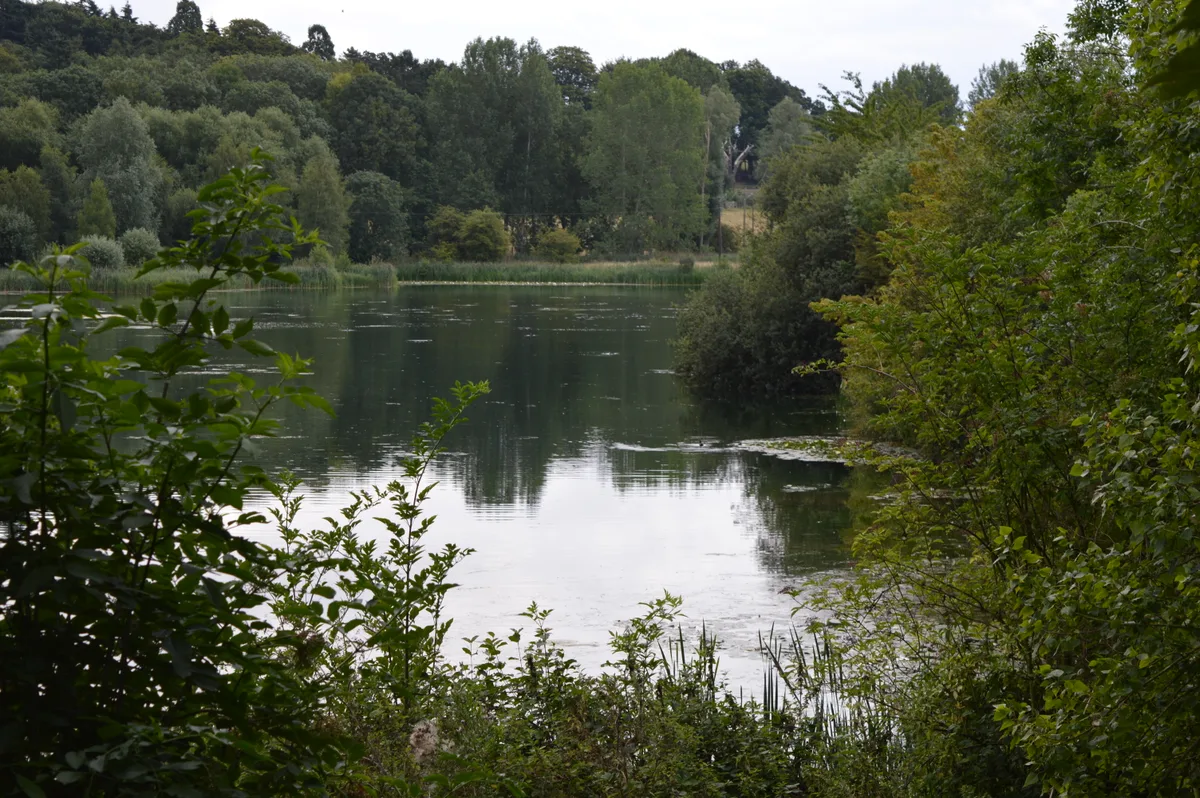
Glebe Lane Pastures is a Site of Borough Importance for Nature Conservation, Grade I, in Arkley in the London Borough of Barnet. It consists of five fields off Glebe Lane, some managed for hay while others are grazed by horses. It contains flower-rich unimproved grassland which is dominated by Yorkshire Fog, with a good variety of other grasses, and Tufted hair-grass is dominant in damper areas. The most important feature of the site is the diversity of its old meadow plants. The site is private, and can only be viewed from Barnet Road east of Glebe Lane.
Excerpt from Wikipedia under CC BY-SA 4.0. See the source article linked in Sources below.
- Coordinates
- 51.6450, -0.2340
- District
- Barnet
- Parish
- Barnet, unparished area
- Postcode
- EN5 3JY
- Parliamentary constituency
- Chipping Barnet
- Nearest railway station
- High Barnet — 2.8 km
Sources
- wikidata: Q5567436 (CC0)
- wikipedia: Glebe Lane Pastures (CC BY-SA 4.0)
Other places nearby
Loading nearby places…
Nearby
 📷 5
📷 5Memorials & monuments · London
Arkley War Memorial
Arkley War Memorial is a memorial in the United Kingdom.
 📷 5
📷 5Chapels · London
Arkley
Arkley — a methodist chapel in england-london, United Kingdom.
 📷 5
📷 5Wildlife reserves · London
Arkley South Field
Arkley South Field is a wildlife reserve in the United Kingdom.
 📷 5
📷 5Wildlife reserves · London
Rowley Lodge Field
Rowley Lodge Field is a wildlife reserve in the United Kingdom.
 📷 5
📷 5Windmills · London
Barnet Gate Mill
Barnet Gate Mill is a windmill in the United Kingdom.
 📷 5
📷 5Parks · London
Whitings Hill Open Space
Whitings Hill Open Space — large public open space in Barnet, England.
More places in this region
 Flagship📷 10
Wildlife reserves · London
Amwell Quarry
Amwell Quarry — nature reserve in United Kingdom.
 Flagship📷 10
Wildlife reserves · London
Aubrey Buxton Nature Reserve
Aubrey Buxton Nature Reserve — Essex Wildlife Trust Nature reserve.
 Flagship📷 10
Wildlife reserves · London
Bedfords Park
Bedfords Park — Havering London Borough green landscape, also an Essex Wildlife Trust Nature reserve.
 Flagship📷 10
Wildlife reserves · London
Biggin Wood
Biggin Wood — preserved ancient woodland.
Frequently asked questions
- Where is Glebe Lane Pastures?
- Glebe Lane Pastures is in London, United Kingdom (postcode EN5 3JY), in the parish of Barnet, unparished area.
- Is Glebe Lane Pastures free to visit?
- Yes, Glebe Lane Pastures is free to enter.
- How do I get to Glebe Lane Pastures?
- The nearest railway station is High Barnet, about 2.8 km away. Drivers can navigate to postcode EN5 3JY.
- Are dogs allowed at Glebe Lane Pastures?
- Most wildlife reserves allow dogs on lead only, with restrictions during ground-nesting bird season (March-July). Check signage at the reserve.