
Islands · North Wales
Anglesey
Anglesey — island in north-west Wales, UK.

Wikimedia Commons contributors — see linked file page for photographer and licence licence
.jpg)
Plan your visit
- Typical visit
- 4 h–12 h
- Free entry
- Dog-friendly
Getting there & planning your visit
Anglesey is located in North Wales, with the postcode LL65 3LJ for sat-nav coordinates. Entry to the island is free.
About
Anglesey is a island in the United Kingdom. It covers approximately 749 km². Recent population estimates put it at around 70,043 people. Heritage designation: National Landscape. Wikidata describes it as: "island in north-west Wales, UK". Coordinates: 53.2939°, -4.3767°.
Photo gallery
From the Wikipedia article
Anglesey ( ANG-gəl-see), or Ynys Môn (Welsh: [ˈənɨs ˈmoːn]), is an island off the north-west coast of Wales. It forms the bulk of the county known in English as the Isle of Anglesey, which also includes Holy Island (Ynys Gybi) and some islets and skerries. The county borders Gwynedd across the Menai Strait to the southeast, and is otherwise surrounded by the Irish Sea. Holyhead is the largest town, and the administrative centre is Llangefni. The Isle of Anglesey (including Holy Island) has an area of 275 square miles (712 km2) and had a population of 69,097 in 2024. After Holyhead, located on Holy Island, the largest settlements are Llangefni in the centre of Anglesey and Amlwch on the northern coast. The economy of the county is mostly based on agriculture, energy, and tourism, the latter especially on the coast. Holyhead is also a major ferry port for Dublin, Ireland. The county has the second-highest percentage of Welsh speakers in Wales, at 57.2%, and is considered a heartland of the language. The Isle of Anglesey is part of the preserved county of Gwynedd. The island of Anglesey, (excluding Holy Island) at 261 square miles (676 km2), is the largest in Wales and the Irish Sea and the seventh largest in Britain. The northern and eastern coasts of the island are rugged, and the southern and western coasts are generally gentler; the interior is gently undulating. In the north of the island is Llyn Alaw, a reservoir with an area of 1.4 square miles (4 km2), which supplies drinking water to the northern half of the island. Holy Island, located off the west coast of Anglesey, has a similar landscape, with a rugged north and west coast and beaches to the east and south. The two larger islands are surrounded by smaller islands; several, including South Stack and Puffin Island, are home to seabird colonies. Large parts of the county's coastline have been designated an Area of Outstanding Natural Beauty. Since 2015 the whole county has been designated as a UNESCO Global…
Excerpt from Wikipedia under CC BY-SA 4.0. See the source article linked in Sources below.
- Coordinates
- 53.2939, -4.3767
- District
- Isle of Anglesey
- Parish
- Bodffordd
- Postcode
- LL65 3LJ
- Parliamentary constituency
- Ynys Môn
- Population
- 70,043
- Official site
- www.anglesey.gov.uk
Sources
- wikidata: Q168159 (CC0)
- wikipedia: Anglesey (CC BY-SA 4.0)
- commons: View from the Anglesey Coastal Path (geograph 6222502).jpg (CC BY-SA 4.0)
Featured in these 4 guides
Itinerary
Britain's most-visitable islands
Skye, Mull, Anglesey, the Scillies, the Channel Islands — fifteen islands worth the ferry.
Itinerary
Anglesey coast & history
Beaumaris Castle, the Menai Bridge and prehistoric Bryn Celli Ddu.
Itinerary
Britain's lesser-known islands
Beyond Skye and the Isle of Wight — eight quieter island destinations.
Itinerary
Britain's tidal causeways
Eight places you can only reach at low tide.
Other places nearby

Coedana
Villages · 1.0 km
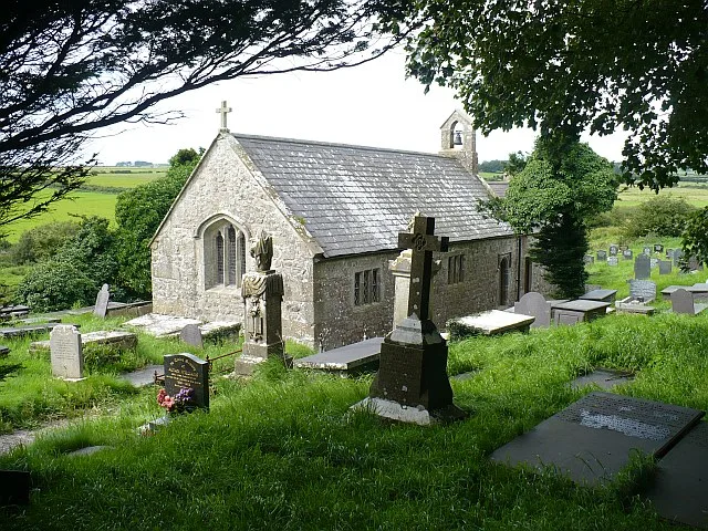
St Cwyllog's Church, Llangwyllog
Historic churches · 1.7 km

Llangwyllog
Historic churches · 2.4 km

Coedana
Historic churches · 2.5 km

Melin Newydd
Windmills · 2.6 km
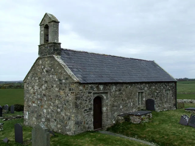
St Twrog's Church, Bodwrog
Historic churches · 2.9 km

Bodychen
Manor houses · 3.0 km

Melin Frogwy
Windmills · 3.0 km

St Trygarn's Church
Historic churches · 3.4 km
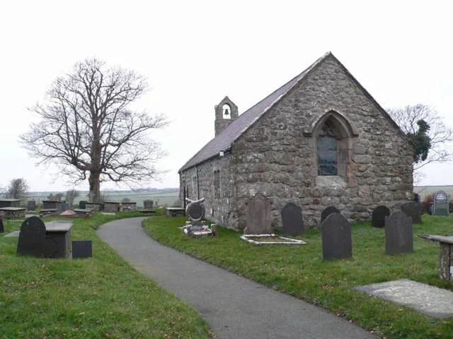
St Caian's Church
Historic churches · 3.4 km

Tre-Ysgawen Hall
Hotels · 3.5 km

Bodffordd
Historic churches · 3.7 km
Nearby
📷 5📷 3Historic churches · North Wales
St Cwyllog's Church, Llangwyllog
St Cwyllog's Church, Llangwyllog — church in Llangwyllog, Anglesey, Wales.
📷 5Historic churches · North Wales
Llangwyllog
Llangwyllog () is a small village and ancient parish in the centre of Anglesey, Wales. It was also a civil parish, and remained as a community until 1984. It is found three miles to the north of the i
📷 5Historic churches · North Wales
Coedana
Coedana is a hamlet in Anglesey, in north-west Wales., in the community of Llanerchymedd. Until 1984 Coedana was a community itself.
📷 5Windmills · North Wales
Melin Newydd
Melin Newydd — Grade II listed building-listed windmill in wales-north, United Kingdom.
📷 3Historic churches · North Wales
St Twrog's Church, Bodwrog
St Twrog's Church, Bodwrog — Grade II* listed church building in Bodffordd Community. Rural church at Bodwrog in Anglesey, North Wales.
Where to eat & stay near Anglesey
Places to stay
📷 5 📷 5
📷 5 📷 5
📷 5Caravan parks · North Wales
Caravan amd Motorhome Club Penrhos
Caravan amd Motorhome Club Penrhos — a caravan park in wales north.
📷 5Caravan parks · North Wales
Ad Astra Caravan Park
Ad Astra Caravan Park — a caravan park in wales north.
 📷 5
📷 5Caravan parks · North Wales
Tyddyn Osgar Caravan Site
Tyddyn Osgar Caravan Site — a caravan park in wales north.
 📷 5
📷 5Campsites · North Wales
Caeau Ty'n Talwrn - Scout Campsite
Caeau Ty'n Talwrn - Scout Campsite — a campsite in wales north.
Places to eat & drink
 📷 5
📷 5Historic pubs · North Wales
The Bull Hotel, Llangefni
The Bull Hotel, Llangefni in Wales North, United Kingdom.
 📷 5
📷 5 📷 5
📷 5Restaurants · North Wales
Oyster Catcher
Oyster Catcher — a restaurant in wales north.
 📷 5
📷 5Historic pubs · North Wales
The Kings Head Hotel
The Kings Head Hotel in Wales North, United Kingdom.
 📷 5
📷 5 📷 5
📷 5More places in this region
 📷 5
📷 5Islands · North Wales
Bardsey Island
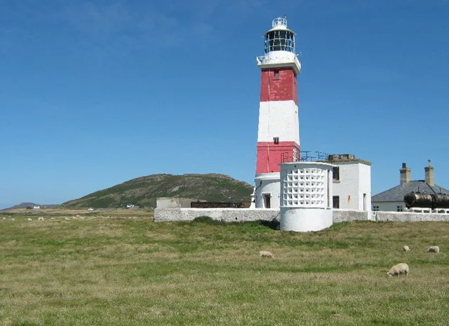
Bardsey Island — island off the coast of North Wales.
 Flagship📷 5
 Flagship📷 3
 Flagship📷 3
Frequently asked questions
- Where is Anglesey?
- Anglesey is in North Wales, United Kingdom (postcode LL65 3LJ), in the parish of Bodffordd.
- What is Anglesey?
- Anglesey — island in north-west Wales, UK.
- How do I get to Anglesey?
- Drivers can use postcode LL65 3LJ.
- Who owns Anglesey?
- Anglesey is owned by Isle of Anglesey County Council.
- Is Anglesey a listed building?
- Anglesey is officially recognised as National Landscape listed.
- Is Anglesey free to visit?
- Yes, Anglesey is free to enter.
- How do I get to Anglesey?
- Drivers can navigate to postcode LL65 3LJ. It sits within the Ynys Môn parliamentary constituency.