
Caravan parks · North West England
Englethwaite Hall
In or near Ainstable.
Englethwaite Hall — a caravan park in scotland lowlands.

Andy Beecroft — CC BY-SA 2.0 via Wikimedia Commons licence

Plan your visit
- Typical visit
- 1 h–2 h
- Nearest railway station
- Armathwaite · 4.3 km
About
Englethwaite Hall is a caravan park located in scotland lowlands. Phone: +44 1228 560202. Address: Armathwaite, CA4 9SY.
Photo gallery
Protected designations
- Site of Special Scientific Interest: River Eden and Tributaries SSSI
Designations sourced from Natural England open data under OGL v3.
Place summary
Englethwaite Hall is a caravan park located in the Scottish Lowlands, postcode CA4. This site offers a range of facilities suitable for touring caravans and camping. Visitors can expect a rural setting, with amenities designed for outdoor leisure and relaxation. The park provides a base for exploring the surrounding countryside and local attractions.
AI-generated from the structured facts on this page (operator, designation, listing, era). Not a substitute for visiting.
- Coordinates
- 54.8443, -2.8012
- District
- Cumberland
- Parish
- Wetheral
- Postcode
- CA4 9SY
- Parliamentary constituency
- Carlisle
- Phone
- +44 1228 560202
- Nearest railway station
- Armathwaite — 4.3 km
Sources
- osm: w342069030 (ODbL)
Other places nearby

Cotehill War Memorial
Memorials & monuments · 1.7 km

High Stand Hill
Mountains & hills · 1.8 km

Cotehill
Villages · 1.8 km

Cumwhitton
Villages · 2.8 km

Slight univallate hillfort on Barrock Fell
Vineyards · 3.5 km
Barrock Fell
Mountains & hills · 3.5 km

Tempietto, Corby Castle
Castles · 3.8 km
Wetheral Caves
Natural landmarks · 3.8 km

St Constantine's cells (Wetheral Caves) and rock-cut Roman inscription
Caves · 3.8 km

Hill Rigg
Mountains & hills · 4.0 km
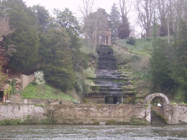
Cascade To West Of Corby Castle
Castles · 4.2 km

Cascade To West Of Corby Castle
Waterfalls · 4.2 km
Nearby
📷 3Memorials & monuments · North West England
Cotehill War Memorial
Cotehill War Memorial — Grade II listed building-listed memorial in scotland-lowlands, United Kingdom.
📷 5Mountains & hills · North West England
High Stand Hill
High Stand Hill — a hill or mountain in scotland lowlands.
📷 5📷 5📷 4Vineyards · North West England
Slight univallate hillfort on Barrock Fell
Slight univallate hillfort on Barrock Fell — a UK vineyard in scotland lowlands, producing English or Welsh wine from cool-climate grape varieties.
📷 5Mountains & hills · North West England
Barrock Fell
Barrock Fell — a hill or mountain in scotland lowlands.
Where to eat & stay near Englethwaite Hall
Places to stay
 📷 5
Hotels · North West England
Crown Hotel
Crown Hotel — a hotel in scotland lowlands.
 📷 5
 📷 5
 📷 5
Caravan parks · North West England
Chapel House Caravan Park
Chapel House Caravan Park — a caravan park in scotland lowlands.
 📷 5
Hotels · North West England
County Hotel
County Hotel — a hotel in scotland lowlands.
 📷 5
Places to eat & drink
 📷 5
Historic pubs · North West England
Graham Arms (West Of Gelt Bridge)
Graham Arms (West Of Gelt Bridge) in Scotland Lowlands, United Kingdom.
 📷 5
Historic pubs · North West England
St Nicholas Arms Public House
St Nicholas Arms Public House in Scotland Lowlands, United Kingdom.
 📷 4
Historic pubs · North West England
The Griffin
The Griffin — Historic pub — listed building or notable heritage status.
 📷 7
Historic pubs · North West England
The Andalusian
The Andalusian in Scotland Lowlands, United Kingdom.
 📷 5
Historic pubs · North West England
Spinners Arms
Spinners Arms in Scotland Lowlands, United Kingdom.
 📷 7
Restaurants · North West England
The Old Bank Gastro House
The Old Bank Gastro House — a restaurant in scotland lowlands.
More places in this region
 📷 5
Caravan parks · North West England
Agden Brow Caravan Park
Agden Brow Caravan Park — a caravan park in england west midlands.
 📷 5
Caravan parks · North West England
Canal Bank Farm caravan site
Canal Bank Farm caravan site — a caravan park in england west midlands.
 📷 5
 📷 5
Caravan parks · North West England
Woodlands Park
Woodlands Park — a caravan park in england west midlands.
Frequently asked questions
- Where is Englethwaite Hall?
- Englethwaite Hall is in North-West England, United Kingdom (postcode CA4 9SY), in the parish of Wetheral.
- What is Englethwaite Hall?
- Englethwaite Hall — a caravan park in scotland lowlands.
- How do I get to Englethwaite Hall?
- The nearest railway station is Armathwaite, about 4.3 km away. The nearest town is Ainstable. Drivers can use postcode CA4 9SY.
- Is Englethwaite Hall a protected site?
- Yes — Englethwaite Hall is part of the River Eden and Tributaries SSSI Site of Special Scientific Interest.
- How do I get to Englethwaite Hall?
- The nearest railway station is Armathwaite, about 4.3 km away. Drivers can navigate to postcode CA4 9SY.