
Hill forts · North West England
Aballava
In or near Burgh by Sands.
Aballava is a hill fort in the United Kingdom.

Wikimedia Commons contributors — see linked file page for photographer and licence licence

Plan your visit
- Typical visit
- 1 h–2 h
- Nearest railway station
- Carlisle · 8.3 km
- Free entry
- Dog-friendly
Getting there & planning your visit
To visit Aballava, the nearest railway station is Carlisle, located 8.3 km away. Entry to the site is free. The postcode for navigation is CA5 6AP.
About
Aballava is a hill fort in the United Kingdom. Part of Hadrian's Wall. Coordinates: 54.9220°, -3.0500°. This entry is part of The Great Britain Guide, a free, ad-free, open-data tourist directory.
Photo gallery
See it from the streetimagery from 2024
Imagery © Mapillary contributors, CC BY-SA 4.0
Protected designations
- Site of Special Scientific Interest: Upper Solway Flats & Marshes SSSI
- Area of Outstanding Natural Beauty: Solway Coast
- Ramsar wetland: Upper Solway Flats & Marshes
Designations sourced from Natural England open data under OGL v3.
From the Wikipedia article
Aballava or Aballaba (with the modern name of Burgh by Sands) was a Roman fort on Hadrian's Wall, between Petriana (Stanwix) to the east and Coggabata (Drumburgh) to the west. It is about one and a half miles south of the Solway Firth, and its purpose was to guard the south end of two important Solway fords, the Peat Wath and the Sandwath, which were also to become favourite routes for medieval border raiders. The name 'Aballava' probably comes from the British Celtic for '(apple) orchard'. The fort is five and a half miles west of Stanwix. The fort was an oblong, straddling the Wall, and measured 500 feet (150 m) north to south by 400 feet (120 m) east to west, occupying an area of 5 acres (20,000 m2). Only the location of the eastern wall is known for certain. It is believed that it was built over the site of turret 71b. There is a fortified border church on the site built almost entirely of Roman stones, and it is believed that this stands on the site of the principia of the fort. There was a vicus to the south-west of the fort, and it is believed that a cemetery existed to the south of the fort.
Excerpt from Wikipedia under CC BY-SA 4.0. See the source article linked in Sources below.
- Coordinates
- 54.9220, -3.0500
- District
- Cumberland
- Parish
- Burgh by Sands
- Postcode
- CA5 6AP
- Parliamentary constituency
- Penrith and Solway
- Nearest railway station
- Carlisle — 8.3 km
Sources
- wikidata: Q602078 (CC0)
- wikipedia: Aballava (CC BY-SA 4.0)
- commons: Cumbria UK location map.svg (CC BY-SA 4.0)
Other places nearby
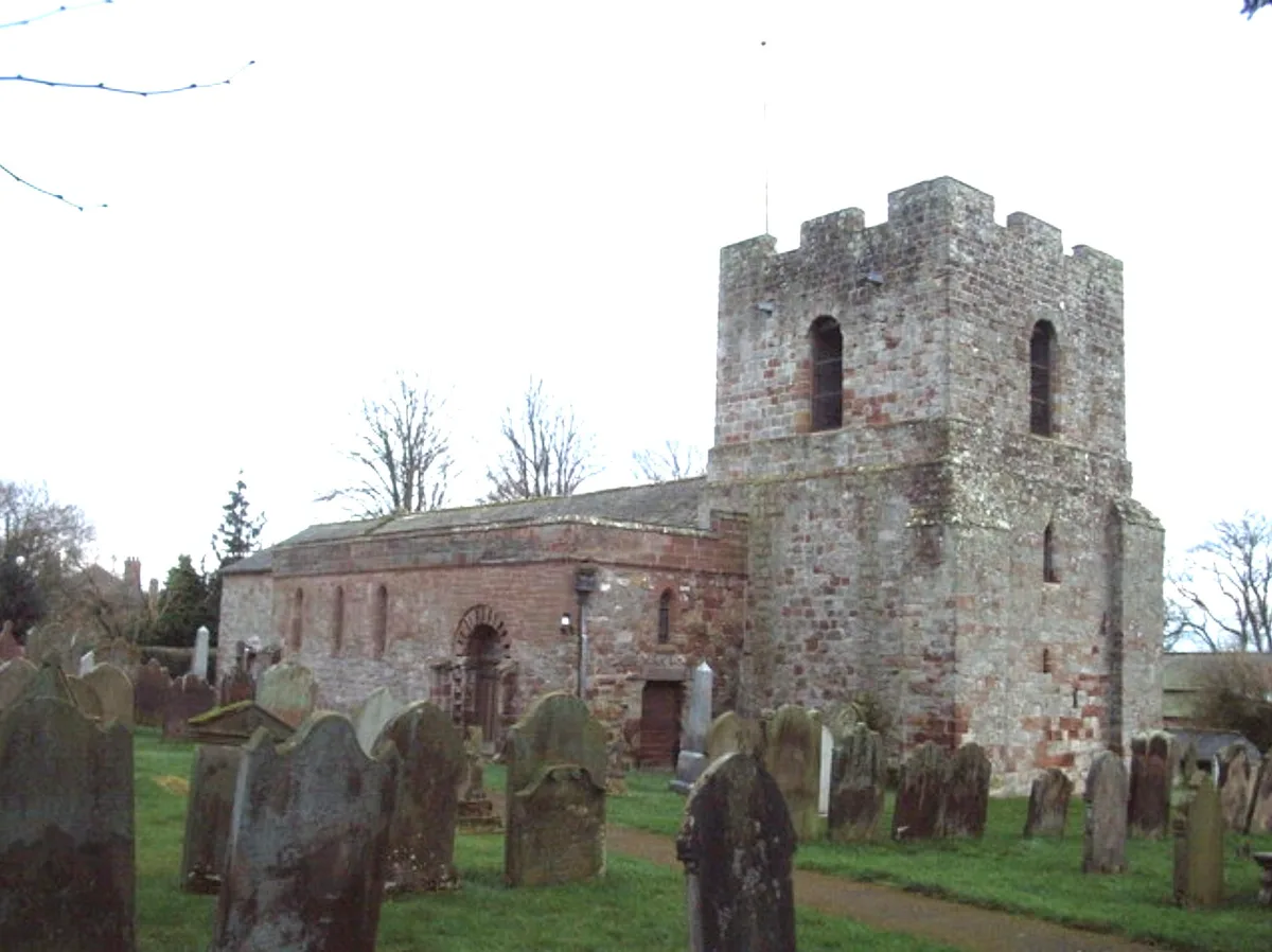
St Michael's Church, Burgh by Sands
Historic churches · 0.1 km

Burgh by Sands War Memorial
Memorials & monuments · 0.1 km

Burgh by Sands
Towns & cities · 0.1 km

Hadrian's Wall vallum between east side of road at Burgh Head, and boundary south of Ash Tree Square, Burgh-by-Sands in wall miles 71 and 72
Archaeological sites · 0.3 km

The Greyhound Inn
Historic pubs · 0.4 km

Burgh by Sands Roman fort, Beaumont camp, Burgh Castle and Hadrian's Wall from boundary west of churchyard, Beaumont to Burgh Head in wall miles 70 and 71
Archaeological sites · 0.7 km

West Green Bridge
Historic bridges · 1.0 km
Burgh by Sands Castle
Castles · 1.0 km

Roman fort and watch tower, 800m SSW of Amberfield
Archaeological sites · 1.0 km

King Edward the 1st
Memorials & monuments · 1.8 km

Milecastle 73 (site of)
Archaeological sites · 1.9 km

Milecastle 73 (site of)
Archaeological sites · 1.9 km
Nearby
📷 5Historic churches · North West England
St Michael's Church, Burgh by Sands
St Michael's Church, Burgh by Sands — Grade I listed church in Burgh by Sands, Cumberland, Cumbria , England, UK.
📷 3Memorials & monuments · North West England
Burgh by Sands War Memorial
Burgh by Sands War Memorial — Grade II listed building-listed memorial in scotland-lowlands, United Kingdom.
📷 4Towns & cities · North West England
Burgh by Sands
Burgh by Sands — village and civil parish in Cumbria, England, UK.
📷 3Archaeological sites · North West England
Hadrian's Wall vallum between east side of road at Burgh Head, and boundary south of Ash Tree Square, Burgh-by-Sands in wall miles 71 and 72
Hadrian's Wall vallum between east side of road at Burgh Head, and boundary south of Ash Tree Square, Burgh-by-Sands in wall miles 71 and 72 — archaeological site in Burgh by Sands, Cumbria, England, UK.
📷 7Historic pubs · North West England
The Greyhound Inn
The Greyhound Inn in Scotland Lowlands, United Kingdom.
📷 3Archaeological sites · North West England
Burgh by Sands Roman fort, Beaumont camp, Burgh Castle and Hadrian's Wall from boundary west of churchyard, Beaumont to Burgh Head in wall miles 70 and 71
Burgh by Sands Roman fort, Beaumont camp, Burgh Castle and Hadrian's Wall from boundary west of churchyard, Beaumont to Burgh Head in wall miles 70 and 71 — archaeological site in Beaumont, Carlisle, England, UK.
Where to eat & stay near Aballava
Places to stay
 📷 5
📷 5Hostels · North West England
Carlisle City Hostel
Carlisle City Hostel — a hostel in scotland lowlands.
 📷 5
📷 5Caravan parks · North West England
Orton Grange Park Home Living
Orton Grange Park Home Living — a caravan park in scotland lowlands.
 📷 5
📷 5Campsites · North West England
Green Meadows Country Park
Green Meadows Country Park — a campsite in scotland lowlands.
 📷 5
📷 5 📷 7
📷 7Hotels · North West England
Crown and Mitre Hotel
Crown and Mitre Hotel — a hotel in scotland lowlands.
 📷 5
📷 5Hotels · North West England
County Hotel
County Hotel — a hotel in scotland lowlands.
Places to eat & drink
📷 7Historic pubs · North West England
The Greyhound Inn
The Greyhound Inn in Scotland Lowlands, United Kingdom.
 📷 5
📷 5Historic pubs · North West England
Horse And Farrier Public House
Horse And Farrier Public House in Scotland Lowlands, United Kingdom.
 📷 5
📷 5Historic pubs · North West England
The Boardroom Public House
The Boardroom Public House in Scotland Lowlands, United Kingdom.
 📷 5
📷 5Historic pubs · North West England
Milbourne Arms Public House
Milbourne Arms Public House in Scotland Lowlands, United Kingdom.
 📷 7
📷 7Restaurants · North West England
The Old Bank Gastro House
The Old Bank Gastro House — a restaurant in scotland lowlands.
 📷 7
📷 7Historic pubs · North West England
The Andalusian
The Andalusian in Scotland Lowlands, United Kingdom.
More places in this region
 📷 5
📷 5Hill forts · North West England
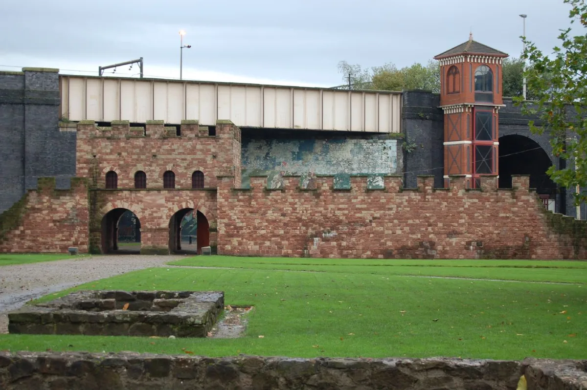
Mamucium
Mamucium — former Roman fort in the Castlefield area of Manchester in North West England.
 📷 3
📷 3Hill forts · North West England
Timperley Hall
Timperley Hall is a hill fort in the United Kingdom.
 📷 3
📷 3Hill forts · North West England
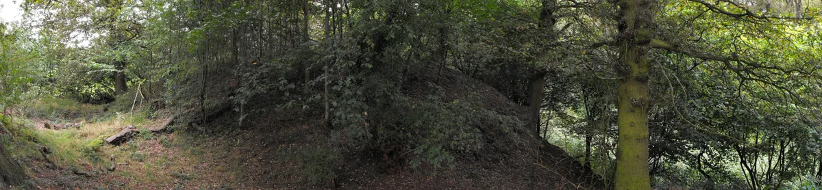
Watch Hill Castle
Watch Hill Castle — medieval castle in Bowdon, Greater Manchester, England, UK.
 📷 5
📷 5Hill forts · North West England
Buckton Castle
Buckton Castle — 12th-century castle in Mossley, Greater Manchester, England, UK.
Frequently asked questions
- Where is Aballava?
- Aballava is in the Scottish Lowlands, United Kingdom (postcode CA5 6AP), in the parish of Burgh by Sands.
- What is Aballava?
- Aballava is a hill fort in the United Kingdom.
- How do I get to Aballava?
- The nearest railway station is Carlisle, about 8.3 km away. Drivers can use postcode CA5 6AP.
- Is Aballava a protected site?
- Yes — Aballava is part of the Upper Solway Flats & Marshes SSSI Site of Special Scientific Interest and the Solway Coast National Landscape (AONB).
- Is Aballava free to visit?
- Yes, Aballava is free to enter.
- How do I get to Aballava?
- Drivers can navigate to postcode CA5 6AP. It sits within the Penrith and Solway parliamentary constituency.