
Watermills · North East England
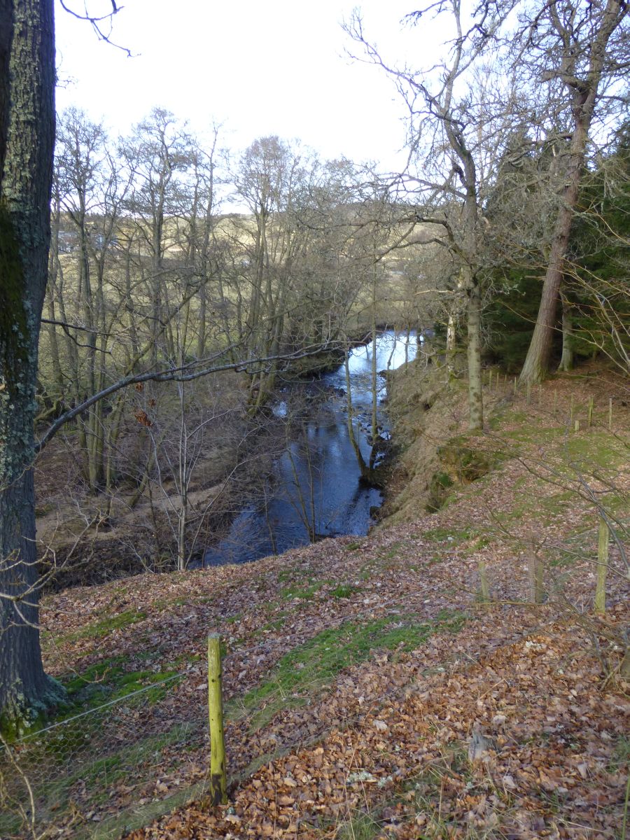
18th century water mill at Grasslees
In or near Elsdon.
18th century water mill at Grasslees — scheduled monument-listed watermill in scotland-lowlands, United Kingdom.

Stanley Howe — CC BY-SA 2.0 via Wikimedia Commons licence

Plan your visit
- Typical visit
- 30 min–1 h
- Free entry
- Family-friendly
- Dog-friendly
About
18th century water mill at Grasslees is a scheduled monument-listed watermill in scotland-lowlands, United Kingdom, registered on the National Heritage List for England (NHLE entry 1006404). Listed status protects buildings and structures of special architectural or historic interest. See the linked Wikipedia article for further details.
Photo gallery
See it from the streetimagery from 2020
Imagery © Mapillary contributors, CC BY-SA 4.0
Heritage listing
Details This record has been generated from an "old county number" (OCN) scheduling record. These are monuments that were not reviewed under the Monuments Protection Programme and are some of our oldest designation records. As such they do not yet have the full descriptions of their modernised counterparts available. Please contact us if you would like further information. Legacy The contents of this record have been generated from a legacy data system. Legacy System number: ND 618 Legacy System: RSM - OCN
From the Historic England List Entry under OGL v3.
Protected designations
- Site of Special Scientific Interest: Simonside Hills SSSI
Designations sourced from Natural England open data under OGL v3.
Place summary
The 18th century water mill at Grasslees is located in the Scottish Lowlands. It is designated as a scheduled monument, highlighting its historical significance within the region. The mill represents the architectural and industrial heritage of the period.
AI-generated from the structured facts on this page (operator, designation, listing, era). Not a substitute for visiting.
- Coordinates
- 55.2751, -2.0739
- District
- Northumberland
- Parish
- Hepple
- Postcode
- NE65 7AU
- Parliamentary constituency
- North Northumberland
Sources
- wikidata: Q17643005 (CC0)
Other places nearby

Billsmoorfoot
Caravan parks · 1.2 km

Billsmoor Park and Grasslees Wood
Wildlife reserves · 1.6 km

Hepple - R. Ponticum woods
Viewpoints · 2.1 km
Soldiers Fold univallate hillfort, 300m south-west of Swindon
Vineyards · 2.4 km

Dues Hill
Mountains & hills · 2.4 km

Leech Hope Crag
Mountains & hills · 2.6 km

Darden Pike
Mountains & hills · 2.7 km
Holystone
Villages · 2.8 km

Whitefield Hill
Mountains & hills · 3.0 km

Witchy Neuk
Vineyards · 3.1 km

Dough Crag
Mountains & hills · 3.1 km

Darden Rigg
Mountains & hills · 3.6 km
Nearby
📷 5📷 3Wildlife reserves · North East England
Billsmoor Park and Grasslees Wood
Billsmoor Park and Grasslees Wood in England North East, United Kingdom.
📷 5Viewpoints · North East England
Hepple - R. Ponticum woods
Hepple - R. Ponticum woods is a viewpoint in the United Kingdom.
📷 5Vineyards · North East England
Soldiers Fold univallate hillfort, 300m south-west of Swindon
Soldiers Fold univallate hillfort, 300m south-west of Swindon — a UK vineyard in scotland lowlands, producing English or Welsh wine from cool-climate grape varieties.
📷 5Mountains & hills · North East England
Dues Hill
Dues Hill — mountain in scotland lowlands. Elevation: 301 m.
📷 5Mountains & hills · North East England
Leech Hope Crag
Leech Hope Crag — mountain in scotland lowlands. Elevation: 322 m.
Where to eat & stay near 18th century water mill at Grasslees
Places to stay
📷 5 📷 5
📷 5Hotels · North East England
William de Percy
William de Percy — a hotel in scotland lowlands.
 📷 5
📷 5Caravan parks · North East England
Whitton Glebe Caravan Park
Whitton Glebe Caravan Park — a caravan park in scotland lowlands.
 📷 5
📷 5 📷 5
📷 5Caravan parks · North East England
Coquetdale Holiday Park
Coquetdale Holiday Park — a caravan park in scotland lowlands.
 📷 7
📷 7Hotels · North East England
Newcastle House Hotel
Newcastle House Hotel — a hotel in scotland lowlands.
Places to eat & drink
 📷 5
📷 5Historic pubs · North East England
The Redesdale Arms
The Redesdale Arms in Scotland Lowlands, United Kingdom.
 📷 7
📷 7 📷 5
📷 5Historic pubs · North East England
The Anglers Arms
The Anglers Arms in Scotland Lowlands, United Kingdom.
 📷 7
📷 7Historic pubs · North East England
Bridge Of Aln Hotel
Bridge Of Aln Hotel in Scotland Lowlands, United Kingdom.
 📷 7
📷 7Historic pubs · North East England
Plough Inn With Outbuilding To North
Plough Inn With Outbuilding To North in Scotland Lowlands, United Kingdom.
 📷 5
📷 5Historic pubs · North East England
Northumberland Arms
Northumberland Arms in Scotland Lowlands, United Kingdom.
More watermills in this region
 📷 3
📷 3 📷 4
📷 4Watermills · North East England
Poltross Burn
Poltross Burn in England North East, United Kingdom.
 📷 4
📷 4Watermills · North East England
Rutter Force
Rutter Force in England North East, United Kingdom.
 📷 4
📷 4Frequently asked questions
- Where is 18th century water mill at Grasslees?
- 18th century water mill at Grasslees is in North-East England, United Kingdom (postcode NE65 7AU), in the parish of Hepple.
- What is 18th century water mill at Grasslees?
- 18th century water mill at Grasslees — scheduled monument-listed watermill in scotland-lowlands, United Kingdom.
- How do I get to 18th century water mill at Grasslees?
- The nearest town is Elsdon. Drivers can use postcode NE65 7AU.
- Is 18th century water mill at Grasslees a listed building?
- 18th century water mill at Grasslees is officially recognised as scheduled monument listed.
- Is 18th century water mill at Grasslees a protected site?
- Yes — 18th century water mill at Grasslees is part of the Simonside Hills SSSI Site of Special Scientific Interest.
- Is 18th century water mill at Grasslees free to visit?
- Yes, 18th century water mill at Grasslees is free to enter.
- How do I get to 18th century water mill at Grasslees?
- Drivers can navigate to postcode NE65 7AU. It sits within the North Northumberland parliamentary constituency.