
Archaeological sites · North East England
Yeavering
In or near Akeld.
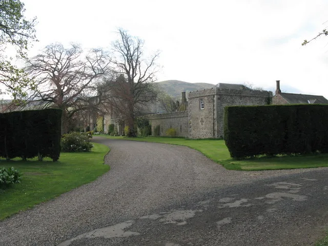
Yeavering in England North East, United Kingdom.

Lisa Jarvis — CC BY-SA 2.0 via Wikimedia Commons licence

Plan your visit
- Typical visit
- 45 min–1.5 h
- Nearest railway station
- Heatherslaw · 8.1 km
- Free entry
- Dog-friendly
Getting there & planning your visit
To visit Yeavering, the nearest railway station is Heatherslaw, located 8.1 km away. Entry to the site is free. The postcode for your sat-nav is NE71 6HG.
About
Yeavering is a place of interest in England North East, United Kingdom — drawn from open-data sources for visitor reference. See the linked Wikipedia article for the full description.
Photo gallery
See it from the streetimagery from 2019
Imagery © Mapillary contributors, CC BY-SA 4.0
Protected designations
- Site of Special Scientific Interest: Tweed Catchment Rivers - England: Till Catchment SSSI
Designations sourced from Natural England open data under OGL v3.
From the Wikipedia article
Yeavering () is a hamlet in the north-east corner of the civil parish of Kirknewton in the English county of Northumberland. It is located on the River Glen at the northern edge of the Cheviot Hills. It is noteworthy as the site of a large Anglo-Saxon period settlement that archaeologists have interpreted as being one of the seats of royal power held by the kings of Bernicia in the 7th century AD. Evidence for human activity in the vicinity has been found from the Mesolithic, Neolithic and Bronze Age periods, although the first significant settlement at Yeavering occurred in the Iron Age. In this period, a heavily inhabited hillfort was constructed on Yeavering Bell which appears to have been a major settlement centre at the time. According to Book 2 Chapter 14 of the Ecclesiastical History of the Venerable Bede (673–735), in the year 627 Bishop Paulinus of York accompanied the Northumbrian king Edwin and his queen Æthelburg to their royal vill (the Latin term is villa regia), Adgefrin, where Paulinus spent 36 days preaching and baptising converts in the river Glen.
Excerpt from Wikipedia under CC BY-SA 4.0. See the source article linked in Sources below.
Background
History
Archaeologist Brian Hope-Taylor believed that the monarchs of Bernicia had to rule over a kingdom in which there were populations belonging to two separate cultural and ethnic groups: the native Britons who were the descendants of the Romano-British population, and the Anglo-Saxons who were migrant colonists from continental Europe. He speculated that the Anglo-Saxon communities were primarily settled around the coastal areas of Bernicia, where trade and other links would have been going on with other Anglo-Saxon populations elsewhere in Britain. He argued that this was evidenced by the heavily Anglicised place name evidence in that area. On the other hand, he thought that the British…
Architecture
There were a series of timber buildings constructed in Gefrin that were excavated by archaeologists in the mid 20th century. Building A1 was initially a "plain, aisled hall, devoid of annexes" which had a doorway situated on every wall. It was a large building, with wall timbers that were 5.5 to 6 inches thick set in trenches that varied from between 36 and 42 inches deep. After burning down in a fire, it was rebuilt "more robustly and precisely", with additional eastern and western annexes being added. Excavators found that daub had apparently been used on the walls, being plastered on to the timber. This too burned down at some point, following which a third version of Building A1 was…
Description
In April 2000 archaeologist Roger Miket returned to north Northumberland after sixteen years living on Skye. While in Sale and Partners, an estate agent in Wooler, the secretary, knowing Roger's interest in the history of the area, informed him of their recent instruction to handle the sale of 'a funny bit of land at Yeavering with a history!' The 'funny bit of land' was, in fact, the site of Ad Gefrin. Northumberland County Council, Northumberland National Park and a number of private bidders all showed an interest in the site but the final successful bidder was Roger. Roger's initial aim was to place the management of the site on an even footing before transferring ownership to an…
Sourced from Wikipedia under CC BY-SA 4.0.
- Coordinates
- 55.5667, -2.1028
- District
- Northumberland
- Parish
- Kirknewton
- Postcode
- NE71 6HG
- Parliamentary constituency
- North Northumberland
- Nearest railway station
- Heatherslaw — 8.1 km
Sources
Other places nearby

River Glen
Natural landmarks · 0.2 km

Burrowses Camp
Vineyards · 0.6 km
Coupland Ford
Natural landmarks · 0.6 km
Unnamed (Kirknewton)
Vineyards · 0.8 km
Coupland Castle
Castles · 0.8 km

The Great Enclosure
Vineyards · 0.9 km

Ad Gefrin Plaque and Information
Memorials & monuments · 0.9 km

Yeavering Bell Hillfort
Hill forts · 1.2 km
Yeavering Bell
Mountains & hills · 1.3 km

Yeavering Bell camp
Vineyards · 1.3 km
Yeavering Bell Hill Fort
Hill forts · 1.3 km

White Law
Mountains & hills · 1.5 km
Nearby
📷 4Natural landmarks · North East England
River Glen
River Glen in England North East, United Kingdom.
📷 5Vineyards · North East England
Burrowses Camp
Burrowses Camp — a UK vineyard in scotland central, producing English or Welsh wine from cool-climate grape varieties.
📷 3Natural landmarks · North East England
Coupland Ford
Coupland Ford — a other in scotland-central, United Kingdom.
📷 5Vineyards · North East England
Unnamed (Kirknewton)
Unnamed (Kirknewton) — a UK vineyard in scotland central, producing English or Welsh wine from cool-climate grape varieties.
📷 3Castles · North East England
Coupland Castle
Coupland Castle — Grade I listed castle in Ewart, Northumberland, England, UK.
📷 5Vineyards · North East England
The Great Enclosure
The Great Enclosure — a UK vineyard in scotland central, producing English or Welsh wine from cool-climate grape varieties.
Where to eat & stay near Yeavering
Places to stay
 📷 5
📷 5Caravan parks · North East England
Highburn House Country Holiday Park
Highburn House Country Holiday Park — a caravan park in scotland central.
 📷 7
📷 7Hotels · North East England
Tankerville Arms Hotel
Tankerville Arms Hotel — a hotel in scotland central.
 📷 7
📷 7Hotels · North East England
The Black Bull
The Black Bull — a hotel in scotland central.
 📷 5
📷 5Hotels · North East England
No 1 Hotel
No 1 Hotel — a hotel in scotland central.
 📷 5
📷 5Hostels · North East England
Wooler Hostel
Wooler Hostel — a hostel in scotland central.
 📷 5
📷 5Caravan parks · North East England
Bridgend Park
Bridgend Park — a caravan park in scotland central.
Places to eat & drink
 📷 7
📷 7 📷 4
📷 4Historic pubs · Scottish Lowlands
Newcastle Arms
Newcastle Arms — Historic pub — listed building or notable heritage status.
 📷 5
📷 5Historic pubs · Scottish Lowlands
The Masons Arms
The Masons Arms in Scotland Lowlands, United Kingdom.
 📷 7
📷 7Historic pubs · Scottish Lowlands
The Victoria Hotel
The Victoria Hotel in Scotland Lowlands, United Kingdom.
 📷 7
📷 7Historic pubs · North East England
Plough Inn With Outbuilding To North
Plough Inn With Outbuilding To North in Scotland Lowlands, United Kingdom.
 📷 7
📷 7Historic pubs · North East England
59 And 61, Bridge Street
59 And 61, Bridge Street in Scotland Lowlands, United Kingdom.
More archaeological sites in this region
 📷 5
📷 5Archaeological sites · North East England
Medieval Manorial Site of Low Dinsdale
Medieval Manorial Site of Low Dinsdale — archaeological in england yorkshire.
 📷 3
📷 3Archaeological sites · North East England
Old Smelting Mill
Old Smelting Mill — a archaeological in england-north-west, United Kingdom.
 📷 5
📷 5Archaeological sites · North East England
Roper Castle or Round Table (Roman Signal Station)
Roper Castle or Round Table (Roman Signal Station) — archaeological in england north west.
 📷 5
📷 5Archaeological sites · North East England
Nine Standards Rigg
Nine Standards Rigg — archaeological in england north west. Elevation: 662 m.
Frequently asked questions
- Where is Yeavering?
- Yeavering is in North-East England, United Kingdom (postcode NE71 6HG), in the parish of Kirknewton.
- What is Yeavering?
- Yeavering in England North East, United Kingdom.
- How do I get to Yeavering?
- The nearest railway station is Heatherslaw, about 8.1 km away. Drivers can use postcode NE71 6HG.
- Is Yeavering a protected site?
- Yes — Yeavering is part of the Tweed Catchment Rivers - England: Till Catchment SSSI Site of Special Scientific Interest.
- Is Yeavering free to visit?
- Yes, Yeavering is free to enter.
- How do I get to Yeavering?
- Drivers can navigate to postcode NE71 6HG. It sits within the North Northumberland parliamentary constituency.