
Natural landmarks · Mid Wales
Y Garn
Y Garn — mountain (684m) in Ceredigion.

Wikimedia Commons contributors — see linked file page for photographer and licence licence

Plan your visit
- Typical visit
- 1 h–2 h
- Nearest railway station
- Rhiwfron · 8.7 km
- Free entry
- Dog-friendly
Getting there & planning your visit
To visit Y Garn in Mid Wales, the nearest railway station is Rhiwfron, located 8.7 km away. Entry is free. There are no specific accessibility details provided.
About
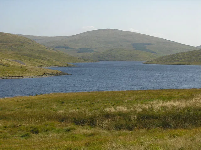
Y Garn is a named natural landmark in the United Kingdom. Wikidata describes it as: "mountain (684m) in Ceredigion". Coordinates: 52.4505°, -3.8031°.
Photo gallery
Heritage listing
http://cadwpublic-api.azurewebsites.net/reports/listedbuilding/FullReport?lang=en&id=26806
From Cadw under OGL v3.
From the Wikipedia article
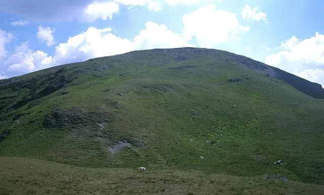
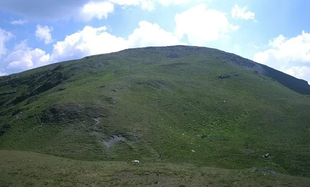
Y Garn is a subsidiary summit of Pen Pumlumon Fawr and the fourth highest peak on the Plynlimon massif, a part of the Cambrian Mountains in the county of Ceredigion, Wales. The summit is marked by a large shelter cairn, hollowed out from an ancient burial cairn. The views include Rhos Fawr, Drygarn Fawr, Pen y Garn to the south and Aran Fawddwy, Glasgwm, Tarrenhendre and Tarren y Gesail to the north. The Nant-y-moch Reservoir can also be seen to the north, with the smaller summits of Drosgol at 550 m (1,800 ft) and Banc Llechwedd-mawr at 560 m (1,840 ft). both Marilyns.
Excerpt from Wikipedia under CC BY-SA 4.0. See the source article linked in Sources below.
- Coordinates
- 52.4505, -3.8031
- Address
- Ceredigion, Wales
- Nearest railway station
- Rhiwfron — 8.7 km
Sources
- wikidata: Q8046133 (CC0)
- wikipedia: Y Garn (Plynlimon) (CC BY-SA 4.0)
- commons: View towards Y Garn - geograph.org.uk - 1495605.jpg (CC BY-SA 4.0)
Other places nearby

Drum Peithnant
Mountains & hills · 0.0 km
Y Garn
Mountains & hills · 0.0 km

Blaenrheidol
Reservoirs & lochs · 1.5 km

Drybedd
Mountains & hills · 1.9 km

Yr Helfa Las
Mountains & hills · 2.2 km
Pumlumon Fawr
Mountains & hills · 2.3 km

Pumlumon
Mountains & hills · 2.3 km

Eisteddfa Gurig
Mountain passes · 2.3 km
Pumlumon Fawr
Natural landmarks · 2.3 km

Eisteddfa Gurig
Historic churches · 2.5 km

Stone Circle and Round Cairns, Hirnant
Stone circles · 2.5 km
Pumlumon Fach
Mountains & hills · 2.6 km
Nearby
📷 5📷 3📷 4Reservoirs & lochs · Mid Wales
Blaenrheidol
Blaenrheidol in Wales Mid, United Kingdom.
📷 3📷 3Mountains & hills · Mid Wales
Yr Helfa Las
Yr Helfa Las — a mountain in wales-mid, United Kingdom, 411 m.
📷 3Where to eat & stay near Y Garn
Places to stay
 📷 5
📷 5 📷 7
📷 7Hotels · Mid Wales
George Borrow Hotel
George Borrow Hotel — a hotel in wales mid.
 📷 5
📷 5Caravan parks · Mid Wales
Tynyffordd Fach Caravan Park
Tynyffordd Fach Caravan Park — a caravan park in wales mid.
 📷 5
📷 5 📷 5
📷 5Caravan parks · Mid Wales
Erwbarfe Farm Caravan Park
Erwbarfe Farm Caravan Park — a caravan park in wales mid.
 📷 5
📷 5Campsites · Mid Wales
Woodlands Touring Park
Woodlands Touring Park — a campsite in wales mid.
Places to eat & drink
 📷 5
📷 5Cafés · Mid Wales
Llywernog Silver Lead Mine
Llywernog Silver Lead Mine — a café in wales mid.
 📷 7
📷 7 📷 5
📷 5Restaurants · Mid Wales
The White Lion Hotel
The White Lion Hotel — a restaurant in wales mid.
 📷 5
📷 5 📷 6
📷 6More natural landmarks in this region
 📷 3
📷 3 📷 3
📷 3 📷 3
📷 3Natural landmarks · Mid Wales
Llyn Gwernan
Llyn Gwernan is a natural landmark in the United Kingdom.
 📷 3
📷 3Frequently asked questions
- Where is Y Garn?
- Y Garn is in Mid Wales, United Kingdom.
- What is Y Garn?
- Y Garn — mountain (684m) in Ceredigion.
- How do I get to Y Garn?
- The nearest railway station is Rhiwfron, about 8.7 km away. Its coordinates are 52.4505°, -3.8031°.
- Is Y Garn a listed building?
- Y Garn is officially recognised as II listed.
- Is Y Garn free to visit?
- Yes, Y Garn is free to enter.