
Historic houses · South West England
WW2 Chain Home Low Radar Station (remains of)
In or near St Germans.
WW2 Chain Home Low Radar Station (remains of) — a historic house in england-south-west, United Kingdom.

Stephen McKay — CC BY-SA 2.0 via Wikimedia Commons licence

Plan your visit
- Typical visit
- 1 h–2 h
- Nearest railway station
- Devonport · 8.1 km
- Family-friendly
- Limited wheelchair access
About
WW2 Chain Home Low Radar Station (remains of) is a historic house located in england-south-west, United Kingdom. Sourced from OpenStreetMap (ODbL licence); see local listings for visitor information, opening hours and admission details.
Photo gallery
360° viewimagery from 2021
Imagery © Mapillary contributors, CC BY-SA 4.0
Protected designations
- Site of Special Scientific Interest: Rame Head & Whitsand Bay SSSI
- Area of Outstanding Natural Beauty: Cornwall
Designations sourced from Natural England open data under OGL v3.
Place summary
The WW2 Chain Home Low Radar Station (remains of) is located in South-West England. This site was part of Britain's early warning radar system during the Second World War, crucial for detecting low-flying enemy aircraft. The remains reflect the technological advancements of the era and are a significant part of military history.
AI-generated from the structured facts on this page (operator, designation, listing, era). Not a substitute for visiting.
- Coordinates
- 50.3136, -4.2231
- District
- Cornwall
- Parish
- Maker-with-Rame
- Postcode
- PL10 1LH
- Parliamentary constituency
- South East Cornwall
- Nearest railway station
- Devonport — 8.1 km
Sources
- osm: way/988868176 (ODbL)
Other places nearby

Chapel Of St Michael
Chapels · 0.0 km

Rame Head
Vineyards · 0.0 km

Polhawn Fort
Memorials & monuments · 0.9 km

Church of St Germanus
Historic churches · 1.2 km

Rame, Maker-with-Rame
Historic churches · 1.4 km
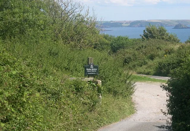
Penlee Battery
Wildlife reserves · 2.3 km

St Andrew's Church, Cawsand
Historic churches · 2.4 km

Cawsand
Historic churches · 2.4 km
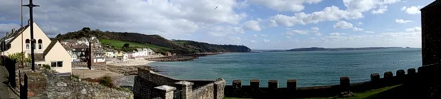
Cawsand Bay
Mountains & hills · 2.5 km

Penlee Point
Viewpoints · 2.5 km

Cawsand and Rame War Memorial
Memorials & monuments · 2.5 km

Wiggle Hill
Mountains & hills · 2.6 km
Nearby
📷 5Chapels · South West England
Chapel Of St Michael
Chapel Of St Michael — chapel in Maker-with-Rame, Cornwall, England, UK.
📷 5Vineyards · South West England
Rame Head
Rame Head — a UK vineyard in england south west, producing English or Welsh wine from cool-climate grape varieties.
📷 5Memorials & monuments · South West England
Polhawn Fort
Polhawn Fort is a memorial in the United Kingdom.
📷 4Historic churches · South West England
Church of St Germanus
Church of St Germanus — Grade I listed building-listed church in england-south-west, United Kingdom.
📷 5Historic churches · South West England
Rame, Maker-with-Rame
Rame (Cornish: Rama) is a village and former civil parish, now in the parish of Maker-with-Rame, in the Cornwall district, in the ceremonial county of Cornwall, England. It is situated on the Rame Pen
📷 5Wildlife reserves · South West England
Penlee Battery
Penlee Battery — artillery battery and nature reserve in Cornwall, England.
Where to eat & stay near WW2 Chain Home Low Radar Station (remains of)
Places to stay
 📷 5
📷 5Campsites · South West England
Whitsand Bay Holiday Park
Whitsand Bay Holiday Park — a campsite in england south west.
 📷 5
📷 5 📷 5
📷 5 📷 5
📷 5Hotels · South West England
Moxy Hotel
Moxy Hotel — a hotel in england south west.
 📷 5
📷 5Hostels · South West England
Plymouth Backpackers
Plymouth Backpackers — a hostel in england south west.
 📷 7
📷 7Places to eat & drink
 📷 3
📷 3Historic pubs · South West England
The Devonport Inn
The Devonport Inn — Historic pub — listed building or notable heritage status.
 📷 5
📷 5Cafés · South West England
The Orangery
The Orangery — a café in england south west.
 📷 7
📷 7Historic pubs · South West England
The Lugger Public House
The Lugger Public House in England South West, United Kingdom.
 📷 5
📷 5Historic pubs · South West England
The Western Public House
The Western Public House in England South West, United Kingdom.
 📷 7
📷 7 📷 7
📷 7More historic houses in this region
 📷 5
📷 5Historic houses · South West England
1 South Parade
1 South Parade — Grade I listed house in Bath, Somerset, England, UK.
_(geograph_6440799).jpg?width=1200) 📷 5
📷 5Historic houses · South West England
1-4 Lansdowne Grove, Morris Lane
1-4 Lansdowne Grove, Morris Lane — houses in Devizes, Wiltshire, England, UK.
 📷 5
📷 5Historic houses · South West England
2 North Parade
2 North Parade — building in Bath, UK; part of Abbey Hotel.
 📷 5
📷 5Historic houses · South West England
2, South Place, Lacock Road
2, South Place, Lacock Road — house in Corsham, Wiltshire, England, UK.
Frequently asked questions
- Where is WW2 Chain Home Low Radar Station (remains of)?
- WW2 Chain Home Low Radar Station (remains of) is in South-West England, United Kingdom (postcode PL10 1LH), in the parish of Maker-with-Rame.
- What is WW2 Chain Home Low Radar Station (remains of)?
- WW2 Chain Home Low Radar Station (remains of) — a historic house in england-south-west, United Kingdom.
- How do I get to WW2 Chain Home Low Radar Station (remains of)?
- The nearest railway station is Devonport, about 8.1 km away. Drivers can use postcode PL10 1LH.
- Is WW2 Chain Home Low Radar Station (remains of) a protected site?
- Yes — WW2 Chain Home Low Radar Station (remains of) is part of the Rame Head & Whitsand Bay SSSI Site of Special Scientific Interest and the Cornwall National Landscape (AONB).
- How do I get to WW2 Chain Home Low Radar Station (remains of)?
- Drivers can navigate to postcode PL10 1LH. It sits within the South East Cornwall parliamentary constituency.