
Waterfalls · North West England
Whitespout
In or near Quernmore.
Whitespout — waterfall in england north west.

Karl and Ali — CC BY-SA 2.0 via Wikimedia Commons licence

Plan your visit
- Typical visit
- 1 h–2 h
About
Whitespout is a waterfall located in england north west. A British waterfall recorded in OpenStreetMap. Most are in upland country where rivers cross resistant rock.
Photo gallery
Protected designations
- Site of Special Scientific Interest: Bowland Fells SSSI
- Area of Outstanding Natural Beauty: Forest Of Bowland
Designations sourced from Natural England open data under OGL v3.
Place summary
Whitespout is a waterfall located in North-West England. It is known for its natural beauty and forms part of the region's landscape. Visitors can expect a tranquil environment, ideal for photography and nature observation. The surrounding area may offer walking paths for those looking to explore the vicinity.
AI-generated from the structured facts on this page (operator, designation, listing, era). Not a substitute for visiting.
- Coordinates
- 54.0390, -2.6442
- County
- Lancashire
- District
- Lancaster
- Parish
- Caton-with-Littledale
- Postcode
- LA2 9HB
- Parliamentary constituency
- Morecambe and Lunesdale
Sources
- osm: n8380988483 (ODbL)
Other places nearby

Littledale Hall
Historic houses · 1.9 km
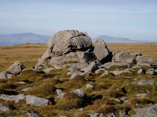
Ward's Stone (West)
Mountains & hills · 2.1 km

BS 1890
Memorials & monuments · 2.2 km
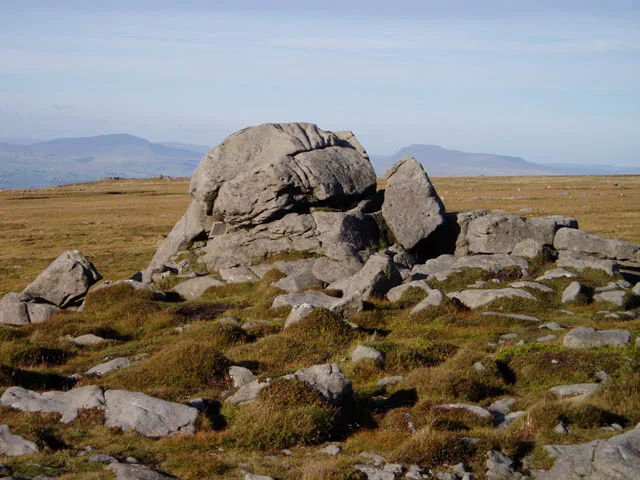
Ward's Stone
Mountains & hills · 2.2 km
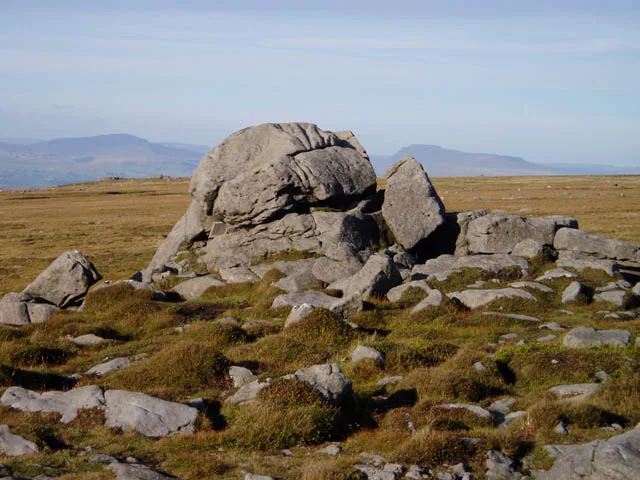
Ward's Stone
Natural landmarks · 2.2 km

Grit Fell
Mountains & hills · 2.8 km

Crossghyll Farm Camping Pods
Campsites · 3.0 km

Littledale Scout Camp
Campsites · 3.1 km

Anthony Mason Hornby
Memorials & monuments · 3.2 km

The Cragg
Mountains & hills · 3.4 km

Caton Moor
Mountains & hills · 3.4 km

Jim Slinn
Memorials & monuments · 3.6 km
Nearby
📷 4Historic houses · North West England
Littledale Hall
Littledale Hall — a Grade II-listed historic house in england-north-west, United Kingdom.
📷 3Mountains & hills · North West England
Ward's Stone (West)
Ward's Stone (West) — Named summit at 560 m.
📷 3Memorials & monuments · North West England
BS 1890
BS 1890 — a memorial in North West England, United Kingdom.
📷 3📷 3Natural landmarks · North West England
Ward's Stone
Ward's Stone — mountain in the United Kingdom.
📷 3Where to eat & stay near Whitespout
Places to stay
📷 5Campsites · North West England
Crossghyll Farm Camping Pods
Crossghyll Farm Camping Pods — a campsite in england north west.
📷 5Campsites · North West England
Littledale Scout Camp
Littledale Scout Camp — a campsite in england north west.
 📷 5
Caravan parks · North West England
Crook O'Lune Caravan Park
Crook O'Lune Caravan Park — a caravan park in england north west.
📷 5Hotels · North West England
Scarthwaite Country House Hotel
Scarthwaite Country House Hotel — a hotel in england north west.
 📷 5
Campsites · North West England
Bridge House Farm Campsite
Bridge House Farm Campsite — a campsite in england north west.
 📷 5
Caravan parks · North West England
New Parkside Farm Caravan Park
New Parkside Farm Caravan Park — a caravan park in england north west.
Places to eat & drink
 📷 3
Historic pubs · North West England
The Borough
The Borough — Historic pub — listed building or notable heritage status.
 📷 5
 📷 7
Restaurants · North West England
GoBurrito
GoBurrito — a restaurant in england north west.
 📷 5
Historic pubs · North West England
Toll House Inn Hotel
Toll House Inn Hotel — Historic pub — listed building or notable heritage status.
 📷 5
Historic pubs · North West England
Brown Cow Public House
Brown Cow Public House in England North West, United Kingdom.
 📷 4
Historic pubs · North West England
The Bobbin
The Bobbin — Historic pub — listed building or notable heritage status.
More places in this region
 📷 5
Waterfalls · North West England
Two Penny Waterfall
Two Penny Waterfall — waterfall in england west midlands.
 📷 5
Waterfalls · North West England
Whorneyside Force
Whorneyside Force — waterfall in england north west.
 📷 5
 📷 5
Frequently asked questions
- Where is Whitespout?
- Whitespout is in Lancashire, North-West England, United Kingdom (postcode LA2 9HB), in the parish of Caton-with-Littledale.
- What is Whitespout?
- Whitespout — waterfall in england north west.
- How do I get to Whitespout?
- The nearest town is Quernmore. Drivers can use postcode LA2 9HB.
- Is Whitespout a protected site?
- Yes — Whitespout is part of the Bowland Fells SSSI Site of Special Scientific Interest and the Forest Of Bowland National Landscape (AONB).
- How do I get to Whitespout?
- Drivers can navigate to postcode LA2 9HB. It sits within the Morecambe and Lunesdale parliamentary constituency.