
Mountains & hills · South East England
Whitecliff Bay
In or near St Helens.
Whitecliff Bay — bay on the south-east coast of the Isle of Wight, England, UK.

Wikimedia Commons contributors — see linked file page for photographer and licence licence

Plan your visit
- Typical visit
- 3 h–8 h
- Best time of year
- Late spring – early autumn (May–Oct)
- Nearest railway station
- Brading · 3.1 km
- Free entry
- Dog-friendly
Getting there & planning your visit
To visit Whitecliff Bay, the nearest railway station is Brading, which is 3.1 km away. The postcode for sat-nav is PO35 5QA, and entry is free.
About
Whitecliff Bay is a named summit in the United Kingdom. Part of English Channel. Wikidata describes it as: "bay on the south-east coast of the Isle of Wight, England, UK". Coordinates: 50.6700°, -1.0969°.
Photo gallery
Protected designations
- Site of Special Scientific Interest: Whitecliff Bay and Bembridge Ledges SSSI
- Area of Outstanding Natural Beauty: Isle Of Wight
Designations sourced from Natural England open data under OGL v3.
From the Wikipedia article
Whitecliff Bay is a sandy bay near Foreland which is the easternmost point of the Isle of Wight, England, about two miles south-west of Bembridge and just to the north of Culver Down. The bay has a shoreline of around three-quarters of a mile (1.2 km) and has a popular sandy shingle beach which is over half a mile long. It is a tourist site with three holiday parks in the vicinity of the bay; it has two cafes though minimal facilities. Access is limited and only possible down two steeply sloping concrete tracks. The site is of major geological interest, being part of the Whitecliff Bay And Bembridge Ledges SSSI.
Excerpt from Wikipedia under CC BY-SA 4.0. See the source article linked in Sources below.
Background
History
Whitecliff Bay was one of the landing points for the French invasion of the Isle of Wight (1545) where they planned to go on to attack Sandown. The bay gets its name from the chalky cliff on the headland, Culver Down, which rises over 340 ft at the south-eastern point of the bay.
Sourced from Wikipedia under CC BY-SA 4.0.
- Coordinates
- 50.6700, -1.0969
- District
- Isle of Wight
- Parish
- Bembridge
- Postcode
- PO35 5QA
- Parliamentary constituency
- Isle of Wight East
- Nearest railway station
- Brading — 3.1 km
Sources
- wikidata: Q7995800 (CC0)
- wikipedia: Whitecliff Bay (CC BY-SA 4.0)
- commons: Across Whitecliff Bay - geograph.org.uk - 1900077.jpg (CC BY-SA 4.0)
Other places nearby

Sandhills Holiday Park
Caravan parks · 0.2 km

Culver Down Battery
Natural landmarks · 0.5 km

Culver Millenium Beacon
Natural landmarks · 0.5 km

The Earl Of Yarborough's Monument
Memorials & monuments · 0.7 km

Yarborough Monument
Memorials & monuments · 0.7 km
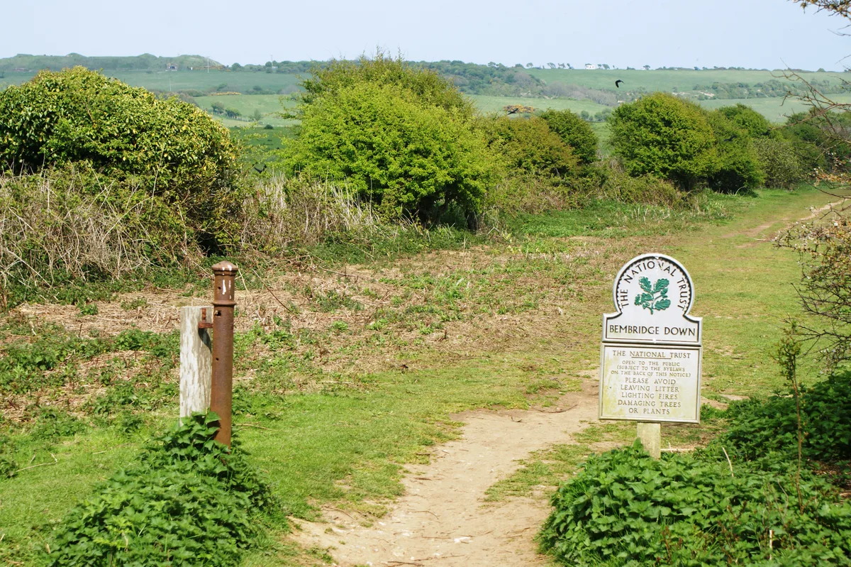
Bembridge Down
Mountains & hills · 1.2 km

Culver Cliff
Natural landmarks · 1.3 km

Bembridge Windmill
Windmills · 1.5 km

Bembridge Harbour
Harbours & ports · 1.5 km

Bembridge Fort
Forts · 1.5 km

Forelands Pop-up Campsite
Caravan parks · 1.9 km

RSPB Brading Marshes
Forests & woodlands · 2.0 km
Nearby
📷 5Caravan parks · South East England
Sandhills Holiday Park
Sandhills Holiday Park — a caravan park in england south east.
📷 5Natural landmarks · South East England
Culver Down Battery
Culver Down Battery — a other in england-south-east, United Kingdom.
📷 5Natural landmarks · South East England
Culver Millenium Beacon
Culver Millenium Beacon — a other in england-south-east, United Kingdom.
📷 5Memorials & monuments · South East England
The Earl Of Yarborough's Monument
The Earl Of Yarborough's Monument — Grade II listed building-listed memorial in england-south-east, United Kingdom.
📷 5Memorials & monuments · South East England
Yarborough Monument
Yarborough Monument is a memorial in the United Kingdom.
📷 5Where to eat & stay near Whitecliff Bay
Places to stay
📷 5Caravan parks · South East England
Sandhills Holiday Park
Sandhills Holiday Park — a caravan park in england south east.
📷 5Caravan parks · South East England
Forelands Pop-up Campsite
Forelands Pop-up Campsite — a caravan park in england south east.
 📷 5
📷 5Caravan parks · South East England
Carpenters Farm Campsite
Carpenters Farm Campsite — a caravan park in england south east.
 📷 5
📷 5Campsites · South East England
Sunrise Hill Camping
Sunrise Hill Camping — a campsite in england south east.
 📷 5
📷 5Caravan parks · South East England
Nodes Point Holiday Park
Nodes Point Holiday Park — a caravan park in england south east. Brand: Parkdean Resorts.
 📷 7
📷 7Places to eat & drink
 📷 5
📷 5Restaurants · South East England
Vernon Cottage
Vernon Cottage — a restaurant in england south east.
 📷 7
📷 7Cafés · South East England
Pencil Cottage
Pencil Cottage — a café in england south east.
 📷 7
📷 7Historic pubs · South East England
King Harry's Bar
King Harry's Bar in England South East, United Kingdom.
 📷 7
📷 7Historic pubs · South East England
The Swans Nest
The Swans Nest in England South East, United Kingdom.
 📷 2
📷 2Historic pubs · South East England
The Castle Hotel
The Castle Hotel in England South East, United Kingdom.
 📷 7
📷 7Historic pubs · South East England
Wellington Tavern
Wellington Tavern in England South East, United Kingdom.
More mountains in this region
 📷 5
📷 5 📷 5
📷 5Mountains & hills · South East England
Reigate Caves
Reigate Caves is a mountain or hill in the United Kingdom.
 📷 5
📷 5Mountains & hills · South East England
North Downs
North Downs — a hill or mountain in england london.
 📷 5
📷 5Mountains & hills · South East England
Blue Bell Hill
Blue Bell Hill — a hill or mountain in england london.
Frequently asked questions
- Where is Whitecliff Bay?
- Whitecliff Bay is in South-East England, United Kingdom (postcode PO35 5QA), in the parish of Bembridge.
- What is Whitecliff Bay?
- Whitecliff Bay — bay on the south-east coast of the Isle of Wight, England, UK.
- How do I get to Whitecliff Bay?
- The nearest railway station is Brading, about 3.1 km away. Drivers can use postcode PO35 5QA.
- Is Whitecliff Bay a protected site?
- Yes — Whitecliff Bay is part of the Whitecliff Bay and Bembridge Ledges SSSI Site of Special Scientific Interest and the Isle Of Wight National Landscape (AONB).
- Is Whitecliff Bay free to visit?
- Yes, Whitecliff Bay is free to enter.
- How do I get to Whitecliff Bay?
- The nearest railway station is Brading, about 3.1 km away. Drivers can navigate to postcode PO35 5QA.