Archaeological sites · Yorkshire & the Humber
Wharram Percy
In or near Towthorpe.
Wharram Percy is a deserted medieval village and former civil parish near Wharram-le-Street, now in the parish of Wharram, on the western edge of the chalk Wolds of North Yorkshire, England. It is abo

Paul Harrop — CC BY-SA 2.0 via Wikimedia Commons licence
Plan your visit
- Typical visit
- 45 min–1.5 h
- Nearest railway station
- Fimber Halt · 6.4 km
Getting there & planning your visit
To visit Wharram Percy, the nearest railway station is Fimber Halt, which is 6.4 km away. The postcode for navigation is YO17 9TD. Entry details are not provided, so please check in advance for accessibility options.
About
Wharram Percy is a deserted medieval village and former civil parish near Wharram-le-Street, now in the parish of Wharram, on the western edge of the chalk Wolds of North Yorkshire, England. It is about 1 mile (1.6 km) south of Wharram-le-Street and is signposted from the Beverley to Malton road (B1248). In 1931 the parish had a population of 40. It was part of the East Riding of Yorkshire until 1974. From 1974 to 2023 it was part of the district of Ryedale, it is now administered by the unitary North Yorkshire Council. The earthworks of the village have been known for many years, and outlines of house platforms were drawn onto the first Ordnance Survey six-inch maps of Yorkshire published in 1854. The site was researched each summer by combined teams of archaeologists, historians and even botanists, from about 1950 to 1990 after it was singled out for study in 1948 by Professor Maurice Beresford of the University of Leeds. The site is now in the care of Historic England (formerly English Heritage).
Photo gallery
From the Wikipedia article
Wharram Percy is a deserted medieval village and former civil parish near Wharram-le-Street, now in the parish of Wharram, on the western edge of the chalk Wolds of North Yorkshire, England. It is about 1 mile (1.6 km) south of Wharram-le-Street and is signposted from the Beverley to Malton road (B1248). In 1931 the parish had a population of 40. It was part of the East Riding of Yorkshire until 1974. From 1974 to 2023 it was part of the district of Ryedale, it is now administered by the unitary North Yorkshire Council. The earthworks of the village have been known for many years, and outlines of house platforms were drawn onto the first Ordnance Survey six-inch maps of Yorkshire published in 1854. The site was researched each summer by combined teams of archaeologists, historians and even botanists, from about 1950 to 1990 after it was singled out for study in 1948 by Professor Maurice Beresford of the University of Leeds. The site is now in the care of Historic England (formerly English Heritage).
Excerpt from Wikipedia under CC BY-SA 4.0. See the source article linked in Sources below.
Background
History
Although the site seems to have been settled since prehistory, the village appears to have been most active from the 10th to the 12th centuries. The name Wharram possibly derives from the plural form of either the Old English hwer meaning 'cauldron', or the Old Norse hvarf meaning 'bend'. The Domesday Book of 1086 records it as 'Warran' or 'Warron'. The suffix 'Percy' stems from the prominent, aristocratic family that owned the area during the Middle Ages. The Black Death of 1348–49 does not seem to have played a significant part in the desertion of Wharram Percy, although the large fall in population in the country as a whole at that time must have encouraged relocation to larger…
Sourced from Wikipedia under CC BY-SA 4.0.
- Coordinates
- 54.0675, -0.6897
- District
- North Yorkshire
- Parish
- Wharram
- Postcode
- YO17 9TD
- Parliamentary constituency
- Thirsk and Malton
- Nearest railway station
- Fimber Halt — 6.4 km
Sources
- wikipedia: Wharram Percy (CC BY-SA 4.0)
Other places nearby

Wharram Percy
Vineyards · 0.0 km

Medieval Village of Wharram Percy (Site Of)
Archaeological sites · 0.1 km

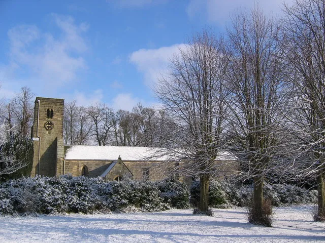
Church of Saint Martin
Historic churches · 0.1 km

Wharram le Street
Villages · 1.8 km

Raisthorpe Manor
Manor houses · 2.7 km

Hill Top Farm Caravans
Caravan parks · 3.3 km

Duggleby Howe
Archaeological sites · 3.4 km

Duggleby Howe
Archaeological sites · 3.4 km
Duggleby
Villages · 3.4 km
Site of Medieval Village of Mowthorpe
Archaeological sites · 3.6 km
Church of Saint Nicholas
Historic churches · 3.9 km

North Grimston
Villages · 4.0 km
Nearby
📷 5Vineyards · Yorkshire & the Humber
Wharram Percy
Wharram Percy — a UK vineyard in england yorkshire, producing English or Welsh wine from cool-climate grape varieties.
📷 3Archaeological sites · Yorkshire & the Humber
Medieval Village of Wharram Percy (Site Of)
Medieval Village of Wharram Percy (Site Of) — a archaeological in england-yorkshire, United Kingdom.
📷 5Historic churches · Yorkshire & the Humber
Church of Saint Martin
Church of Saint Martin — church in Wharram Percy, Ryedale, UK.
📷 5Villages · Yorkshire & the Humber
Wharram le Street
Wharram le Street — a village in england yorkshire.
📷 3Manor houses · Yorkshire & the Humber
Raisthorpe Manor
Raisthorpe Manor — Grade II listed building-listed manor in england-yorkshire, United Kingdom.
📷 5Caravan parks · Yorkshire & the Humber
Hill Top Farm Caravans
Hill Top Farm Caravans — a caravan park in england yorkshire.
Where to eat & stay near Wharram Percy
Places to stay
📷 5Caravan parks · Yorkshire & the Humber
Hill Top Farm Caravans
Hill Top Farm Caravans — a caravan park in england yorkshire.
 📷 5
📷 5Campsites · Yorkshire & the Humber
The Private Hill
The Private Hill — a campsite in england yorkshire.
 📷 5
📷 5Campsites · Yorkshire & the Humber
Thornthorpe Caravan & Camping Site
Thornthorpe Caravan & Camping Site — a campsite in england yorkshire.
 📷 5
📷 5Caravan parks · Yorkshire & the Humber
Yorkshire Wolds Way Caravan & Camping
Yorkshire Wolds Way Caravan & Camping — a caravan park in england yorkshire.
 📷 5
📷 5Campsites · Yorkshire & the Humber
Givendale Scout Campsite
Givendale Scout Campsite — a campsite in england yorkshire.
 📷 4
📷 4Campsites · Yorkshire & the Humber
Field House Camping
Field House Camping — a campsite in england yorkshire.
Places to eat & drink
 📷 5
📷 5 📷 7
📷 7Historic pubs · Yorkshire & the Humber
The Coach And Horses
The Coach And Horses in England Yorkshire, United Kingdom.
 📷 5
📷 5Historic pubs · Yorkshire & the Humber
The New Globe Public House
The New Globe Public House in England Yorkshire, United Kingdom.
 📷 7
📷 7Historic pubs · Yorkshire & the Humber
The Cross Keys Public House
The Cross Keys Public House in England Yorkshire, United Kingdom.
 📷 5
📷 5Historic pubs · Yorkshire & the Humber
The Golden Lion Public House
The Golden Lion Public House in England Yorkshire, United Kingdom.
 📷 7
📷 7Historic pubs · Yorkshire & the Humber
The Blue Ball Public House And Attached Outbuildings At Rear
The Blue Ball Public House And Attached Outbuildings At Rear in England Yorkshire, United Kingdom.
More archaeological sites in this region
 📷 3
📷 3Archaeological sites · Yorkshire & the Humber
Mellor Mill dig site
Mellor Mill dig site — a archaeological in england-west-midlands, United Kingdom.
 📷 3
📷 3Archaeological sites · Yorkshire & the Humber
Industrial Chimney
Industrial Chimney — a archaeological in england-west-midlands, United Kingdom.
 📷 3
📷 3Archaeological sites · Yorkshire & the Humber
The Dipping Stone
The Dipping Stone — a archaeological in england-west-midlands, United Kingdom.
 📷 3
📷 3Archaeological sites · Yorkshire & the Humber
Murder Stone
Murder Stone — a archaeological in england-west-midlands, United Kingdom.
Frequently asked questions
- Where is Wharram Percy?
- Wharram Percy is in Yorkshire, United Kingdom (postcode YO17 9TD), in the parish of Wharram.
- What is Wharram Percy?
- Wharram Percy is a deserted medieval village and former civil parish near Wharram-le-Street, now in the parish of Wharram, on the western edge of the chalk Wolds of North Yorkshire, England. It is abo
- How do I get to Wharram Percy?
- The nearest railway station is Fimber Halt, about 6.4 km away. Drivers can use postcode YO17 9TD.
- How do I get to Wharram Percy?
- The nearest railway station is Fimber Halt, about 6.4 km away. Drivers can navigate to postcode YO17 9TD.