Towns & cities · Scottish Lowlands
Westlinton
Westlinton — village and civil parish in Cumbria, England.

Wikimedia Commons contributors — see linked file page for photographer and licence licence
Plan your visit
- Typical visit
- 3 h–6 h
- Nearest railway station
- Gretna Green · 8.3 km
- Free entry
- Family-friendly
- Dog-friendly
About
Westlinton is a town, city, village or settlement in the United Kingdom. Recent population estimates put it at around 350 people. Address: CA6. Wikidata describes it as: "village and civil parish in Cumbria, England". Coordinates: 54.9710°, -2.9480°.
Photo gallery
Protected designations
- Site of Special Scientific Interest: River Eden and Tributaries SSSI
Designations sourced from Natural England open data under OGL v3.
From the Wikipedia article
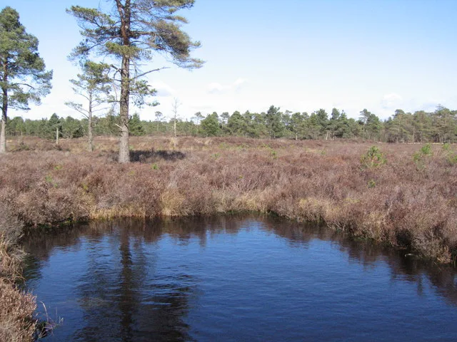
Westlinton (or West Linton) is a small village and civil parish in Cumbria, England. It is in the Cumberland district, and is located north of Carlisle, on the A7 road between Carlisle and Longtown. In the south of the parish, and also on the A7, is another small village, Blackford. In the 2001 census, the parish had a population of 359, increasing to 380 at the 2011 census. decreasing again to 350 in 2021. North of the village of Westlinton is the River Lyne, which forms the northern boundary of the parish.
Excerpt from Wikipedia under CC BY-SA 4.0. See the source article linked in Sources below.
- Coordinates
- 54.9710, -2.9480
- District
- Cumberland
- Parish
- Westlinton
- Postcode
- CA6
- Parliamentary constituency
- Carlisle
- Population
- 350
- Nearest railway station
- Gretna Green — 8.3 km
Sources
- wikidata: Q598303 (CC0)
- wikipedia: Westlinton (CC BY-SA 4.0)
- commons: Hedge and Ditch - geograph.org.uk - 283717.jpg (CC BY-SA 4.0)
Other places nearby
Loading nearby places…
Nearby
 📷 3
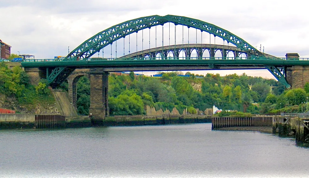
📷 3Historic bridges · Scottish Lowlands
Westlington Bridge
Westlington Bridge — Grade II listed building-listed bridge in scotland-lowlands, United Kingdom.
 📷 5
📷 5Campsites · Scottish Lowlands
Green Meadows Country Park
Green Meadows Country Park — a campsite in scotland lowlands.
 📷 2
📷 2Archaeological sites · Scottish Lowlands
Scaleby Moss
Scaleby Moss — wood and Site of Special Scientific Interest in Scaleby, Carlisle, Cumbria, England.
 📷 5
📷 5Villages · Scottish Lowlands
Harker
Harker — a village in scotland lowlands.
 📷 5
📷 5Villages · Scottish Lowlands
Kingstown
Kingstown — a village in scotland lowlands.
 📷 5
📷 5Museums · Scottish Lowlands
Longtown, Cumbria
Longtown, Cumbria — a museum in scotland-lowlands, United Kingdom.
Where to eat & stay near Westlinton
Places to stay
📷 5Campsites · Scottish Lowlands
Green Meadows Country Park
Green Meadows Country Park — a campsite in scotland lowlands.
 📷 5
📷 5Hotels · Scottish Lowlands
Graham Arms Hotel
Graham Arms Hotel — a hotel in scotland lowlands.
 📷 5
📷 5Caravan parks · Scottish Lowlands
High Gaitle Caravan & Camping Park
High Gaitle Caravan & Camping Park — a caravan park in scotland lowlands.
 📷 5
📷 5Campsites · Scottish Lowlands
Broomhills Farm River Eco Pods
Broomhills Farm River Eco Pods — a campsite in scotland lowlands.
 📷 3
📷 3Caravan parks · Scottish Lowlands
Hunley Farm Caravan Park
Hunley Farm Caravan Park — a caravan park in scotland lowlands.
 📷 5
📷 5Caravan parks · Scottish Lowlands
Hadrians Park
Hadrians Park — a caravan park in scotland lowlands.
Places to eat & drink
 📷 5
📷 5Historic pubs · Scottish Lowlands
The Globe Tavern
The Globe Tavern in Scotland Lowlands, United Kingdom.
 📷 5
📷 5Historic pubs · Scottish Lowlands
The Boardroom Public House
The Boardroom Public House in Scotland Lowlands, United Kingdom.
 📷 5
📷 5Restaurants · Scottish Lowlands
The Old Bank Gastro House
The Old Bank Gastro House — a restaurant in scotland lowlands.
 📷 5
📷 5Historic pubs · Scottish Lowlands
The Andalusian
The Andalusian in Scotland Lowlands, United Kingdom.
 📷 5
📷 5Historic pubs · Scottish Lowlands
The Greyhound Inn
The Greyhound Inn in Scotland Lowlands, United Kingdom.
 📷 5
📷 5Historic pubs · Scottish Lowlands
Milbourne Arms Public House
Milbourne Arms Public House in Scotland Lowlands, United Kingdom.
More towns in this region
 Flagship📷 3
Towns & cities · Scottish Lowlands
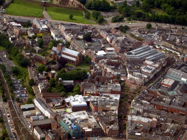
Carlisle
Carlisle — city in Cumberland, Cumbria, England.
 Flagship📷 3
Towns & cities · Scottish Lowlands
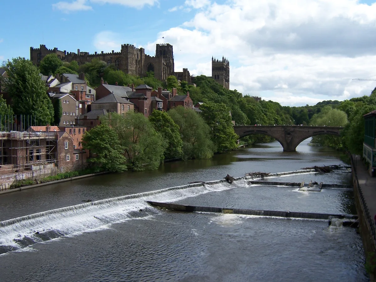
Durham
Durham — city and the county town of County Durham in North East England.
 Flagship📷 5
Towns & cities · Scottish Lowlands
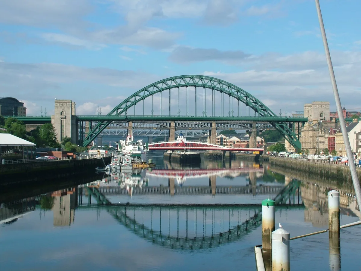
Newcastle upon Tyne
Newcastle upon Tyne — city in Tyne and Wear, England, UK.
 Flagship📷 3
Towns & cities · Scottish Lowlands
Sunderland
Sunderland — city in Tyne and Wear, North East England.
Frequently asked questions
- Where is Westlinton?
- Westlinton is in the Scottish Lowlands, United Kingdom (postcode CA6), in the parish of Westlinton.
- What is Westlinton?
- Westlinton — village and civil parish in Cumbria, England.
- How do I get to Westlinton?
- The nearest railway station is Gretna Green, about 8.3 km away. Drivers can use postcode CA6.
- Is Westlinton a protected site?
- Yes — Westlinton is part of the River Eden and Tributaries SSSI Site of Special Scientific Interest.
- Is Westlinton free to visit?
- Yes, Westlinton is free to enter.
- How do I get to Westlinton?
- Drivers can navigate to postcode CA6. It sits within the Carlisle parliamentary constituency.