Mountains & hills · West Midlands
Wendover Woods
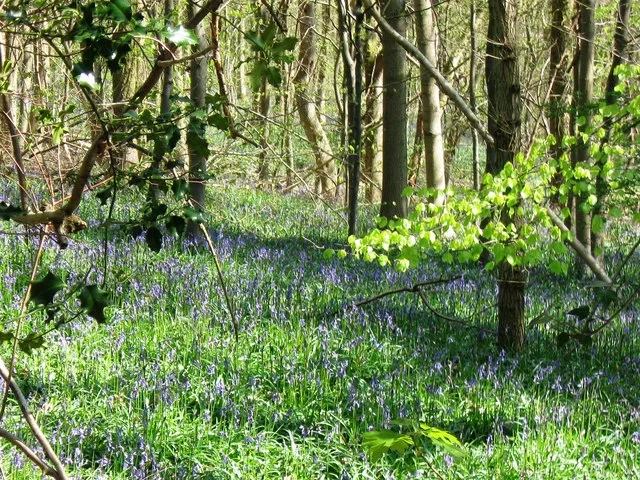
Wendover Woods — Named summit at 267.5 m.

Wikimedia Commons contributors — see linked file page for photographer and licence licence
Plan your visit
- Typical visit
- 3 h–8 h
- Best time of year
- Late spring – early autumn (May–Oct)
- Nearest railway station
- Wendover · 2.8 km
- Free entry
- Dog-friendly
About
Wendover Woods is a named summit in the United Kingdom. Wikidata describes it as: "Named summit at 267.5 m.". Coordinates: 51.7724°, -0.7111°.
Photo gallery
Protected designations
- Area of Outstanding Natural Beauty: Chilterns
Designations sourced from Natural England open data under OGL v3.
From the Wikipedia article
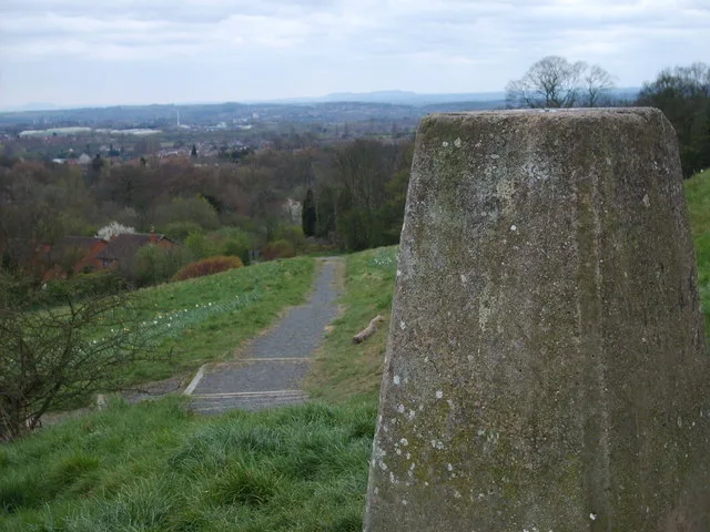
Haddington Hill (also called Wendover Hill) is a hill in The Chilterns within the parish of Halton, and the highest point in the English county of Buckinghamshire. On the north-eastern flank is Coombe Hill, not to be confused with another Coombe Hill 4 kilometres (2.5 mi) to the south-west. Haddington Hill is owned by the Forestry Commission, whose Wendover Woods cover much of the hill. Many tracks run through the forest, and a car park is located near the summit among the trees: the flat summit means the precise location of the highest point is difficult to determine with certainty. However, in the woods to the east of the car park there are a series of large stones bearing the inscription 'The Chiltern Summit'. The stones are surrounded by trees.
Excerpt from Wikipedia under CC BY-SA 4.0. See the source article linked in Sources below.
- Coordinates
- 51.7724, -0.7111
- District
- Buckinghamshire
- Parish
- Aston Clinton
- Postcode
- HP23 6LD
- Parliamentary constituency
- Aylesbury
- Nearest railway station
- Wendover — 2.8 km
- Official site
- goape.co.uk
Sources
- osm: n1430010075 (ODbL)
- wikipedia: Haddington Hill (CC BY-SA 4.0)
- commons: Wendover Woods.jpg (CC BY-SA 4.0)
Other places nearby
Loading nearby places…
Nearby
 📷 3
📷 3Memorials & monuments · West Midlands
Countryside Award 1970
Countryside Award 1970 — a memorial in england-west-midlands, United Kingdom.
 📷 3
📷 3Memorials & monuments · West Midlands
The Chiltern Summit
The Chiltern Summit — a memorial in england-west-midlands, United Kingdom.
 📷 3
📷 3Memorials & monuments · West Midlands
Gruffalo Statue
Gruffalo Statue — a memorial in england-west-midlands, United Kingdom.
Campsites · West Midlands
Hill Farm Campsite
Hill Farm Campsite — a campsite in england west midlands.
 📷 3
📷 3Wildlife reserves · West Midlands
Dancersend Nature Reserve
Dancersend Nature Reserve — nature reserve in the United Kingdom.
 📷 3
📷 3Museums · West Midlands
Trenchard Museum
Trenchard Museum — military Museum in Buckinghamshire, England.
More mountains in this region
 📷 5
📷 5Mountains & hills · West Midlands
Arbury Hill
Arbury Hill — Named summit at 224.3 m.
Mountains & hills · West Midlands
Barr Beacon
Barr Beacon — Named summit at 227 m.
 📷 3
📷 3Mountains & hills · West Midlands
Barrow Hill
Barrow Hill — Named summit at 179 m.
Mountains & hills · West Midlands
Beacon Hill
Beacon Hill — Named summit at 237 m.
Frequently asked questions
- Where is Wendover Woods?
- Wendover Woods is in the West Midlands, United Kingdom (postcode HP23 6LD), in the parish of Aston Clinton.
- Is Wendover Woods a protected site?
- Yes — Wendover Woods is part of the Chilterns National Landscape (AONB).
- Is Wendover Woods free to visit?
- Yes, Wendover Woods is free to enter.
- How do I get to Wendover Woods?
- The nearest railway station is Wendover, about 2.8 km away. Drivers can navigate to postcode HP23 6LD.