
Wildlife reserves · South East England
Dancersend Nature Reserve
In or near Halton.
Dancersend Nature Reserve — nature reserve in the United Kingdom.

Wikimedia Commons contributors — see linked file page for photographer and licence licence

Plan your visit
- Typical visit
- 2 h–4 h
- Best time of year
- Autumn & winter (migration & wildfowl)
- Nearest railway station
- Wendover · 3.6 km
- Free entry
- Dog-friendly
About
Dancersend Nature Reserve is a nature reserve in the West Midlands. The site is within the Chilterns National Landscape (AONB), and is a designated Site of Special Scientific Interest. It sits within the Aylesbury parliamentary constituency. The nearest railway station is Wendover, about 3.6 km away. Postcode area HP23.
Photo gallery
Official information
Dancersend Nature Reserve is a tranquil area rich in wildlife, located in the Chilterns. Visitors can explore diverse woodland habitats, enjoy seasonal displays of flowers, and observe various bird species. The reserve also features walking trails, including a half-mile Wildlife Walk.
Protected designations
- Site of Special Scientific Interest: Dancersend SSSI
- Area of Outstanding Natural Beauty: Chilterns
Designations sourced from Natural England open data under OGL v3.
Place summary
Dancersend Nature Reserve is a wildlife reserve located in Aston Clinton, West Midlands (postcode HP23). It is designated as a Site of Special Scientific Interest (SSSI) and lies within the Chilterns Area of Outstanding Natural Beauty (AONB).
AI-generated from the structured facts on this page (operator, designation, listing, era). Not a substitute for visiting.
- Coordinates
- 51.7749, -0.7003
- District
- Buckinghamshire
- Parish
- Aston Clinton
- Postcode
- HP23 6LD
- Parliamentary constituency
- Aylesbury
- Phone
- 01865 775476
- Nearest railway station
- Wendover — 3.6 km
- Opening
- Open at all times
- Official site
- www.bbowt.org.uk
Sources
- wikidata: Q29841951 (CC0)
- commons: The First Flush of Bluebells in Tatnall's Wood - geograph.org.uk - 1263156.jpg (CC BY-SA 4.0)
Other places nearby

Dancersend
Forests & woodlands · 0.1 km
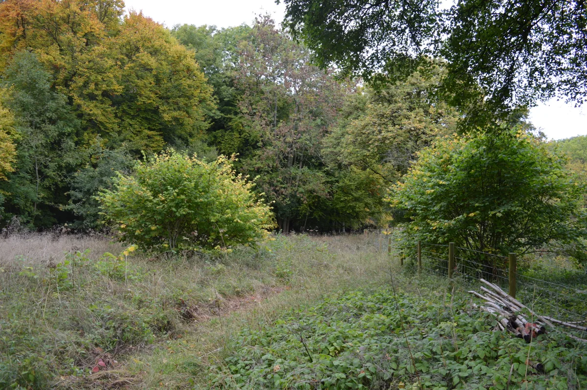
Dancersend
Wildlife reserves · 0.3 km

The Chiltern Summit
Memorials & monuments · 0.7 km

Hill Farm Campsite
Campsites · 0.8 km
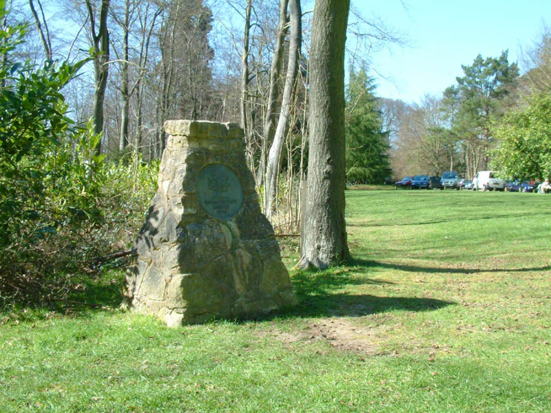
Wendover Woods
Mountains & hills · 0.8 km

Haddington Hill
Mountains & hills · 0.8 km

Countryside Award 1970
Memorials & monuments · 0.9 km

Gruffalo Statue
Memorials & monuments · 0.9 km

Aston Martin memorial
Memorials & monuments · 1.1 km

Trenchard Museum
Museums · 1.4 km

James McCudden Heritage Flight Centre
Museums · 1.5 km

Pavis Wood
Mountains & hills · 1.7 km
Nearby
📷 3Forests & woodlands · South East England
Dancersend
Dancersend is a forest or woodland in the United Kingdom.
📷 3Wildlife reserves · South East England
Dancersend
Dancersend — SSSI in in Buckinghamshire, England.
📷 3Memorials & monuments · South East England
The Chiltern Summit
The Chiltern Summit — a memorial in South East England, United Kingdom.
📷 5Campsites · South East England
Hill Farm Campsite
Hill Farm Campsite — a campsite in england west midlands.
📷 3Mountains & hills · South East England
Wendover Woods
Wendover Woods — Named summit at 267.5 m.
📷 5Mountains & hills · South East England
Haddington Hill
Haddington Hill — a hill or mountain in england west midlands.
Where to eat & stay near Dancersend Nature Reserve
Places to stay
📷 5Campsites · South East England
Hill Farm Campsite
Hill Farm Campsite — a campsite in england west midlands.
 📷 5
📷 5Hotels · South East England
Bel & The Dragon at the Red Lion
Bel & The Dragon at the Red Lion — a hotel in england west midlands. Brand: Fuller's.
 📷 3
📷 3 📷 5
📷 5Campsites · South East England
Braid Wood Scout & Guide Activity Centre
Braid Wood Scout & Guide Activity Centre — a campsite in england west midlands.
 📷 5
📷 5Campsites · South East England
Norcott Campsite - Camping In The Orchard
Norcott Campsite - Camping In The Orchard — a campsite in england west midlands.
 📷 4
📷 4Places to eat & drink
 📷 5
📷 5Restaurants · South East England
China Water
China Water — a restaurant in england west midlands.
 📷 5
📷 5Historic pubs · South East England
The Pack Horse Public House
The Pack Horse Public House in England South East, United Kingdom.
📷 7Restaurants · South East England
Prince of India
Prince of India — a restaurant in england west midlands.
 📷 5
📷 5Historic pubs · South East England
The White Swan
The White Swan — Historic pub — listed building or notable heritage status.
 📷 7
📷 7Historic pubs · South East England
King And Queen Public House
King And Queen Public House in England South East, United Kingdom.
 📷 5
📷 5Historic pubs · South East England
The Gate Public House
The Gate Public House in England South East, United Kingdom.
More places in this region
 📷 5
📷 5 📷 5
📷 5Wildlife reserves · South East England
Burham Down
Burham Down — nature reserve in Kent, England, UK.
 📷 5
📷 5Wildlife reserves · South East England
Combe Bottom
Combe Bottom — nature reserve in Surrey, England.
 📷 5
📷 5Wildlife reserves · South East England
Dryhill Nature Reserve
Dryhill Nature Reserve is a wildlife reserve in the United Kingdom.
Frequently asked questions
- Where is Dancersend Nature Reserve?
- Dancersend Nature Reserve is in South-East England, United Kingdom (postcode HP23 6LD), in the parish of Aston Clinton.
- What is Dancersend Nature Reserve?
- Dancersend Nature Reserve — nature reserve in the United Kingdom.
- How do I get to Dancersend Nature Reserve?
- The nearest railway station is Wendover, about 3.6 km away. The nearest town is Halton. Drivers can use postcode HP23 6LD.
- Is Dancersend Nature Reserve a protected site?
- Yes — Dancersend Nature Reserve is part of the Dancersend SSSI Site of Special Scientific Interest and the Chilterns National Landscape (AONB).
- Is Dancersend Nature Reserve free to visit?
- Yes, Dancersend Nature Reserve is free to enter.
- How do I get to Dancersend Nature Reserve?
- The nearest railway station is Wendover, about 3.6 km away. Drivers can navigate to postcode HP23 6LD.
- Are dogs allowed at Dancersend Nature Reserve?
- Most wildlife reserves allow dogs on lead only, with restrictions during ground-nesting bird season (March-July). Check signage at the reserve.