
Towns & cities · East of England
Welney
Welney — village and civil parish in Norfolk, UK.

Wikimedia Commons contributors — see linked file page for photographer and licence licence

Plan your visit
- Typical visit
- 3 h–6 h
- Nearest railway station
- Manea · 4.3 km
- Free entry
- Family-friendly
- Dog-friendly
Getting there & planning your visit
To visit Welney, the nearest railway station is Manea, located 4.3 km away. Entry to the town is free. The postcode for navigation is PE14.
About
Welney is a town, city, village or settlement in the United Kingdom. It covers approximately 21 km². Recent population estimates put it at around 528 people. Address: PE14. Wikidata describes it as: "village and civil parish in Norfolk, UK". Coordinates: 52.5167°, 0.2333°.
Photo gallery
Protected designations
- Site of Special Scientific Interest: Ouse Washes SSSI
- Ramsar wetland: Ouse Washes
Designations sourced from Natural England open data under OGL v3.
From the Wikipedia article
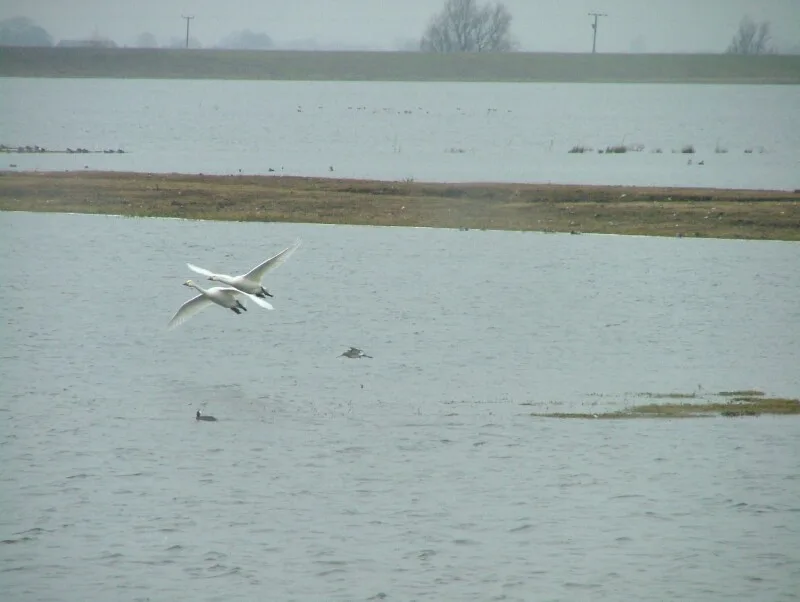
Welney is a village and civil parish in the Fens of England and the county of Norfolk. The village is about 10 miles (16 km) south-west of the town of Downham Market, 20 miles (30 km) south of the town of King's Lynn and 45 miles (70 km) west of the city of Norwich. The county boundary with Cambridgeshire is adjacent, with the city of Cambridge 25 miles (40 km) to the south. Welney is immediately to the west of the Old Bedford River, River Delph and New Bedford River, which are parallel channels and are here crossed by the A1101 road. Welney is on the Ouse Washes, an area of wildlife conservation. WWT Welney, near the village, is a nature reserve in the care of the Wildfowl and Wetlands Trust. Nearby there are also the RSPB Ouse Washes, a reserve managed by the Royal Society for the Protection of Birds. The parish covers an area of 8 square miles (20 km2) and had a population of 528 in 217 households at the 2001 census, which had increased to 542 by the 2011 Census. For the purposes of local government the parish falls within the district of King's Lynn and West Norfolk.
Excerpt from Wikipedia under CC BY-SA 4.0. See the source article linked in Sources below.
Background
History
In the 14th century Welney was called Wellenhe, meaning ‘a river called Welle’ (the old name of the Old Croft River). In the 18th century Woad was grown in the parish. In 1820 a road was built from Welney across The Wash to the New Bedford River (also known as the Hundred Foot Drain), where a ferry-boat was established opposite the public house of Thomas Golding, formerly Washington's; this provided a direct route into Lincolnshire through Wisbech from Bury St Edmunds, Ely and Cambridge. In the second half of the 19th century Welney became significant for its skaters. On 21 February 1855 Turkey Smart of Welney became champion skater of the Fens. James Smart of Welney became champion on 21…
Sourced from Wikipedia under CC BY-SA 4.0.
- Coordinates
- 52.5167, 0.2333
- County
- Norfolk
- District
- King's Lynn and West Norfolk
- Parish
- Welney
- Postcode
- PE14
- Parliamentary constituency
- South West Norfolk
- Population
- 528
- Nearest railway station
- Manea — 4.3 km
Sources
- wikidata: Q834299 (CC0)
- wikipedia: Welney (CC BY-SA 4.0)
- commons: St Mary's Church and water tower - geograph.org.uk - 432107.jpg (CC BY-SA 4.0)
Other places nearby

Welney Village Sign
Public art & sculpture · 1.2 km

Welney
Villages · 1.2 km
Ouse Washes
Wildlife reserves · 3.1 km

WWT Welney
Wildlife reserves · 3.1 km

Wetland Trust Visitor Centre
Natural landmarks · 3.3 km

Ouse Washes (Norfolk)
Forests & woodlands · 3.5 km

War Memorial in Churchyard
Memorials & monuments · 3.9 km

Christchurch Village Sign
Public art & sculpture · 4.1 km

Fen View Lakes
Campsites · 5.0 km

Croft Country Club
Caravan parks · 5.1 km

Manea
Villages · 5.1 km

New Bedford River
Historic churches · 6.0 km
Welney is a village in Norfolk, located in the London region, with a population of 528. Our guide lists N attractions within reach.
At a glance
- Population
- 528
- Administrative county
- Norfolk
- Constituency
- South West Norfolk
Things to see in Welney
17 attractions within 12 km. Full guide: things to do in Welney →
📷 5Wildlife reserves · East of England
Ouse Washes
Ouse Washes — nature reserve in the United Kingdom.
📷 5Forests & woodlands · East of England
Ouse Washes (Norfolk)
Ouse Washes (Norfolk) is a forest or woodland in the United Kingdom.
📷 5Natural landmarks · East of England
Wetland Trust Visitor Centre
Wetland Trust Visitor Centre — a natural landmark in england-london, United Kingdom.
📷 5Memorials & monuments · East of England
War Memorial in Churchyard
War Memorial in Churchyard — Grade II listed building-listed memorial in england-london, United Kingdom.
 📷 5
📷 5Public art & sculpture · East of England
Pymoor Village Sign
Pymoor Village Sign — a public art in england-london, United Kingdom.
📷 5Public art & sculpture · East of England
Welney Village Sign
Welney Village Sign — a public art in england-london, United Kingdom.
 📷 5
📷 5Public art & sculpture · East of England
Three Holes Village Sign
Three Holes Village Sign — a public art in england-london, United Kingdom.
📷 5Public art & sculpture · East of England
Christchurch Village Sign
Christchurch Village Sign — a public art in england-london, United Kingdom.
📷 5Historic churches · East of England
New Bedford River
New Bedford River — a church in england-london, United Kingdom.
📷 5Campsites · East of England
Fen View Lakes
Fen View Lakes — a campsite in england london.
📷 4Caravan parks · East of England
Croft Country Club
Croft Country Club — a caravan park in england london.
📷 5📷 5📷 3 📷 5
📷 5Memorials & monuments · East Midlands
Tower 30 Metres North Of Welle Manor Hall
Tower 30 Metres North Of Welle Manor Hall — Grade II listed building-listed memorial in england-london, United Kingdom.
 📷 5
📷 5Public art & sculpture · East Midlands
Upwell Village Sign
Upwell Village Sign — a public art in england-london, United Kingdom.
 📷 5
📷 5Nearby
📷 5Public art & sculpture · East of England
Welney Village Sign
Welney Village Sign — a public art in england-london, United Kingdom.
📷 5📷 5Wildlife reserves · East of England
Ouse Washes
Ouse Washes — nature reserve in the United Kingdom.
📷 3📷 5Natural landmarks · East of England
Wetland Trust Visitor Centre
Wetland Trust Visitor Centre — a natural landmark in england-london, United Kingdom.
📷 5Forests & woodlands · East of England
Ouse Washes (Norfolk)
Ouse Washes (Norfolk) is a forest or woodland in the United Kingdom.
Where to eat & stay near Welney
Places to stay
📷 5Campsites · East of England
Fen View Lakes
Fen View Lakes — a campsite in england london.
📷 4Caravan parks · East of England
Croft Country Club
Croft Country Club — a caravan park in england london.
 📷 5
📷 5Caravan parks · East of England
Fenland Camping & Caravan Park
Fenland Camping & Caravan Park — a caravan park in england london.
 📷 4
📷 4Caravan parks · East Midlands
Westerby Farm Touring Caravan and Camping Park
Westerby Farm Touring Caravan and Camping Park — a caravan park in england london.
 📷 5
📷 5 📷 5
📷 5Caravan parks · East of England
Lakeside Caravan Park (and Fishing Lakes)
Lakeside Caravan Park (and Fishing Lakes) — a caravan park in england london.
Places to eat & drink
 📷 7
📷 7Restaurants · East of England
The Old Fire Engine House
The Old Fire Engine House — a restaurant in england london.
 📷 7
📷 7Historic pubs · East of England
Royal Standard Public House
Royal Standard Public House in England East, United Kingdom.
 📷 7
📷 7Historic pubs · East of England
Cutter Public House
Cutter Public House in England East, United Kingdom.
 📷 5
📷 5Historic pubs · East of England
Sportsman Public House
Sportsman Public House in England East, United Kingdom.
 📷 5
📷 5 📷 5
📷 5More towns in this region
 Flagship📷 10
 Flagship📷 10
Towns & cities · East of England
Cambridge
Cambridge — city in Cambridgeshire, England.
 Flagship📷 10
Towns & cities · East of England
Chelmsford
Chelmsford — city in Essex, United Kingdom.
 Flagship📷 10
Towns & cities · East of England
Colney Heath
Colney Heath — village and civil parish in St Albans, Hertfordshire, England, UK.
Frequently asked questions
- Where is Welney?
- Welney is in Norfolk, London, United Kingdom (postcode PE14), in the parish of Welney.
- What is Welney?
- Welney — village and civil parish in Norfolk, UK.
- How do I get to Welney?
- The nearest railway station is Manea, about 4.3 km away. Drivers can use postcode PE14.
- Is Welney a protected site?
- Yes — Welney is part of the Ouse Washes SSSI Site of Special Scientific Interest and the Ouse Washes Ramsar wetland.
- Is Welney free to visit?
- Yes, Welney is free to enter.
- How do I get to Welney?
- The nearest railway station is Manea, about 4.3 km away. Drivers can navigate to postcode PE14.