
Historic houses · North West England
Wayside cross 150m north east of Ince Blundell Hall
In or near Sefton.
Wayside cross 150m north east of Ince Blundell Hall — a Grade II*-listed historic house in england-north-west, United Kingdom.

Norman Caesar — CC BY-SA 2.0 via Wikimedia Commons licence

Plan your visit
- Typical visit
- 1 h–2 h
- Nearest railway station
- Hightown · 2.9 km
- Family-friendly
- Limited wheelchair access
About
Wayside cross 150m north east of Ince Blundell Hall is a Grade II*-listed building in england-north-west, United Kingdom. Grade II* status is conferred by Historic England (or Cadw, Historic Environment Scotland or NIEA equivalents) on buildings of exceptional national interest. See the linked Wikipedia article for full historical and architectural details.
Photo gallery
Protected designations
- Ramsar wetland: Ribble & Alt Estuaries
Designations sourced from Natural England open data under OGL v3.
Place summary
The Wayside Cross, located 150 metres north-east of Ince Blundell Hall in North-West England, is a historic monument designated as Grade II*. It is situated within the parish of Ince Blundell and highlights the area's ecclesiastical heritage.
AI-generated from the structured facts on this page (operator, designation, listing, era). Not a substitute for visiting.
- Coordinates
- 53.5199, -3.0145
- District
- Sefton
- Parish
- Ince Blundell
- Postcode
- L38 6JL
- Parliamentary constituency
- Sefton Central
- Nearest railway station
- Hightown — 2.9 km
Sources
- wikidata: Q17675534 (CC0)
Other places nearby
Monument Approximately 20 Metres To South Of Main Range Of Ince Blundell Hall
Memorials & monuments · 0.1 km

Standing cross on the village green, 30m south east of the junction of Carr House Lane and Lady Green Lane
Historic houses · 0.9 km

Broom's Cross, Thornton, Merseyside
Historic houses · 2.0 km

Wayside cross 100m north of Liverpool Lodge, Little Crosby
Historic houses · 2.0 km

Thornton Sundial
Memorials & monuments · 2.3 km
Standing cross at the junction of Green Lane and Water Street
Historic houses · 2.3 km

Moor Lane windmill, Crosby
Windmills · 2.7 km

Hightown Cross
Historic houses · 2.8 km

Hightown War Memorial
Memorials & monuments · 3.0 km

Saint Helen's Well
Archaeological sites · 3.1 km
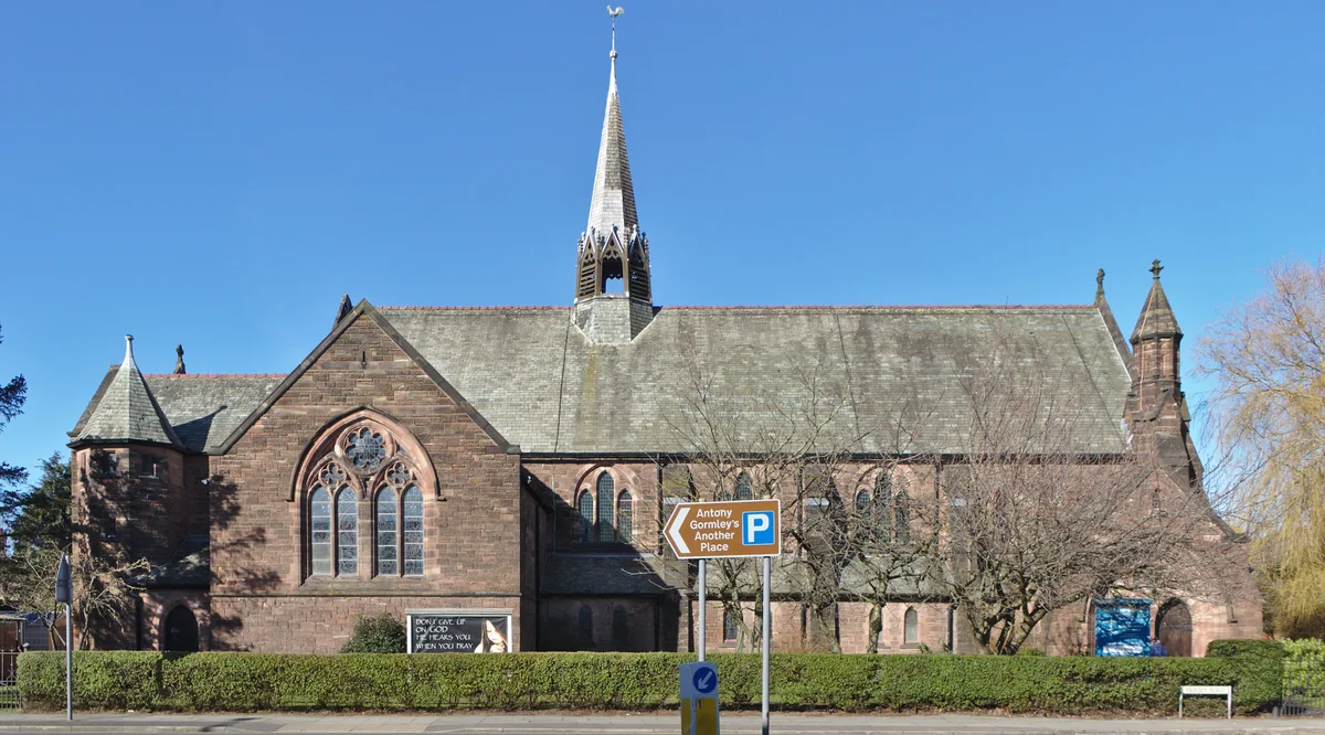
Crosby United Reformed Church
Historic churches · 3.2 km

Great Altcar
Villages · 3.3 km
Nearby
📷 3Memorials & monuments · North West England
Monument Approximately 20 Metres To South Of Main Range Of Ince Blundell Hall
Monument Approximately 20 Metres To South Of Main Range Of Ince Blundell Hall — Grade II listed building-listed memorial in england-north-west, United Kingdom.
📷 3Historic houses · North West England
Standing cross on the village green, 30m south east of the junction of Carr House Lane and Lady Green Lane
Standing cross on the village green, 30m south east of the junction of Carr House Lane and Lady Green Lane — a Grade II*-listed historic house in england-north-west, United Kingdom.
📷 3Historic houses · North West England
Broom's Cross, Thornton, Merseyside
Broom's Cross, Thornton, Merseyside — a Grade II*-listed historic house in england-north-west, United Kingdom.
📷 3Historic houses · North West England
Wayside cross 100m north of Liverpool Lodge, Little Crosby
Wayside cross 100m north of Liverpool Lodge, Little Crosby — a Grade II*-listed historic house in england-north-west, United Kingdom.
📷 3Memorials & monuments · North West England
Thornton Sundial
Thornton Sundial — a memorial in england-north-west, United Kingdom.
📷 3Historic houses · North West England
Standing cross at the junction of Green Lane and Water Street
Standing cross at the junction of Green Lane and Water Street — a Grade II*-listed historic house in england-north-west, United Kingdom.
Where to eat & stay near Wayside cross 150m north east of Ince Blundell Hall
Places to stay
 📷 5
📷 5Campsites · North West England
Hidden Corner Camp Site
Hidden Corner Camp Site — a campsite in england north west.
 📷 5
📷 5Caravan parks · North West England
Formby Point Caravan Park
Formby Point Caravan Park — a caravan park in england north west.
 📷 5
📷 5Caravan parks · North West England
Plex Moss Caravan Park
Plex Moss Caravan Park — a caravan park in england north west.
 📷 5
📷 5Caravan parks · North West England
Freshfield Caravan Park
Freshfield Caravan Park — a caravan park in england north west.
 📷 5
📷 5Caravan parks · North West England
Willowbank Caravan Park
Willowbank Caravan Park — a caravan park in england north west.
 📷 5
📷 5Caravan parks · North West England
Tristram's Farmhouse
Tristram's Farmhouse — a caravan park in england north west.
Places to eat & drink
 📷 5
📷 5Historic pubs · North West England
Former bank and residence
Former bank and residence in Wales North, United Kingdom.
 📷 7
📷 7Historic pubs · North West England
Buck I' Th' Vine Inn
Buck I' Th' Vine Inn in England North West, United Kingdom.
 📷 7
📷 7Historic pubs · North West England
The Windmill Public House
The Windmill Public House in England North West, United Kingdom.
 📷 5
📷 5Historic pubs · North West England
Throstles Nest Hotel, Scotland Road
Throstles Nest Hotel, Scotland Road in Wales North, United Kingdom.
 📷 5
📷 5Historic pubs · North West England
That Part Of The Brighton Public House Contained Within Buchanan Road The Brighton Public House
That Part Of The Brighton Public House Contained Within Buchanan Road The Brighton Public House in Wales North, United Kingdom.
 📷 5
📷 5Historic pubs · North West England
The Hare And Hounds Public House
The Hare And Hounds Public House in Wales North, United Kingdom.
More historic houses in this region
 📷 3
📷 3Historic houses · North West England
116 Hospital Street, Nantwich
116 Hospital Street, Nantwich — substantial townhouse in Nantwich, Cheshire, England, UK.
 📷 3
📷 3Historic houses · North West England
140–142 Hospital Street, Nantwich
140–142 Hospital Street, Nantwich — grade II listed building in Nantwich, Cheshire East, Cheshire, England, UK.
 📷 3
📷 3Historic houses · North West England
46 High Street, Nantwich
46 High Street, Nantwich — house in Nantwich, Cheshire, England, UK.
 📷 3
📷 3Historic houses · North West England
64, St Ann's Road
64, St Ann's Road — Grade II* listed house in Middlewich, Cheshire East, England, UK.
Frequently asked questions
- Where is Wayside cross 150m north east of Ince Blundell Hall?
- Wayside cross 150m north east of Ince Blundell Hall is in North-West England, United Kingdom (postcode L38 6JL), in the parish of Ince Blundell.
- What is Wayside cross 150m north east of Ince Blundell Hall?
- Wayside cross 150m north east of Ince Blundell Hall — a Grade II*-listed historic house in england-north-west, United Kingdom.
- How do I get to Wayside cross 150m north east of Ince Blundell Hall?
- The nearest railway station is Hightown, about 2.9 km away. Drivers can use postcode L38 6JL.
- Is Wayside cross 150m north east of Ince Blundell Hall a listed building?
- Wayside cross 150m north east of Ince Blundell Hall is officially recognised as Grade II* listed.
- Is Wayside cross 150m north east of Ince Blundell Hall a protected site?
- Yes — Wayside cross 150m north east of Ince Blundell Hall is part of the Ribble & Alt Estuaries Ramsar wetland.
- How do I get to Wayside cross 150m north east of Ince Blundell Hall?
- The nearest railway station is Hightown, about 2.9 km away. Drivers can navigate to postcode L38 6JL.