
Natural landmarks · North East England
Water Tower To South West Of Gabriel Farmhouse
In or near Swainby.
Water Tower To South West Of Gabriel Farmhouse in England North East, United Kingdom.

Paul Buckingham — CC BY-SA 2.0 via Wikimedia Commons licence

Plan your visit
- Typical visit
- 1 h–2 h
- Free entry
- Dog-friendly
About
Water Tower To South West Of Gabriel Farmhouse is a place of interest in England North East, United Kingdom — drawn from open-data sources for visitor reference. See the linked Wikipedia article for the full description.
Photo gallery
From the Wikipedia article
Ingleby Arncliffe Water Tower is a historic structure in Ingleby Arncliffe, a village in North Yorkshire, in England. The tower was commissioned by Sir Hugh Bell, chair of the Tees Valley Water Board. A local story claims that Bell commissioned it over concerns that the local water supply would be interrupted during World War I. The tower is fed from a spring in the Cleveland Hills, about one mile away, and is stored in the tower, originally able to feed standpipes on demand. It was designed by Walter Brierley, and was completed in 1915. The building was grade II listed in 1990. It now feeds one cottage and some cattle troughs. Inside the base of the tower are stored a fire engine dating from about 1870, and an earlier funeral bier. The water tower is built of sandstone on a stepped and chamfered plinth, with quoins, a double corbel table, gargoyles, an embattled parapet, and a stone-flagged saddleback roof. There are three storeys, and the tower contains a doorway with a chamfered moulded surround, and an inscribed and dated lintel. Above it is a panel containing an achievement and a motto. The tower is surrounded by a parterre of cobbles.
Excerpt from Wikipedia under CC BY-SA 4.0. See the source article linked in Sources below.
- Coordinates
- 54.4009, -1.3143
- District
- North Yorkshire
- Parish
- Ingleby Arncliffe
- Postcode
- DL6 3NB
- Parliamentary constituency
- Richmond and Northallerton
Sources
- wikidata: Q26582333 (CC0)
- wikipedia: Ingleby Arncliffe Water Tower (CC BY-SA 4.0)
Other places nearby
Ingleby Arncliffe
Memorials & monuments · 0.1 km

Church of All Saints
Historic churches · 0.9 km

Arncliffe Hall
Historic houses · 0.9 km

The Cleveland Tontine
Hotels · 1.5 km

Beacon Hill
Mountains & hills · 1.7 km
Beacon Hill
Mountains & hills · 1.7 km
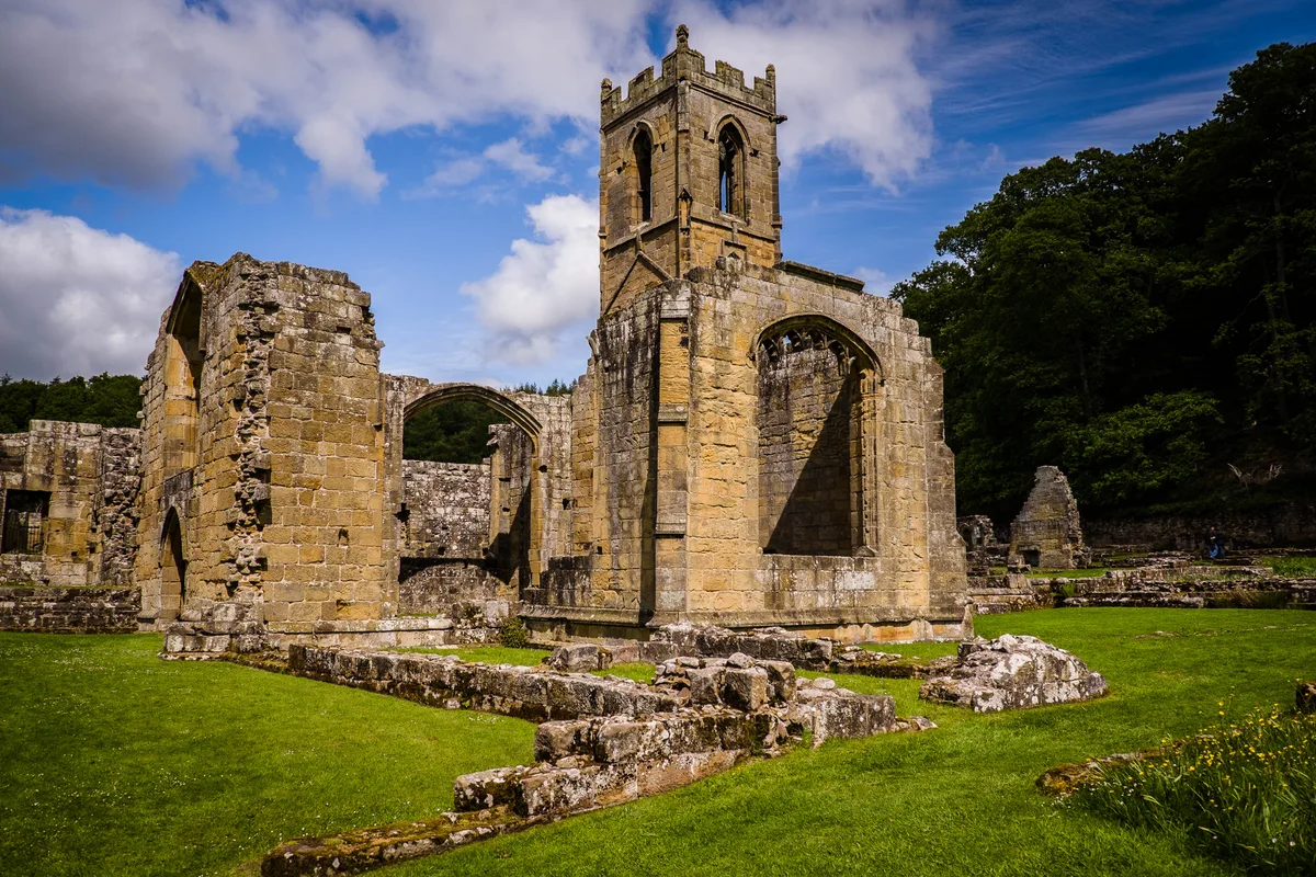
Mount Grace Priory
Hill forts · 2.3 km

The Madonna of the Cross
Public art & sculpture · 2.4 km

Mount Grace House
Historic houses · 2.4 km

East Harlsey
Villages · 2.4 km
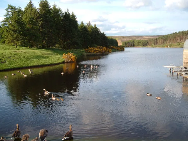
Cod Beck Reservoir
Reservoirs & lochs · 2.8 km

Swan House Caravan Park
Caravan parks · 2.8 km
Nearby
📷 4Memorials & monuments · North East England
Ingleby Arncliffe
Ingleby Arncliffe in England North East, United Kingdom.
📷 5Historic churches · Yorkshire & the Humber
Church of All Saints
Church of All Saints — church in Ingleby Arncliffe, North Yorkshire, England, UK.
📷 3Historic houses · Yorkshire & the Humber
Arncliffe Hall
Arncliffe Hall — house in Ingleby Arncliffe, North Yorkshire, England, UK.
📷 7Hotels · Yorkshire & the Humber
The Cleveland Tontine
The Cleveland Tontine — a hotel in england yorkshire.
📷 5Mountains & hills · Yorkshire & the Humber
Beacon Hill
Beacon Hill — a hill or mountain in england yorkshire.
📷 5Mountains & hills · Yorkshire & the Humber
Beacon Hill
Beacon Hill — mountain in england yorkshire. Elevation: 299 m.
Where to eat & stay near Water Tower To South West Of Gabriel Farmhouse
Places to stay
📷 7Hotels · Yorkshire & the Humber
The Cleveland Tontine
The Cleveland Tontine — a hotel in england yorkshire.
📷 5Caravan parks · Yorkshire & the Humber
Swan House Caravan Park
Swan House Caravan Park — a caravan park in england yorkshire.
 📷 5
📷 5Hostels · Yorkshire & the Humber
Cote Ghyll Mill Youth Hostel
Cote Ghyll Mill Youth Hostel — a hostel in england yorkshire.
 📷 5
📷 5 📷 5
📷 5Hotels · Yorkshire & the Humber
Queen Catherine Hotel
Queen Catherine Hotel — a hotel in england yorkshire.
 📷 5
📷 5Caravan parks · Yorkshire & the Humber
Goulton Beck Lodges
Goulton Beck Lodges — a caravan park in england yorkshire.
Places to eat & drink
 📷 5
📷 5 📷 4
📷 4Historic pubs · North East England
The Horse Shoe Inn
The Horse Shoe Inn in England North East, United Kingdom.
 📷 4
📷 4Historic pubs · North East England
The Bay Horse Inn
The Bay Horse Inn in England North East, United Kingdom.
 📷 5
📷 5Historic pubs · North East England
The Crathorne Arms Public House And Outbuilding Adjoining To South
The Crathorne Arms Public House And Outbuilding Adjoining To South in England North East, United Kingdom.
 📷 5
📷 5Historic pubs · North East England
The Lord Nelson Inn
The Lord Nelson Inn in England North East, United Kingdom.
 📷 5
📷 5Historic pubs · Yorkshire & the Humber
The Three Horseshoes Inn
The Three Horseshoes Inn in England Yorkshire, United Kingdom.
More natural landmarks in this region
 📷 4
📷 4Natural landmarks · North East England
Cleveland Way
109-mile horseshoe trail around the North York Moors and its sea cliffs.
 📷 3
📷 3Natural landmarks · North East England
The Hand Stone
The Hand Stone — a other in england-yorkshire, United Kingdom.
 📷 3
📷 3Natural landmarks · North East England
The Face Stone
The Face Stone — a other in england-yorkshire, United Kingdom.
 📷 3
📷 3Frequently asked questions
- Where is Water Tower To South West Of Gabriel Farmhouse?
- Water Tower To South West Of Gabriel Farmhouse is in North-East England, United Kingdom (postcode DL6 3NB), in the parish of Ingleby Arncliffe.
- What is Water Tower To South West Of Gabriel Farmhouse?
- Water Tower To South West Of Gabriel Farmhouse in England North East, United Kingdom.
- How do I get to Water Tower To South West Of Gabriel Farmhouse?
- The nearest town is Swainby. Drivers can use postcode DL6 3NB.
- Is Water Tower To South West Of Gabriel Farmhouse free to visit?
- Yes, Water Tower To South West Of Gabriel Farmhouse is free to enter.
- How do I get to Water Tower To South West Of Gabriel Farmhouse?
- Drivers can navigate to postcode DL6 3NB. It sits within the Richmond and Northallerton parliamentary constituency.