
Mountains & hills · Scottish Islands
Ward Hill
Also known as: Ward Hill (Hòigh)
In or near Stromness.
Ward Hill — Named summit at 481 m.

Wikimedia Commons contributors — see linked file page for photographer and licence licence

Plan your visit
- Typical visit
- 3 h–8 h
- Best time of year
- Late spring – early autumn (May–Oct)
- Free entry
- Dog-friendly
About
Ward Hill is a named summit in the United Kingdom. Wikidata describes it as: "Named summit at 481 m.". Coordinates: 58.9004°, -3.3406°.
Photo gallery
From the Wikipedia article
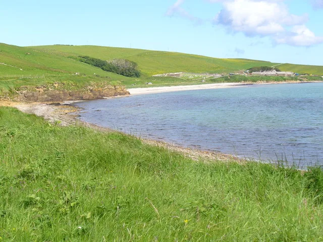
Ward Hill is a hill on the island of Hoy in Orkney, Scotland. It lies at the north of the island between Moaness and Rackwick, and is the highest point in both Orkney and the Scottish Northern Isles at an elevation of 481 m (1,578 ft). The hill forms a curved ridge, reminiscent of a 'J' in shape. The lower slopes are covered in heather and grass, though the top of the ridge is covered in small stones with bare sandy soil. The highest summit is towards the northern end and is crowned by a trig point. The ridge is well separated from the other hills of Hoy, and both the other Marilyns on the island have high topographic prominence. Ward Hill is separated from Cuilags by the Glens of Kinnaird, and from Knap of Trowieglen by the glen carrying the road between Moaness and Rackwick, in which lies the Dwarfie Stane. The existence of Anastrepta orcadensis (also known as Orkney Notchwort), a liverwort found in the United States, Canada, and widely in Europe, was first discovered on Ward Hill by William Jackson Hooker in 1808.
Excerpt from Wikipedia under CC BY-SA 4.0. See the source article linked in Sources below.
- Coordinates
- 58.9004, -3.3406
- District
- Orkney Islands
- Postcode
- KW16 3NJ
- Parliamentary constituency
- Orkney and Shetland
Sources
- osm: n612578114 (ODbL)
- wikipedia: Ward Hill, Hoy (CC BY-SA 4.0)
- commons: Orkney Ward Hill.jpg (CC BY-SA 4.0)
Other places nearby

Round Hill
Mountains & hills · 1.6 km

Cuilags
Mountains & hills · 2.2 km
Cuilags
Mountains & hills · 2.2 km

Bay of Quoys
Natural landmarks · 2.3 km

Quoyness
Villages · 2.3 km

Dwarfie Stane
Islands · 2.4 km

The Witter
Mountains & hills · 2.5 km

Bu Hill
Mountains & hills · 2.5 km
Bay of Creekland
Mountains & hills · 2.6 km

Berriedale Wood
Battlefields & battle sites · 2.8 km

Skerry battery fire control tower
Historic houses · 3.1 km
Generator builidng
Natural landmarks · 3.1 km
Nearby
📷 5Mountains & hills · Scottish Islands
Round Hill
Round Hill — mountain in scotland islands. Elevation: 136 m.
📷 5Mountains & hills · Scottish Islands
Cuilags
Cuilags — mountain in scotland islands. Elevation: 435 m.
📷 5📷 5Natural landmarks · Scottish Islands
Bay of Quoys
Bay of Quoys — a natural feature in scotland islands.
📷 5📷 5Where to eat & stay near Ward Hill
Places to stay
 📷 5
📷 5 📷 5
📷 5 📷 5
📷 5Campsites · Scottish Islands
Point of Ness Campsite
Point of Ness Campsite — a campsite in scotland islands.
 📷 5
📷 5 📷 7
📷 7Hotels · Scottish Islands
The Stromness Hotel
The Stromness Hotel — a hotel in scotland islands.
 📷 5
📷 5Places to eat & drink
 📷 4
📷 4More mountains in this region
 📷 3
📷 3Mountains & hills · Scottish Islands
Acairseid Mhor
Acairseid Mhor — bay in Outer Hebrides, Scotland, UK.
 📷 3
📷 3Mountains & hills · Scottish Islands
Ainshval
Ainshval — Named summit at 781 m.
 📷 3
📷 3 📷 5
📷 5Mountains & hills · Scottish Islands
An Cliseam
An Cliseam — Named summit at 799 m.
Frequently asked questions
- Where is Ward Hill?
- Ward Hill is in the Scottish Islands, United Kingdom (postcode KW16 3NJ).
- What is Ward Hill?
- Ward Hill — Named summit at 481 m.
- How do I get to Ward Hill?
- Drivers can use postcode KW16 3NJ.
- Is Ward Hill free to visit?
- Yes, Ward Hill is free to enter.
- How do I get to Ward Hill?
- Drivers can navigate to postcode KW16 3NJ. It sits within the Orkney and Shetland parliamentary constituency.