
Archaeological sites · South West England
Wansdyke: section 1230yds (1120m) eastwards from Burnt House Inn
In or near Limpley Stoke.
Wansdyke: section 1230yds (1120m) eastwards from Burnt House Inn — archaeological site in Southstoke, Bath and North East Somerset, England, UK.

Wikimedia Commons contributors — see linked file page for photographer and licence licence

Plan your visit
- Typical visit
- 45 min–1.5 h
- Nearest railway station
- Oldfield Park · 2.8 km
- Free entry
- Dog-friendly
About
Wansdyke: section 1230yds (1120m) eastwards from Burnt House Inn is a place of interest in South-East England. Officially recognised as scheduled monument. The site is within the Cotswolds National Landscape (AONB). It sits within the Bath parliamentary constituency. The nearest railway station is Oldfield Park, about 2.8 km away. Postcode area BA2.
Photo gallery
Protected designations
- Area of Outstanding Natural Beauty: Cotswolds
Designations sourced from Natural England open data under OGL v3.
Place summary
Wansdyke is an archaeological site located in South-East England, specifically in the Bath and North East Somerset area. This scheduled monument spans 1230 yards (1120 metres) eastwards from the Burnt House Inn and is situated within the Cotswolds Area of Outstanding Natural Beauty (AONB).
AI-generated from the structured facts on this page (operator, designation, listing, era). Not a substitute for visiting.
- Coordinates
- 51.3547, -2.3734
- District
- Bath and North East Somerset
- Parish
- Bath and North East Somerset, unparished area
- Postcode
- BA2 2UP
- Parliamentary constituency
- Bath
- Nearest railway station
- Oldfield Park — 2.8 km
- Official site
- www.walknowtracks.co.uk
Sources
- wikidata: Q17641978 (CC0)
- commons: Path along the Wansdyke bank, east of Burnt House.JPG (CC BY-SA 4.0)
Other places nearby

Wansdyke
Archaeological sites · 0.0 km
Three Ways School
Natural landmarks · 0.2 km

Bath Union Workhouse Burial Ground
Cemeteries · 0.4 km

South Stoke Millenium Viewpoint
Viewpoints · 0.6 km

Cross Keys Inn
Historic houses · 0.7 km

Cross Keys Inn
Historic pubs · 0.7 km
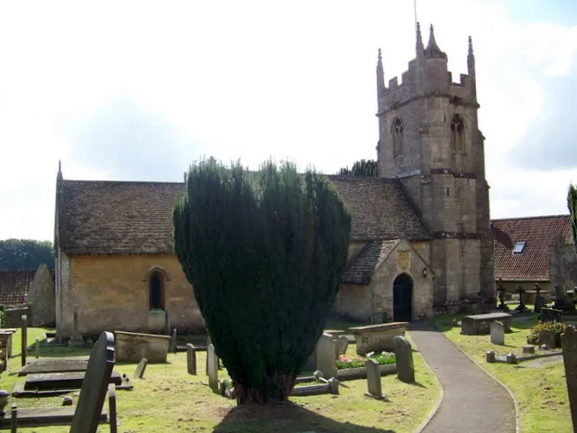
Church of St James, Southstoke
Historic churches · 0.8 km

Berwick
Vineyards · 0.8 km

The Packhorse
Historic pubs · 0.8 km

Bridge Over Canal,25 Yards East Of Caisson House
Historic bridges · 1.5 km
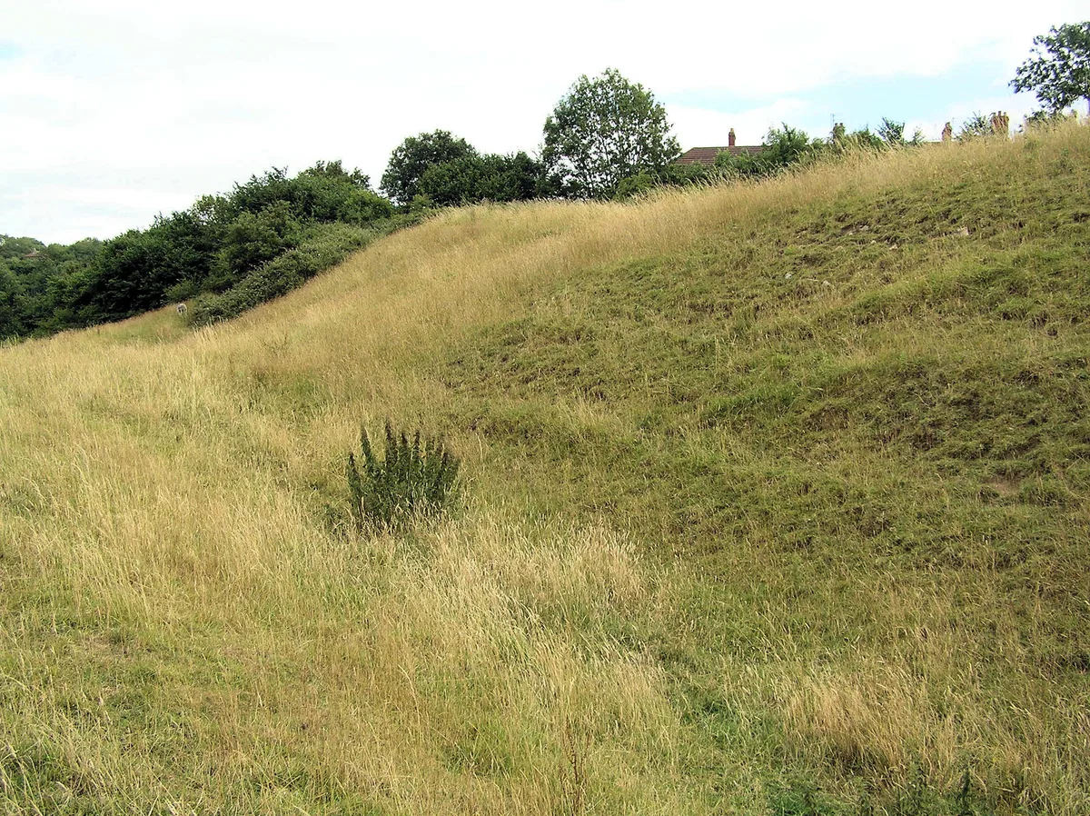
Part of the linear boundary known as the Wansdyke 420m south west of Barrowmead Cottage
Archaeological sites · 1.5 km

South Stoke
Vineyards · 1.5 km
Nearby
📷 5Archaeological sites · South West England
Wansdyke
Wansdyke — a archaeological in england-south-east, United Kingdom.
📷 5Natural landmarks · South West England
Three Ways School
Three Ways School — a school heritage in england-south-east, United Kingdom.
📷 5Cemeteries · South West England
Bath Union Workhouse Burial Ground
Bath Union Workhouse Burial Ground is a cemetery in the United Kingdom.
📷 5Viewpoints · South West England
South Stoke Millenium Viewpoint
South Stoke Millenium Viewpoint is a viewpoint in the United Kingdom.
📷 5Historic houses · South West England
Cross Keys Inn
Cross Keys Inn — a Grade II*-listed historic house in england-south-east, United Kingdom.
📷 5Historic pubs · South West England
Cross Keys Inn
Cross Keys Inn in England South West, United Kingdom.
Where to eat & stay near Wansdyke: section 1230yds (1120m) eastwards from Burnt House Inn
Places to stay
 📷 5
📷 5B&Bs · South West England
Bloomfield House
Bloomfield House — a bed-and-breakfast in england south east.
 📷 5
📷 5Hotels · South West England
Wentworth House
Wentworth House — a hotel in england south east.
 📷 7
📷 7B&Bs · South West England
Dorian House
Dorian House — a bed-and-breakfast in england south east.
📷 7B&Bs · South West England
Oldfields House
Oldfields House — a bed-and-breakfast in england south east.
 📷 5
📷 5Hotels · South West England
Royal Hotel
Royal Hotel — a hotel in england south east.
 📷 7
📷 7Places to eat & drink
📷 5Historic pubs · South West England
Cross Keys Inn
Cross Keys Inn in England South West, United Kingdom.
📷 5 📷 5
📷 5Cafés · South West England
The Darling Deli Kitchen
The Darling Deli Kitchen — a café in england south east.
 📷 5
📷 5Historic pubs · South West England
The Wheatsheaf
The Wheatsheaf in England South West, United Kingdom.
 📷 5
📷 5Restaurants · South West England
Velo Lounge
Velo Lounge — a restaurant in england south east. Cuisine: british. Brand: Lounges.
 📷 5
📷 5Cafés · South West England
Bath City Cafe
Bath City Cafe — a café in england south east.
More archaeological sites in this region
 📷 5
📷 5Archaeological sites · South West England
Battlesbury Camp Monuments: hillfort, settlement, cemetery, barrows, enclosure, and field systems
Battlesbury Camp Monuments: hillfort, settlement, cemetery, barrows, enclosure, and field systems — archaeological site in Warminster, Wiltshire, England, UK.
 📷 2
📷 2Archaeological sites · South West England
Blandford Forest
Blandford Forest — forest in Blandford Forum, England.
 📷 5
📷 5Archaeological sites · South West England
Boulsbury Wood
Boulsbury Wood — protected area in Dorset and Hampshire, England.
.jpg?width=1200) 📷 5
📷 5Archaeological sites · South West England
Cranborne Chase
Cranborne Chase — Plateau in southern England.
Frequently asked questions
- Where is Wansdyke: section 1230yds (1120m) eastwards from Burnt House Inn?
- Wansdyke: section 1230yds (1120m) eastwards from Burnt House Inn is in South-East England, United Kingdom (postcode BA2 2UP), in the parish of Bath and North East Somerset, unparished area.
- What is Wansdyke: section 1230yds (1120m) eastwards from Burnt House Inn?
- Wansdyke: section 1230yds (1120m) eastwards from Burnt House Inn — archaeological site in Southstoke, Bath and North East Somerset, England, UK.
- How do I get to Wansdyke: section 1230yds (1120m) eastwards from Burnt House Inn?
- The nearest railway station is Oldfield Park, about 2.8 km away. Drivers can use postcode BA2 2UP.
- Is Wansdyke: section 1230yds (1120m) eastwards from Burnt House Inn a listed building?
- Wansdyke: section 1230yds (1120m) eastwards from Burnt House Inn is officially recognised as scheduled monument listed.
- Is Wansdyke: section 1230yds (1120m) eastwards from Burnt House Inn a protected site?
- Yes — Wansdyke: section 1230yds (1120m) eastwards from Burnt House Inn is part of the Cotswolds National Landscape (AONB).
- Is Wansdyke: section 1230yds (1120m) eastwards from Burnt House Inn free to visit?
- Yes, Wansdyke: section 1230yds (1120m) eastwards from Burnt House Inn is free to enter.
- How do I get to Wansdyke: section 1230yds (1120m) eastwards from Burnt House Inn?
- The nearest railway station is Oldfield Park, about 2.8 km away. Drivers can navigate to postcode BA2 2UP.