
Towns & cities · South West England
Limpley Stoke
Limpley Stoke — village and civil parish in Wiltshire, England, UK.

Wikimedia Commons contributors — see linked file page for photographer and licence licence

Plan your visit
- Typical visit
- 3 h–6 h
- Nearest railway station
- Freshford · 1.2 km
- Free entry
- Family-friendly
- Dog-friendly
Getting there & planning your visit
To visit Limpley Stoke, the nearest railway station is Freshford, located 1.2 km away. Entry to the town is free.
About
Limpley Stoke is a town, city, village or settlement in the United Kingdom. Recent population estimates put it at around 541 people. Address: BA15. Wikidata describes it as: "village and civil parish in Wiltshire, England, UK". Coordinates: 51.3467°, -2.3165°.
Photo gallery
See it from the streetimagery from 2018
Imagery © Mapillary contributors, CC BY-SA 4.0
Protected designations
- Area of Outstanding Natural Beauty: Cotswolds
Designations sourced from Natural England open data under OGL v3.
From the Wikipedia article
Limpley Stoke is a village and civil parish in Wiltshire, England. It lies in the Avon valley between Bath and Freshford, and is both above and below the A36 road. The parish is surrounded to the north, west and south by the Bath and North East Somerset district and includes the outskirts of the Somerset villages of Freshford and Midford. The Avon forms the eastern boundary of the parish, and its tributary the Midford Brook is the boundary in the north and west. The parish had a population of 593 in 2021, up from 541 in 2011.
Excerpt from Wikipedia under CC BY-SA 4.0. See the source article linked in Sources below.
Background
History
The 18th-century country house at Waterhouse is a Grade II listed building. Limpley Stoke was the westernmost part of the ancient hundred of Bradford, and a tithing of Bradford parish, which was divided into civil parishes in 1894. A small Baptist chapel was built on Middle Stoke in 1815 and rebuilt in 1888, providing 150 seats. The chapel closed in the 1970s. A National School was opened on Middle Stoke in 1845; in 1893 there were 51 pupils. The school closed in 1932 owing to low pupil numbers, and the building is now the village hall. In 1886 E.G. Browne and J.C. Margetson acquired a cloth mill, known as Avon Mill, on the banks of the River Avon at Limpley Stoke. The previous owners of…
Sourced from Wikipedia under CC BY-SA 4.0.
- Coordinates
- 51.3467, -2.3165
- District
- Wiltshire
- Parish
- Limpley Stoke
- Postcode
- BA15
- Parliamentary constituency
- Melksham and Devizes
- Population
- 541
- Nearest railway station
- Freshford — 1.2 km
- Official site
- limpleystoke.com
Sources
- wikidata: Q251961 (CC0)
- wikipedia: Limpley Stoke (CC BY-SA 4.0)
- commons: Limpley Stoke , Midford Brook - geograph.org.uk - 6563331.jpg (CC BY-SA 4.0)
Other places nearby

The Hop Pole Inn
Historic pubs · 0.2 km

Limpley Stoke War Memorial
Memorials & monuments · 0.2 km

Limpley Stoke Bridge (or Stokeford Bridge)
Historic bridges · 0.4 km

Kennet And Avon Canal, Limpley Stoke Canal Bridge
Historic bridges · 0.5 km

Two Unidentified Monuments In The Churchyard Between 1 And 4 Metres North East Of Porch Of Church Of St Mary
Memorials & monuments · 0.6 km

Freshford
Towns & cities · 0.7 km

Freshford War Memorial
Memorials & monuments · 1.1 km

War Memorial
Memorials & monuments · 1.1 km

Freshford Manor
Stately homes · 1.2 km

Lock Up, Mill Lane
Historic houses · 1.3 km
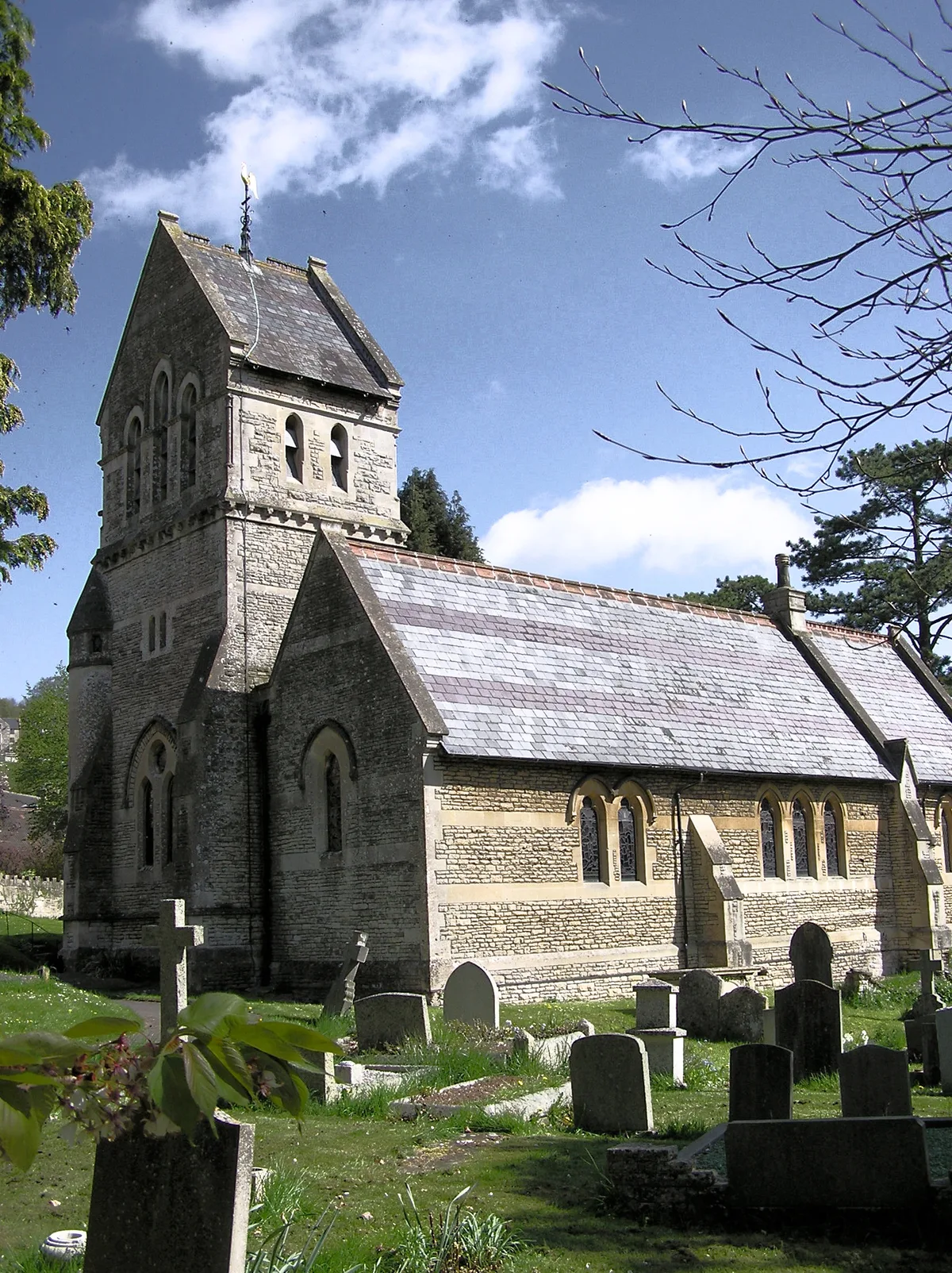
St Michael's Church, Monkton Combe
Historic churches · 1.3 km

The Wheelwright's Arms
Historic pubs · 1.3 km
Limpley Stoke is a town in South West England offering several notable sites for visitors. You can explore the Dundas Aqueduct and the historic Cross Keys Inn during your stay. The area also features St Michael's Church in Monkton Combe as a key attraction to see.
At a glance
- Population
- 541
- Constituency
- Melksham and Devizes
- Top categories near here
Things to see in Limpley Stoke
66 attractions within 12 km — showing the 24 most editorially-significant. Full guide: things to do in Limpley Stoke →
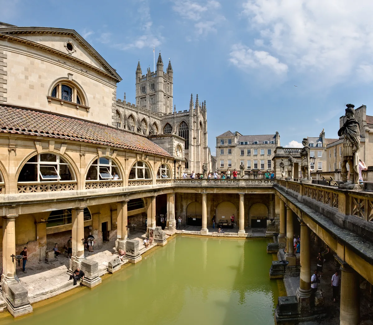 ★ Iconic📷 10
UNESCO World Heritage · South West England
Buildings and architecture of Bath
Buildings and architecture of Bath — aspect of the city in Somerset, England.
.jpg?width=1200) 📷 5
📷 5Cemeteries · South West England
Bath Abbey Cemetery
Bath Abbey Cemetery is a cemetery in the United Kingdom.
 📷 5
📷 5Distilleries · South West England
Bath Botanical Gin Distillery
Bath Botanical Gin Distillery — Whisky/spirit distillery.
 📷 5
📷 5Cemeteries · South West England
Bath Jewish Burial Ground
Bath Jewish Burial Ground is a cemetery in the United Kingdom.
 📷 5
📷 5Cemeteries · South West England
Bath Natural Burial Meadow
Bath Natural Burial Meadow is a cemetery in the United Kingdom.
 📷 5
📷 5Cemeteries · South West England
Bath Union Workhouse Burial Ground
Bath Union Workhouse Burial Ground is a cemetery in the United Kingdom.
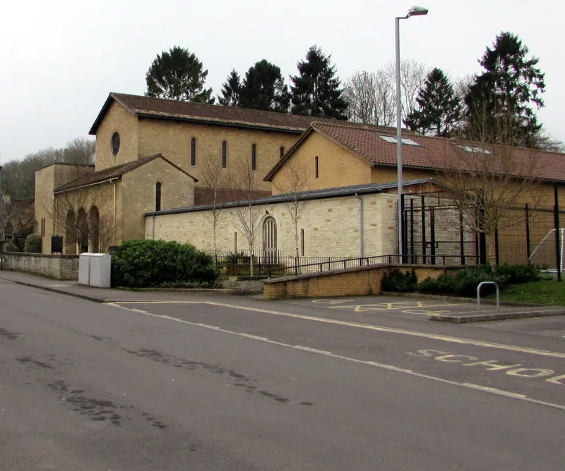 📷 5
📷 5Historic churches · South West England
Church of Our Lady & St Alphege, Bath
Church of Our Lady & St Alphege, Bath — church in Bath and North East Somerset, England, UK.
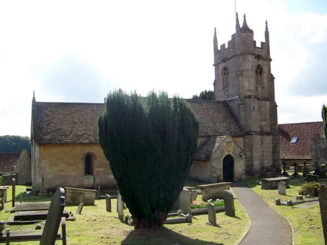 📷 5
📷 5Historic churches · South West England
Church of St James, Southstoke
Church of St James, Southstoke — church in Bath and North East Somerset, England, UK.
 📷 5
📷 5Historic houses · South West England
Crowe Hall
Crowe Hall — Grade II listed house in Bath, Somerset, England, UK.
 📷 5
📷 5Castles · South West England
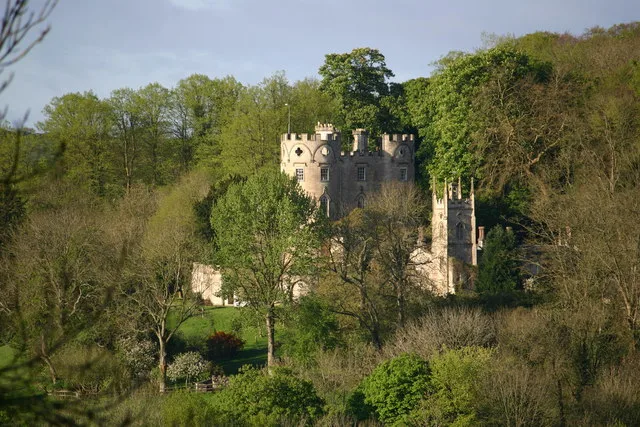
Midford Castle
Midford Castle — Grade I listed folly in Bath and North East Somerset, England, UK.
 📷 5📷 5
Cemeteries · South West England
Perrymead Catholic Cemetery
Perrymead Catholic Cemetery is a cemetery in the United Kingdom.
 📷 5
📷 5Historic houses · South West England
Prior Park
Prior Park — grade I listed Palladian building in south west England.
 📷 5
📷 5Viewpoints · South West England
South Stoke Millenium Viewpoint
South Stoke Millenium Viewpoint is a viewpoint in the United Kingdom.
 📷 5
📷 5Historic churches · South West England
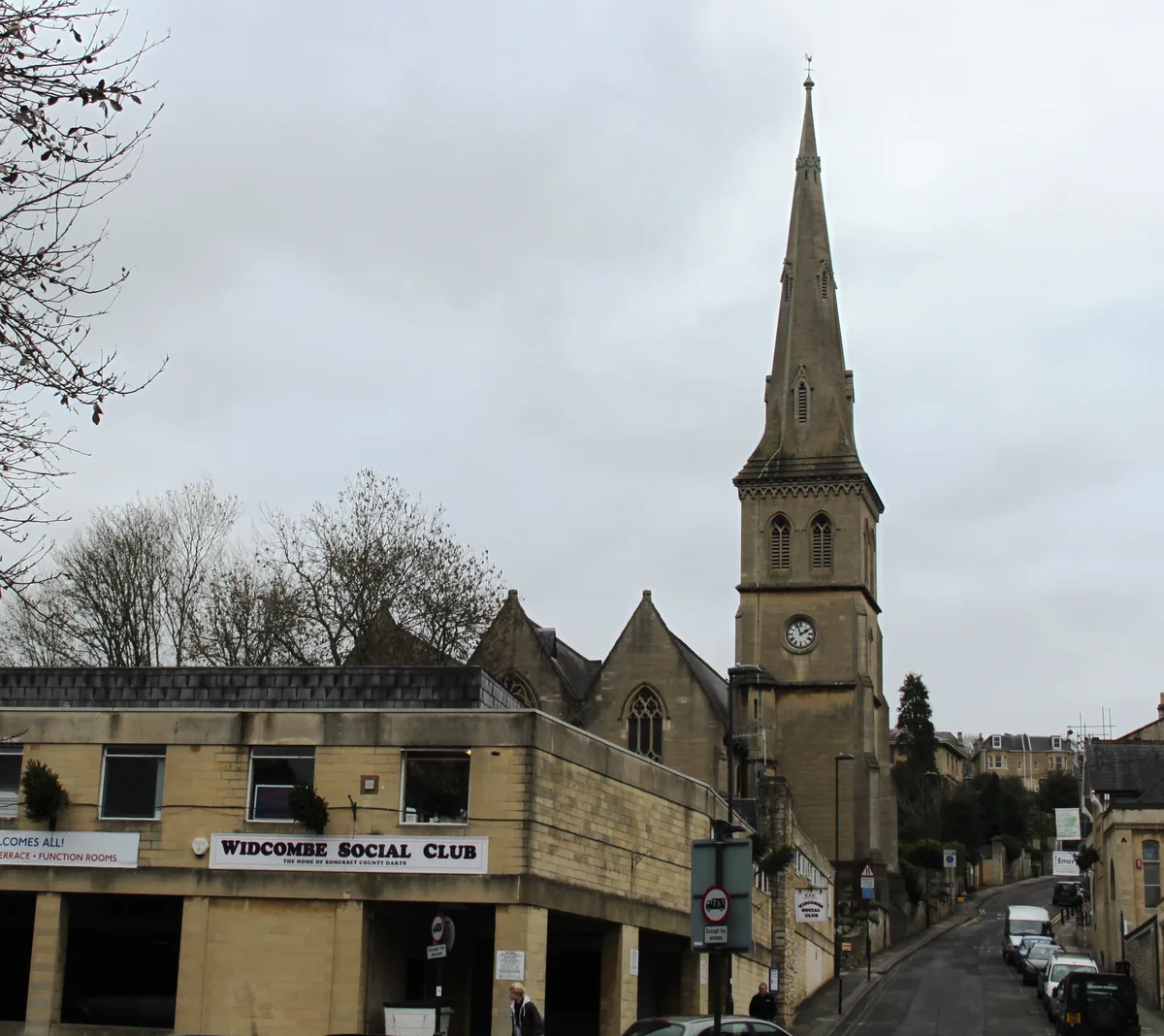
St Matthew's Church, Widcombe
St Matthew's Church, Widcombe is a historic church in the United Kingdom.
📷 5Historic churches · South West England
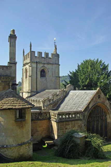
St Michael's Church, Monkton Combe
St Michael's Church, Monkton Combe — church in Monkton Combe, Bath and North East Somerset, Somerset, England, UK.
 📷 5
📷 5Historic churches · South West England
St Thomas à Becket Church, Widcombe
St Thomas à Becket Church, Widcombe is a historic church in the United Kingdom.
 📷 5
📷 5 📷 5
📷 5Archaeological sites · South West England
Wansdyke: section 1230yds (1120m) eastwards from Burnt House Inn
Wansdyke: section 1230yds (1120m) eastwards from Burnt House Inn — archaeological site in Southstoke, Bath and North East Somerset, England, UK.
 📷 5
📷 5Escape rooms · South West England
Tempo Escape Room
Tempo Escape Room — a escape room in england-south-east, United Kingdom.
 📷 5
📷 5Archaeological sites · South West England
Wansdyke
Wansdyke — a archaeological in england-south-east, United Kingdom.
 📷 5
📷 5Museums · South West England
Museum of Bath Stone
Museum of Bath Stone — a museum in england-south-east, United Kingdom.
 Flagship📷 5
Historic houses · South West England
Dundas Aqueduct
Dundas Aqueduct — a Grade I-listed historic house in england-south-east, United Kingdom.
 📷 5
📷 5Manor houses · South West England
Fountain At Widcombe Manor House
Fountain At Widcombe Manor House — a Grade I-listed manor in england-south-east, United Kingdom.
Nearby
📷 7Historic pubs · South West England
The Hop Pole Inn
The Hop Pole Inn in England South West, United Kingdom.
📷 5Memorials & monuments · South West England
Limpley Stoke War Memorial
Limpley Stoke War Memorial — Grade II listed building-listed memorial in england-south-east, United Kingdom.
📷 5Historic bridges · South West England
Limpley Stoke Bridge (or Stokeford Bridge)
Limpley Stoke Bridge (or Stokeford Bridge) — scheduled monument-listed bridge in england-south-east, United Kingdom.
📷 5Historic bridges · South West England
Kennet And Avon Canal, Limpley Stoke Canal Bridge
Kennet And Avon Canal, Limpley Stoke Canal Bridge — Grade II listed building-listed bridge in england-south-east, United Kingdom.
📷 5Memorials & monuments · South West England
Two Unidentified Monuments In The Churchyard Between 1 And 4 Metres North East Of Porch Of Church Of St Mary
Two Unidentified Monuments In The Churchyard Between 1 And 4 Metres North East Of Porch Of Church Of St Mary — Grade II listed building-listed memorial in england-south-east, United Kingdom.
📷 5Towns & cities · South West England
Freshford
Freshford — village and civil parish in Somerset, England.
Where to eat & stay near Limpley Stoke
Places to stay
 📷 5
📷 5Hotels · South West England
Combe Grove Manor Hotel
Combe Grove Manor Hotel — a hotel in england south east.
 📷 5
📷 5B&Bs · South West England
Rainbow Wood Farm
Rainbow Wood Farm — a bed-and-breakfast in england south east.
 📷 5
📷 5 📷 5
📷 5Campsites · South West England
Stowford Manor Farm Camping
Stowford Manor Farm Camping — a campsite in england south east.
 📷 5
📷 5B&Bs · South West England
Brindleys
Brindleys — a bed-and-breakfast in england south east.
 📷 5
📷 5B&Bs · South West England
Bloomfield House
Bloomfield House — a bed-and-breakfast in england south east.
Places to eat & drink
📷 7Historic pubs · South West England
The Hop Pole Inn
The Hop Pole Inn in England South West, United Kingdom.
📷 7Historic pubs · South West England
The Wheelwright's Arms
The Wheelwright's Arms in England South West, United Kingdom.
 📷 5
📷 5Historic pubs · South West England
The Inn Public House
The Inn Public House in England South West, United Kingdom.
 📷 5
📷 5Cafés · South West England
The Darling Deli Kitchen
The Darling Deli Kitchen — a café in england south east.
 📷 5
📷 5 📷 5
📷 5Historic pubs · South West England
Cross Keys Inn
Cross Keys Inn in England South West, United Kingdom.
More towns in this region
 Flagship📷 10
Towns & cities · South West England
Shoscombe
Shoscombe — village and civil parish in Somerset, UK.
 Flagship📷 10
Towns & cities · South West England
Tarrant Keyneston
Tarrant Keyneston — village and civil parish in Dorset, United Kingdom.
 📷 5
📷 5 📷 5
📷 5Towns & cities · South West England
Arne
Arne — village in Purbeck, Dorset, United Kingdom.
Frequently asked questions
- Where is Limpley Stoke?
- Limpley Stoke is in South-West England, United Kingdom (postcode BA15), in the parish of Limpley Stoke.
- What is Limpley Stoke?
- Limpley Stoke — village and civil parish in Wiltshire, England, UK.
- How do I get to Limpley Stoke?
- The nearest railway station is Freshford, about 1.2 km away. Drivers can use postcode BA15.
- Is Limpley Stoke a protected site?
- Yes — Limpley Stoke is part of the Cotswolds National Landscape (AONB).
- Is Limpley Stoke free to visit?
- Yes, Limpley Stoke is free to enter.
- How do I get to Limpley Stoke?
- The nearest railway station is Freshford, about 1.2 km away. Drivers can navigate to postcode BA15.