
Public art & sculpture · South East England
Via Lucem Continues
In or near Molash.
Via Lucem Continues — a public art in South East England, United Kingdom.

sam dale — CC BY-SA 2.0 via Wikimedia Commons licence

Plan your visit
- Typical visit
- 1 h–2 h
- Nearest railway station
- Wye · 4.0 km
- Free entry
- Dog-friendly
About
Via Lucem Continues is a public art located in South East England, United Kingdom. Sourced from OpenStreetMap (ODbL licence); see local listings for visitor information, opening hours and admission details.
Photo gallery
Protected designations
- Area of Outstanding Natural Beauty: Kent Downs
Designations sourced from Natural England open data under OGL v3.
Place summary
Via Lucem Continues is a public art installation located in South-East England. This piece contributes to the region's cultural landscape, reflecting contemporary artistic practices.
AI-generated from the structured facts on this page (operator, designation, listing, era). Not a substitute for visiting.
- Coordinates
- 51.2204, 0.9167
- County
- Kent
- District
- Ashford
- Parish
- Molash
- Postcode
- CT4 8HQ
- Parliamentary constituency
- Weald of Kent
- Nearest railway station
- Wye — 4 km
Sources
- osm: node/1359927537 (ODbL)
Other places nearby
The Miracle of The Legs
Public art & sculpture · 0.4 km
Coppice Cloud Chamber
Public art & sculpture · 0.5 km
Ring
Public art & sculpture · 0.6 km
Score for a Hole in The Ground
National landscapes (AONB) · 0.6 km

Walkway
Public art & sculpture · 0.6 km
Untitled Artwork
Public art & sculpture · 0.7 km

Super Kingdom
Public art & sculpture · 0.8 km

The Last Eleven Years
Public art & sculpture · 1.0 km
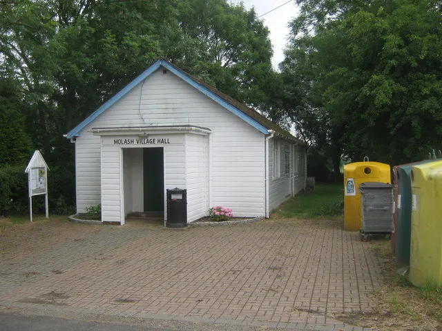
Molash
Towns & cities · 1.3 km

B52
Public art & sculpture · 1.3 km

Play Sculpture and Picnic Furniture
Public art & sculpture · 1.5 km

Godmersham Park
Historic houses · 2.4 km
Nearby
📷 5Public art & sculpture · South East England
The Miracle of The Legs
The Miracle of The Legs — a public art in South East England, United Kingdom.
📷 5Public art & sculpture · South East England
Coppice Cloud Chamber
Coppice Cloud Chamber — a public art in South East England, United Kingdom.
📷 5Public art & sculpture · South East England
Ring
Ring — a public art in South East England, United Kingdom.
📷 5National landscapes (AONB) · South East England
Score for a Hole in The Ground
Score for a Hole in The Ground — Public artwork (installation) by Jem Finer.
📷 5Public art & sculpture · South East England
Walkway
Walkway — a public art in South East England, United Kingdom.
📷 5Public art & sculpture · South East England
Untitled Artwork
Untitled Artwork — a public art in South East England, United Kingdom.
Where to eat & stay near Via Lucem Continues
Places to stay
 📷 5
 📷 5
Campsites · South East England
Dunn Street Farm Campsite
Dunn Street Farm Campsite — a campsite in england south east.
 📷 5
Campsites · South East England
Mystole Campsite
Mystole Campsite — a campsite in england south east.
 📷 5
Caravan parks · South East England
Sunnyside Farm Caravan Park
Sunnyside Farm Caravan Park — a caravan park in england south east.
 📷 5
Caravan parks · South East England
Kent Gliding Club Caravan Park
Kent Gliding Club Caravan Park — a caravan park in england south east.
 📷 5
Campsites · South East England
Shepherd Park Scout Campsite
Shepherd Park Scout Campsite — a campsite in england south east.
Places to eat & drink
 📷 7
Historic pubs · South East England
The Tickled Trout
The Tickled Trout in England South East, United Kingdom.
 📷 5
Restaurants · South East England
The White Horse
The White Horse — a restaurant in england south east.
 📷 5
Historic pubs · South East England
The New Flying Horse
The New Flying Horse in England South East, United Kingdom.
 📷 5
 📷 7
Restaurants · South East England
The Woolpack
The Woolpack — a restaurant in england south east. Cuisine: british. Brand: Beefeater.
 📷 5
More places in this region
 📷 5
Public art & sculpture · South East England
The Jurors
The Jurors — Public artwork (installation) by Hew Locke.
 📷 5
Public art & sculpture · South East England
The Woking Martian
The Woking Martian — a public art in South East England, United Kingdom.
 📷 5
Public art & sculpture · South East England
The Golf Ball
The Golf Ball — a public art in South East England, United Kingdom.
 📷 5
Public art & sculpture · South East England
Memorial to Alan Turing
Memorial to Alan Turing — a public art in South East England, United Kingdom.
Frequently asked questions
- Where is Via Lucem Continues?
- Via Lucem Continues is in Kent, South-East England, United Kingdom (postcode CT4 8HQ), in the parish of Molash.
- What is Via Lucem Continues?
- Via Lucem Continues — a public art in South East England, United Kingdom.
- How do I get to Via Lucem Continues?
- The nearest railway station is Wye, about 4.0 km away. The nearest town is Molash. Drivers can use postcode CT4 8HQ.
- Is Via Lucem Continues a protected site?
- Yes — Via Lucem Continues is part of the Kent Downs National Landscape (AONB).
- Is Via Lucem Continues free to visit?
- Yes, Via Lucem Continues is free to enter.
- How do I get to Via Lucem Continues?
- The nearest railway station is Wye, about 4.0 km away. Drivers can navigate to postcode CT4 8HQ.