
Museums · South East England
Vale of White Horse
In or near Grove.
Vale of White Horse — a museum in england-west-midlands, United Kingdom.

Earth Science and Remote Sensing Unit, NASA Johnson Space Center — Public domain via Wikimedia Commons licence

Plan your visit
- Typical visit
- 1.5 h–3 h
- Best time of year
- Year-round
- Free entry
- Family-friendly
- Limited wheelchair access
About
Vale of White Horse is a museum in england-west-midlands, United Kingdom, listed in the Wikipedia register of British heritage and tourism sites. See the linked Wikipedia article for full details.
Photo gallery
Official information
The Vale of White Horse is a picturesque district in Oxfordshire, known for its stunning landscapes and historical sites. Visitors can explore various countryside sites and enjoy outdoor activities amidst the natural beauty of the area.
Protected designations
- Area of Outstanding Natural Beauty: Cotswolds
- Area of Outstanding Natural Beauty: North Wessex Downs
Designations sourced from Natural England open data under OGL v3.
Place summary
The Vale of White Horse is a museum located in the West Midlands. It features a distinctive landscape known for its chalk hill figure, which dates back to prehistoric times. The site is a designated Area of Outstanding Natural Beauty, highlighting its cultural and historical significance.
AI-generated from the structured facts on this page (operator, designation, listing, era). Not a substitute for visiting.
Background
History
The area has been long settled as a productive fertile chalklands above well-drained clay valleys, and well-farmed with many small woodlands and hills between the Berkshire Downs and the River Thames on its north and east sides. It is named after the prominent and large Bronze Age-founded Uffington White Horse hill figure. The local government district was formed as part of the 1974 re-organisation, taking in three small Berkshire towns – in descending size order Abingdon, Faringdon and Wantage – and the surrounding rural parishes. There are 68 parishes in the district. Previously, since the 19th century, the administrative areas had been the Municipal Borough of Abingdon, Wantage Urban…
Description
A grassy track represents the Ridgeway, claimed as the oldest road in Europe, perhaps five thousand years old or more. It travels along the crest of the hills, far above what would then have been marshy lowlands or forests, continuing Icknield Street, from the Chilterns to Goring and Streatley on the River Thames. It links The Wash and Salisbury Plain, and would have been an important artery for trade. Other earthworks, in addition to those near the White Horse, overlook the Vale, such as Letcombe Castle (also known as Segsbury Camp) above Wantage. At the foot of the hills, not far east of the Horse, is preserved the so-called Blowing Stone of Kingston Lisle, a mass of sandstone (a sarsen)…
Sourced from Wikipedia under CC BY-SA 4.0.
- Coordinates
- 51.6000, -1.5000
- County
- Oxfordshire
- District
- Vale of White Horse
- Parish
- Sparsholt
- Postcode
- OX12 9PE
- Parliamentary constituency
- Didcot and Wantage
- Official site
- www.whitehorsedc.gov.uk
Sources
- wikipedia: Vale of White Horse (CC BY-SA 4.0)
Other places nearby

West Challow
Villages · 2.2 km

Vale of White Horse
Gorges · 2.2 km

Childrey
Villages · 2.2 km

Kingston Lisle Park
Historic houses · 2.6 km
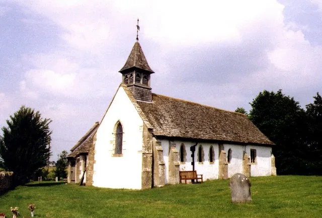
Church of All Saints
Historic churches · 2.7 km

Fawler Manor
Manor houses · 2.9 km

Woodhill Lane Caravan Park
Caravan parks · 3.1 km

Blowing Stone
Gardens · 3.1 km
The Blowing Stone
Natural landmarks · 3.1 km

The Pound Public House
Historic pubs · 3.1 km

Seven Acre Hill
Mountains & hills · 3.5 km

East Challow
Villages · 3.6 km
Nearby
📷 5📷 5Gorges · South East England
Vale of White Horse
Vale of White Horse — a gorge in england west midlands.
📷 5📷 5Historic houses · South East England
Kingston Lisle Park
Kingston Lisle Park — country house in Oxfordshire, England.
📷 3Historic churches · South East England
Church of All Saints
Church of All Saints — church in Goosey, Oxfordshire, England, UK.
📷 5Manor houses · South East England
Fawler Manor
Fawler Manor — Grade II listed building-listed manor in england-south-east, United Kingdom.
Where to eat & stay near Vale of White Horse
Places to stay
📷 5Caravan parks · South East England
Woodhill Lane Caravan Park
Woodhill Lane Caravan Park — a caravan park in england south east.
 📷 7
📷 7Hotels · South East England
The Bear Hotel
The Bear Hotel — a hotel in england south east.
 📷 5
📷 5 📷 5
📷 5Campsites · South East England
Oxford Oak Camping
Oxford Oak Camping — a campsite in england west midlands.
📷 5 📷 7
📷 7B&Bs · South East England
The Old Crown Coaching Inn
The Old Crown Coaching Inn — a bed-and-breakfast in england west midlands.
Places to eat & drink
📷 5Historic pubs · South East England
The Pound Public House
The Pound Public House in England South East, United Kingdom.
 📷 6
📷 6Historic pubs · South East England
King Alfred's Head Public House
King Alfred's Head Public House in England South East, United Kingdom.
 📷 5
📷 5Historic pubs · South East England
The Kings Arms Public House
The Kings Arms Public House in England South East, United Kingdom.
 📷 7
📷 7 📷 5
📷 5Historic pubs · South East England
The Wheatsheaf Public House
The Wheatsheaf Public House in England South East, United Kingdom.
 📷 7
📷 7Historic pubs · South East England
The Duke Of Wellington Public House
The Duke Of Wellington Public House in England South East, United Kingdom.
More museums in this region
 📷 5
📷 5Museums · South East England
Coldrum Long Barrow
Coldrum Long Barrow — neolithic chambered long barrow near Trottiscliffe, Kent, England, UK.
 📷 5
📷 5Museums · South East England
Guildford House
Guildford House — house in Guildford, Surrey, England, UK.
 📷 5
📷 5Museums · South East England
Huguenot Museum
Huguenot Museum — museum in Rochester, England, UK.
 📷 5
📷 5Museums · South East England
Medway megaliths
Medway megaliths — group of long barrows in Kent, England.
Frequently asked questions
- Where is Vale of White Horse?
- Vale of White Horse is in Oxfordshire, South-East England, United Kingdom (postcode OX12 9PE), in the parish of Sparsholt.
- What is Vale of White Horse?
- Vale of White Horse — a museum in england-west-midlands, United Kingdom.
- How do I get to Vale of White Horse?
- The nearest town is Grove. Drivers can use postcode OX12 9PE.
- Who owns Vale of White Horse?
- Vale of White Horse is owned by Vale of White Horse District Council.
- Is Vale of White Horse a protected site?
- Yes — Vale of White Horse is part of the Cotswolds National Landscape (AONB) and the North Wessex Downs National Landscape (AONB).
- Is Vale of White Horse free to visit?
- Yes, Vale of White Horse is free to enter.
- How do I get to Vale of White Horse?
- Drivers can navigate to postcode OX12 9PE. It sits within the Didcot and Wantage parliamentary constituency.