
Gorges · East Midlands
Vale of the Trent
In or near Torksey.
Vale of the Trent — a gorge in england east midlands.

Marathon — CC BY-SA 2.0 via Wikimedia Commons licence

Plan your visit
- Typical visit
- 1 h–2 h
- Nearest railway station
- Gainsborough Lea Road · 6.0 km
About
A British gorge — a narrow, steep-sided valley typically carved by a river through resistant limestone or sandstone country.
Photo gallery
Place summary
The Vale of the Trent is a gorge located in the East Midlands. This geographical feature is characterised by its steep sides and the meandering River Trent flowing through it. The area offers scenic views and opportunities for outdoor activities. It is a notable landmark in the region, attracting visitors interested in natural landscapes.
AI-generated from the structured facts on this page (operator, designation, listing, era). Not a substitute for visiting.
- Coordinates
- 53.3333, -0.7500
- County
- Lincolnshire
- District
- West Lindsey
- Parish
- Gate Burton
- Postcode
- DN21 5BD
- Parliamentary constituency
- Gainsborough
- Nearest railway station
- Gainsborough Lea Road — 6 km
Sources
- manual: geonames-2635502 (CC BY 4.0)
Other places nearby

Gate Burton
Historic churches · 0.4 km
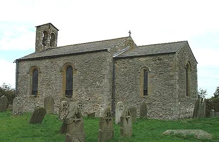
St Nicholas' Church, Littleborough
Historic churches · 0.9 km

Ingelby Arms Public House
Historic pubs · 0.9 km

Marton
Villages · 1.0 km

Littleborough
Villages · 1.1 km

Knaith
Villages · 2.2 km

Brampton, Lincolnshire
Historic churches · 3.4 km

Foss Dyke
Canals · 3.7 km

Lea
Villages · 3.7 km
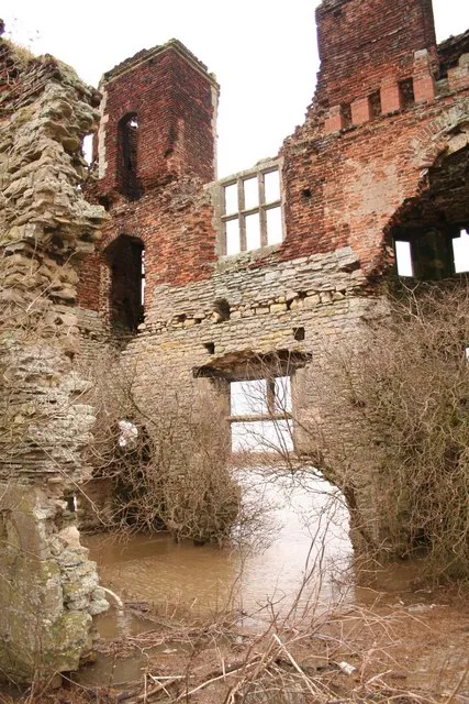
Torksey Castle
Stately homes · 3.8 km

Cottam
Villages · 3.9 km

Torksey
Towns & cities · 3.9 km
Nearby
📷 5Historic churches · East Midlands
Gate Burton
Gate Burton (sometimes called Burton Gate), is a village and civil parish in the West Lindsey district of Lincolnshire, England. It is situated 4 miles (6.4 km) south from the town of Gainsborough. Th
📷 3Historic churches · East Midlands
St Nicholas' Church, Littleborough
St Nicholas' Church, Littleborough — church in Bassetlaw, UK.
📷 5Historic pubs · East Midlands
Ingelby Arms Public House
Ingelby Arms Public House in England Yorkshire, United Kingdom.
📷 5📷 5📷 5Where to eat & stay near Vale of the Trent
Places to stay
 📷 5
📷 5 📷 5
📷 5Caravan parks · East Midlands
Little London Park
Little London Park — a caravan park in england east midlands.
 📷 5
📷 5Campsites · East Midlands
Trentfield Farm
Trentfield Farm — a campsite in england east midlands.
 📷 5
📷 5Caravan parks · East Midlands
Manor House Caravan Park
Manor House Caravan Park — a caravan park in england east midlands.
 📷 5
📷 5Campsites · East Midlands
Brownlow Arms Camp Site
Brownlow Arms Camp Site — a campsite in england east midlands.
📷 5Caravan parks · East Midlands
Trentside Caravan Park
Trentside Caravan Park — a caravan park in england east midlands.
Places to eat & drink
📷 5Historic pubs · East Midlands
Ingelby Arms Public House
Ingelby Arms Public House in England Yorkshire, United Kingdom.
 📷 5
📷 5 📷 7
📷 7Historic pubs · East Midlands
Black Boy Public House
Black Boy Public House in England Yorkshire, United Kingdom.
 📷 5
📷 5Historic pubs · East Midlands
New Inn Public House
New Inn Public House in England Yorkshire, United Kingdom.
 📷 5
📷 5 📷 5
📷 5Historic pubs · East Midlands
Newcastle Arms Public House
Newcastle Arms Public House in England Yorkshire, United Kingdom.
More places in this region
 📷 5
📷 5 📷 5
📷 5 📷 5
📷 5 📷 5
📷 5Frequently asked questions
- Where is Vale of the Trent?
- Vale of the Trent is in Lincolnshire, the East Midlands, United Kingdom (postcode DN21 5BD), in the parish of Gate Burton.
- What is Vale of the Trent?
- Vale of the Trent — a gorge in england east midlands.
- How do I get to Vale of the Trent?
- The nearest railway station is Gainsborough Lea Road, about 6.0 km away. Drivers can use postcode DN21 5BD.
- How do I get to Vale of the Trent?
- The nearest railway station is Gainsborough Lea Road, about 6.0 km away. Drivers can navigate to postcode DN21 5BD.