
Natural landmarks · East Midlands
Uppingham School
Also known as: Ysgol Uppingham
In or near Ayston.
Uppingham School — a school heritage in england-west-midlands, United Kingdom.

Andrew Abbott — CC BY-SA 2.0 via Wikimedia Commons licence

Plan your visit
- Typical visit
- 1 h–2 h
- Nearest railway station
- Oakham · 9.4 km
- Free entry
- Dog-friendly
- Wheelchair accessible
About
Uppingham School is a school heritage located in england-west-midlands, United Kingdom. Catalogued from Wikidata's UK heritage register; see the Wikipedia article for further historical and visitor details.
Photo gallery
Place summary
Uppingham School is an independent school located in the West Midlands. Established in the 16th century, it is known for its strong academic reputation and historic architecture. The school has been a significant educational institution in the region for centuries.
AI-generated from the structured facts on this page (operator, designation, listing, era). Not a substitute for visiting.
Background
History
In 1584 Uppingham School was founded with a hospital, or almshouse, by Archdeacon Robert Johnson. The original 1584 schoolroom in Uppingham churchyard is still owned by the school and is a Grade I listed building. The original hospital building is now incorporated in the School Library. The first recorded Uppingham schoolboy was Henry Ferne from York, who was chaplain to Charles I. Another prominent early schoolboy was the Jesuit Anthony Turner, one of the martyrs of the Popish Plot. In the 17th, 18th and early 19th centuries Uppingham remained a small school of 30–60 pupils, with two staff. Despite its small size, pupils then regularly gained places and scholarships to Oxford and Cambridge…
Sourced from Wikipedia under CC BY-SA 4.0.
- Coordinates
- 52.5878, -0.7250
- District
- Rutland
- Parish
- Uppingham
- Postcode
- LE15 9QB
- Parliamentary constituency
- Rutland and Stamford
- Established
- 1584
- Nearest railway station
- Oakham — 9.4 km
- Official site
- uppingham.co.uk
Sources
- wikidata: Q3403302 (CC0)
- wikipedia: Uppingham School (CC BY-SA 4.0)
Other places nearby

Uppingham School Chapel
Chapels · 0.0 km

Forest Framing and Gallery
Galleries · 0.1 km
_(geograph_7143448).jpg?width=1200)
5 and 7 High Street and Falcon Hotel Annexe
Historic houses · 0.2 km

The Falcon Hotel
Hotels · 0.2 km

Uppingham War Memorial
Memorials & monuments · 0.2 km
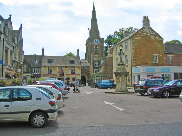
Church of St Peter and St Paul, Uppingham
Historic churches · 0.2 km

Uppingham
Castles · 0.3 km

Rutland Cinema
Theatres · 0.4 km

Uppingham Village Sign
Public art & sculpture · 0.9 km
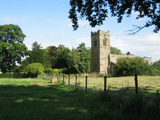
Ayston
Towns & cities · 1.4 km

St Mary the Virgin's Church, Ayston
Historic churches · 1.4 km

Castle Hill motte and bailey
Literary houses · 1.7 km
Nearby
📷 3Chapels · East Midlands
Uppingham School Chapel
Uppingham School Chapel — chapel in Uppingham, Rutland, England, UK.
📷 3Galleries · East Midlands
Forest Framing and Gallery
Forest Framing and Gallery — a gallery in england-west-midlands, United Kingdom.
📷 3Historic houses · East Midlands
5 and 7 High Street and Falcon Hotel Annexe
5 and 7 High Street and Falcon Hotel Annexe — building in Uppingham, Rutland, England, UK.
📷 5📷 3Memorials & monuments · East Midlands
Uppingham War Memorial
Uppingham War Memorial — Grade II listed building-listed memorial in england-west-midlands, United Kingdom.
📷 5Historic churches · East Midlands
Church of St Peter and St Paul, Uppingham
Church of St Peter and St Paul, Uppingham — church in Uppingham, Rutland, England, UK.
Where to eat & stay near Uppingham School
Places to stay
📷 5 📷 5
📷 5Campsites · East Midlands
Wing Hall Camping & Caravan Site
Wing Hall Camping & Caravan Site — a campsite in england west midlands.
 📷 5
📷 5Campsites · East Midlands
The Paddock
The Paddock — a campsite in england west midlands.
📷 5Campsites · East Midlands
Lyndon Top
Lyndon Top — a campsite in england west midlands.
 📷 5
📷 5Campsites · East Midlands
Rutland Water Campsite
Rutland Water Campsite — a campsite in england west midlands.
 📷 7
📷 7Hotels · East Midlands
Wisteria Hotel
Wisteria Hotel — a hotel in england west midlands.
Places to eat & drink
 📷 5
📷 5Historic pubs · East Midlands
The White Swan Public House And Attached Carriage Arch
The White Swan Public House And Attached Carriage Arch in England East, United Kingdom.
 📷 5
📷 5Historic pubs · East Midlands
The Hatton Arms Inn
The Hatton Arms Inn in England East, United Kingdom.
 📷 5
📷 5Historic pubs · East Midlands
The Sun Public House
The Sun Public House in England East Midlands, United Kingdom.
 📷 5
📷 5Historic pubs · East Midlands
The Old Royal Oak Public House
The Old Royal Oak Public House in England East Midlands, United Kingdom.
 📷 5
📷 5 📷 5
📷 5Historic pubs · East Midlands
Horse and Trumpet Inn
Horse and Trumpet Inn in England East Midlands, United Kingdom.
More natural landmarks in this region
 📷 5
📷 5Natural landmarks · East Midlands
The Cage
The Cage — a other in england-london, United Kingdom.
 📷 5
📷 5Natural landmarks · East Midlands
Roman Sea Bank
Roman Sea Bank — a other in england-london, United Kingdom.
 📷 5
📷 5Natural landmarks · East Midlands
The Stamford Spa
The Stamford Spa — a other in england-london, United Kingdom.
 📷 5
📷 5Natural landmarks · East Midlands
John Clare's grave
John Clare's grave — a other in england-london, United Kingdom.
Frequently asked questions
- Where is Uppingham School?
- Uppingham School is in the West Midlands, United Kingdom (postcode LE15 9QB), in the parish of Uppingham.
- What is Uppingham School?
- Uppingham School — a school heritage in england-west-midlands, United Kingdom.
- How do I get to Uppingham School?
- The nearest railway station is Oakham, about 9.4 km away. Drivers can use postcode LE15 9QB.
- When was Uppingham School built?
- Built or established in 1584.
- Is Uppingham School free to visit?
- Yes, Uppingham School is free to enter.
- How do I get to Uppingham School?
- Drivers can navigate to postcode LE15 9QB. It sits within the Rutland and Stamford parliamentary constituency.