Mountains & hills · Scottish Lowlands
Upper Hill
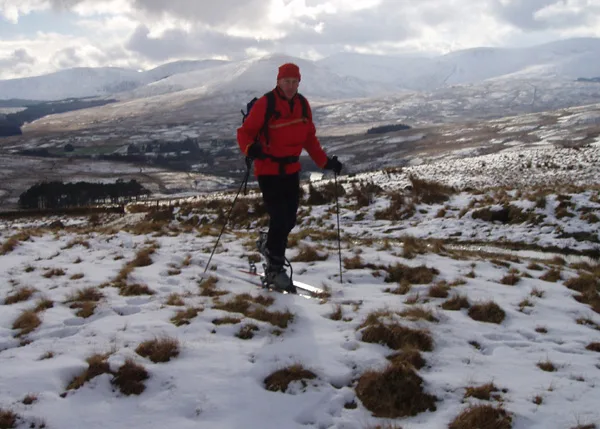
Upper Hill — a hill or mountain in scotland lowlands.

Rab McMurdo — CC BY-SA 2.0 via Wikimedia Commons licence
Plan your visit
- Typical visit
- 3 h–8 h
- Best time of year
- Late spring – early autumn (May–Oct)
About
A British hill or mountain, named on Ordnance Survey maps and walked by hill-baggers. Upper Hill is a named hill or mountain in scotland lowlands, recorded in the GeoNames UK gazetteer. British landmarks of this type are typically marked on Ordnance Survey maps and recorded in the national gazetteer for cartographic and navigational reference. Coordinates and feature classification are sourced from the GeoNames open dataset.
Photo gallery
Place summary
Upper Hill is a mountain located in the Scottish Lowlands. It is noted for its rolling landscapes and natural beauty typical of the region. Visitors can expect a range of outdoor activities, including hiking and nature observation, amidst the scenic surroundings. The area is characterised by its varied terrain and opportunities for exploration.
AI-generated from the structured facts on this page (operator, designation, listing, era). Not a substitute for visiting.
- Coordinates
- 55.2774, -4.2358
Sources
- manual: geonames-12610652 (CC BY 4.0)
Other places nearby
Loading nearby places…
Nearby
 📷 5
📷 5Mountains & hills · Scottish Lowlands
Nether Hill
Nether Hill — mountain in scotland lowlands. Elevation: 521 m.
 📷 5
📷 5Mountains & hills · Scottish Lowlands
Dugland
Dugland — a hill or mountain in scotland lowlands.
 📷 3
📷 3Memorials & monuments · Scottish Lowlands
David Hunter-Blair Memorial Stone
David Hunter-Blair Memorial Stone — a memorial in scotland-lowlands, United Kingdom.
 📷 3
📷 3Memorials & monuments · Scottish Lowlands
Spitfire AD540 Crash-Site Memorial Stone
Spitfire AD540 Crash-Site Memorial Stone — a memorial in scotland-lowlands, United Kingdom.
 📷 3
📷 3Natural landmarks · Scottish Lowlands
Cairnsmore of Carsphairn
Cairnsmore of Carsphairn — 797m high mountain in Dumfries and Galloway, Scotland, UK.
 📷 3
📷 3Mountains & hills · Scottish Lowlands
Cairnsmore of Carsphairn
Cairnsmore of Carsphairn — Named summit at 797 m.
Where to eat & stay near Upper Hill
Places to stay

Places to eat & drink
 📷 5
📷 5Historic pubs · Scottish Lowlands
Doon Tavern, High Street, Dalmellington
Doon Tavern, High Street, Dalmellington in Scotland Lowlands, United Kingdom.
 📷 5
📷 5Historic pubs · Scottish Lowlands
Queensberry Arms Hotel
Queensberry Arms Hotel in Scotland Lowlands, United Kingdom.
 📷 5
📷 5Historic pubs · Scottish Lowlands
The Sun Inn, 23 The Square, Cumnock
The Sun Inn, 23 The Square, Cumnock in Scotland Lowlands, United Kingdom.
 📷 5
📷 5Historic pubs · Scottish Lowlands
Commercial Inn, 1-3 Mill Street, Ochiltree
Commercial Inn, 1-3 Mill Street, Ochiltree in Scotland Lowlands, United Kingdom.
More mountains in this region
 📷 3
📷 3Mountains & hills · Scottish Lowlands
Andrewhinney Hill
Andrewhinney Hill — Named summit at 677 m.
 📷 3
📷 3Mountains & hills · Scottish Lowlands
Arbory Hill
Arbory Hill — Named summit at 429 m.
 📷 3
📷 3Mountains & hills · Scottish Lowlands
Auchenton Hill ( East Mount Lowther)
Auchenton Hill ( East Mount Lowther) — Named summit at 631 m.
 📷 3
📷 3Mountains & hills · Scottish Lowlands
Bakestall
Bakestall — Named summit at 673.5 m.
Frequently asked questions
- Where is Upper Hill?
- Upper Hill is in the Scottish Lowlands, United Kingdom.
- What is Upper Hill?
- Upper Hill — a hill or mountain in scotland lowlands.
- How do I get to Upper Hill?
- Its coordinates are 55.2774°, -4.2358°.