
Towns & cities · South East England
Upavon
Upavon — village and civil parish in Wiltshire, England, United Kingdom.

Wikimedia Commons contributors — see linked file page for photographer and licence licence

Plan your visit
- Typical visit
- 3 h–6 h
- Nearest railway station
- Pewsey · 6.0 km
- Free entry
- Family-friendly
- Dog-friendly
Getting there & planning your visit
To visit Upavon in Wiltshire, the nearest railway station is Pewsey, located 6 km away. Entry to the town is free.
About
Upavon is a town, city, village or settlement in the United Kingdom. Recent population estimates put it at around 1,175 people. Address: SN9. Wikidata describes it as: "village and civil parish in Wiltshire, England, United Kingdom". Coordinates: 51.2940°, -1.8080°.
Photo gallery
Official information
Upavon is a picturesque village located in Wiltshire, England, known for its charming cottages and scenic landscapes. The village is situated along the River Avon and is surrounded by fields, making it a delightful spot for visitors to explore its history and natural beauty.
Protected designations
- Site of Special Scientific Interest: River Avon System SSSI
- Site of Special Scientific Interest: Salisbury Plain SSSI
- Area of Outstanding Natural Beauty: North Wessex Downs
Designations sourced from Natural England open data under OGL v3.
From the Wikipedia article
Upavon is a rural village and civil parish in the county of Wiltshire, England. As its name suggests, it is on the upper portion of the River Avon which runs from north to south through the village. It is on the north edge of Salisbury Plain about 4 miles (6.4 km) south of Pewsey, 10 miles (16 km) southeast of the market town of Devizes, and 20 miles (32 km) north of the cathedral city of Salisbury. The A345 and A342 roads run through the village.
Excerpt from Wikipedia under CC BY-SA 4.0. See the source article linked in Sources below.
Background
History
Occupation of the area dates back to the Iron Age and Romano-British settlement at Casterley Camp, approximately 1.5 mi southwest of the current village, and to the southeast was the small Iron Age settlement of Chisenbury Camp. The first mention of Upavon is in the 1086 Domesday Book as Oppavrene; although no population was recorded, it can be estimated that the village supported some 200 to 250 people. The village prospered during the 12th and 13th centuries and started to develop features that are recognisable today. A large Norman church replaced the previous Saxon one, a manor house was built in the south of the village and a market square developed west of the church, in the area that…
Sourced from Wikipedia under CC BY-SA 4.0.
- Coordinates
- 51.2940, -1.8080
- District
- Wiltshire
- Parish
- Upavon
- Postcode
- SN9
- Parliamentary constituency
- East Wiltshire
- Population
- 1,175
- Nearest railway station
- Pewsey — 6 km
- Official site
- www.upavonpc.co.uk
Sources
- wikidata: Q1229979 (CC0)
- wikipedia: Upavon (CC BY-SA 4.0)
- commons: Upavon church.jpg (CC BY-SA 4.0)
Other places nearby

Upavon Cemetery War Memorial
Memorials & monuments · 0.3 km

Rushall Manor Park Bridge
Historic bridges · 1.0 km

Upavon Hill
Mountains & hills · 1.2 km

Group Of Fowle Monuments In Churchyard, 8 Metres South Of Chancel, Church Of St Peter
Memorials & monuments · 2.0 km

Chisenbury Camp
Hill forts · 2.0 km

The Woodbridge Camp SIte
Campsites · 2.2 km

Charlton Manor
Caravan parks · 2.4 km
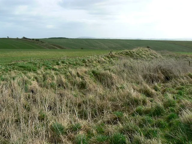
Casterley Camp
Hill forts · 2.4 km

Manningford Abbots
Villages · 2.6 km

Cliff Monument In Churchyard, 15 Metres South Of Nave, Church Of St James
Memorials & monuments · 2.7 km
Melcock Monument In Churchyard, 9 Metres South Of Nave, Church Of St James
Memorials & monuments · 2.7 km

Cleave Hill
Mountains & hills · 2.8 km
Located in South East England, Upavon offers a quiet charm for visitors exploring its local heritage. You can discover the historic Church of All Saints And St Margaret and walk across the picturesque Rushall Manor Park Bridge. The town also features significant landmarks like Casterley Camp and several poignant memorials, including the Cross Dyke.
At a glance
- Population
- 1,175
- Constituency
- East Wiltshire
- Top categories near here
Things to see in Upavon
16 attractions within 12 km. Full guide: things to do in Upavon →
📷 5Hill forts · South East England
Casterley Camp
Casterley Camp — site of an Iron Age univallate hillfort located in Wiltshire, England, UK.
📷 3Hill forts · South East England
Chisenbury Camp
Chisenbury Camp — site of an Iron Age univallate hillfort located in Wiltshire, England.
 📷 5
📷 5Historic churches · South East England
Church of All Saints And St Margaret
Church of All Saints And St Margaret — Grade I listed church in Enford, Wiltshire, England, UK.
 📷 5
📷 5Memorials & monuments · South East England
Cross Dyke
Cross Dyke — a memorial in england-south-east, United Kingdom.
 📷 5
📷 5Archaeological sites · South East England
Lindbury Camp
Lindbury Camp — a archaeological in england-south-east, United Kingdom.
📷 5Historic bridges · South East England
Rushall Manor Park Bridge
Rushall Manor Park Bridge — Grade II listed building-listed bridge in england-south-east, United Kingdom.
📷 5Memorials & monuments · South East England
Upavon Cemetery War Memorial
Upavon Cemetery War Memorial — Grade II listed building-listed memorial in england-south-east, United Kingdom.
📷 5Memorials & monuments · South East England
Group Of Fowle Monuments In Churchyard, 8 Metres South Of Chancel, Church Of St Peter
Group Of Fowle Monuments In Churchyard, 8 Metres South Of Chancel, Church Of St Peter — Grade II listed building-listed memorial in england-south-east, United Kingdom.
 📷 5
📷 5Memorials & monuments · South East England
Three Baden Monuments In Churchyard, 14 Metres South Of Tower, Church Of All Saints
Three Baden Monuments In Churchyard, 14 Metres South Of Tower, Church Of All Saints — Grade II listed building-listed memorial in england-south-east, United Kingdom.
📷 5Campsites · South East England
The Woodbridge Camp SIte
The Woodbridge Camp SIte — a campsite in england south east.
📷 5Caravan parks · South East England
Charlton Manor
Charlton Manor — a caravan park in england south east.
📷 5Villages · South East England
Manningford Abbots
Manningford Abbots — a village in england south east.
 📷 5
📷 5 📷 5📷 5
Mountains & hills · South East England
Cleave Hill
Cleave Hill — mountain in england south east. Elevation: 170 m.
📷 5Mountains & hills · South East England
Upavon Hill
Upavon Hill — mountain in england south east. Elevation: 179 m.
Nearby
📷 5Memorials & monuments · South East England
Upavon Cemetery War Memorial
Upavon Cemetery War Memorial — Grade II listed building-listed memorial in england-south-east, United Kingdom.
📷 5Historic bridges · South East England
Rushall Manor Park Bridge
Rushall Manor Park Bridge — Grade II listed building-listed bridge in england-south-east, United Kingdom.
📷 5Mountains & hills · South East England
Upavon Hill
Upavon Hill — mountain in england south east. Elevation: 179 m.
📷 5Memorials & monuments · South East England
Group Of Fowle Monuments In Churchyard, 8 Metres South Of Chancel, Church Of St Peter
Group Of Fowle Monuments In Churchyard, 8 Metres South Of Chancel, Church Of St Peter — Grade II listed building-listed memorial in england-south-east, United Kingdom.
📷 3Hill forts · South East England
Chisenbury Camp
Chisenbury Camp — site of an Iron Age univallate hillfort located in Wiltshire, England.
📷 5Campsites · South East England
The Woodbridge Camp SIte
The Woodbridge Camp SIte — a campsite in england south east.
Where to eat & stay near Upavon
Places to stay
📷 5Campsites · South East England
The Woodbridge Camp SIte
The Woodbridge Camp SIte — a campsite in england south east.
📷 5Caravan parks · South East England
Charlton Manor
Charlton Manor — a caravan park in england south east.
 📷 5
📷 5B&Bs · South West England
Puckshipton House
Puckshipton House — a bed-and-breakfast in england south east.
 📷 5
📷 5Campsites · South East England
Totteridge Farm
Totteridge Farm — a campsite in england south east.
 📷 5
📷 5Campsites · South East England
The Bruce Arms Campsite
The Bruce Arms Campsite — a campsite in england south east.
 📷 5
📷 5Campsites · South West England
Stonehenge Touring Park
Stonehenge Touring Park — a campsite in england south east.
Places to eat & drink
 📷 5
📷 5 📷 5
📷 5Historic pubs · South West England
The Greyhound Tavern
The Greyhound Tavern in England South West, United Kingdom.
 📷 5
📷 5 📷 7
📷 7Historic pubs · South West England
Black Swan Hotel
Black Swan Hotel in England South West, United Kingdom.
 📷 7
📷 7Cafés · South East England
St Peter's and St Paul's
St Peter's and St Paul's — a café in england south east.
 📷 7
📷 7More towns in this region
 Flagship📷 10
Towns & cities · South East England
Betchworth
Betchworth — village and civil parish in the Mole Valley district of Surrey, England.
 Flagship📷 10
Towns & cities · South East England
Boxley
Boxley — village and civil parish in Maidstone District, Kent, England, UK.
 Flagship📷 10
Towns & cities · South East England
Effingham
Effingham — village and civil parish in Guildford borough, Surrey, England, UK.
 Flagship📷 10
Towns & cities · South East England
Englefield Green
Englefield Green — village in the borough of Runnymede, Surrey, UK.
Frequently asked questions
- Where is Upavon?
- Upavon is in South-East England, United Kingdom (postcode SN9), in the parish of Upavon.
- What is Upavon?
- Upavon — village and civil parish in Wiltshire, England, United Kingdom.
- How do I get to Upavon?
- The nearest railway station is Pewsey, about 6.0 km away. Drivers can use postcode SN9.
- Is Upavon a protected site?
- Yes — Upavon is part of the River Avon System SSSI Site of Special Scientific Interest and the Salisbury Plain SSSI Site of Special Scientific Interest.
- Is Upavon free to visit?
- Yes, Upavon is free to enter.
- How do I get to Upavon?
- The nearest railway station is Pewsey, about 6.0 km away. Drivers can navigate to postcode SN9.