
Memorials & monuments · South West England
Unidentified Monument In The Churchyard About 3 Metres South Of Church Of St Mary
In or near Upton Scudamore.
Unidentified Monument In The Churchyard About 3 Metres South Of Church Of St Mary — Grade II listed building-listed memorial in england-south-east, United Kingdom.

Phil Williams — CC BY-SA 2.0 via Wikimedia Commons licence

Plan your visit
- Typical visit
- 15 min–45 min
- Nearest railway station
- Dilton Marsh · 1.0 km
- Free entry
- Dog-friendly
Getting there & planning your visit
The nearest railway station is Dilton Marsh, located 1 km away. Entry to the Unidentified Monument in the Churchyard is free, and the postcode for navigation is BA13 3RA.
About
Unidentified Monument In The Churchyard About 3 Metres South Of Church Of St Mary is a Grade II listed building-listed memorial in england-south-east, United Kingdom, registered on the National Heritage List for England (NHLE entry 1021477). Listed status protects buildings and structures of special architectural or historic interest. See the linked Wikipedia article for further details.
Photo gallery
Heritage listing
Details DILTON MARSH OLD DILTON ST 84 NE (west side) 8/119 Unidentified monument in the church- yard about 3 metres south of Church of St Mary GV II Chest tomb. Probably late C17. Limestone. Plinth, two shield- shaped panels to main sides with relief-carved scroll decoration to centre and corner pilasters, west end panel has three cherubs, east panel has heraldic cartouche, cornice to cyma-moulded flat top. Illegible inscriptions. Listing NGR: ST8585249031 Legacy The contents of this record have been generated from a legacy data system. Legacy System number: 313757 Legacy System: LBS
From the Historic England List Entry under OGL v3.
Place summary
The Unidentified Monument in the churchyard, located approximately 3 metres south of the Church of St Mary in Westbury, South-East England, is a Grade II listed memorial. Its designation reflects its historical significance, though specific details about the monument remain unknown.
AI-generated from the structured facts on this page (operator, designation, listing, era). Not a substitute for visiting.
- Coordinates
- 51.2403, -2.2041
- District
- Wiltshire
- Parish
- Westbury
- Postcode
- BA13 3RA
- Parliamentary constituency
- South West Wiltshire
- Nearest railway station
- Dilton Marsh — 1 km
Sources
- wikidata: Q26272234 (CC0)
Other places nearby
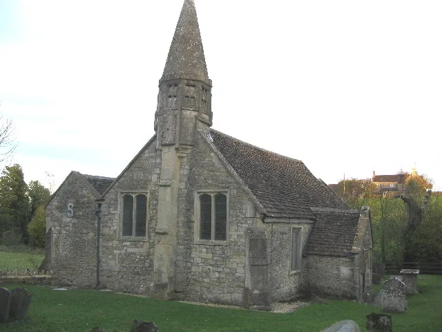
St Mary's Church, Old Dilton
Historic churches · 0.0 km
_(geograph_6808156).jpg?width=1200)
Boyer's House
Historic houses · 1.0 km

Dilton Marsh War Memorial
Memorials & monuments · 1.2 km

Dilton Marsh
Villages · 1.3 km

Upton Scudamore
Towns & cities · 1.5 km

Westbury Ironstone Quarry
Quarries · 2.0 km

Upton Cow Down
Mountains & hills · 2.0 km

Matravers School
Natural landmarks · 2.1 km

Dodd Fell
Hamlets · 2.3 km

Westbury, Wiltshire
Museums · 2.4 km

Vista Cinema
Theatres · 2.5 km
_(geograph_6837994).jpg?width=1200)
Edgar House
Historic houses · 2.6 km
Nearby
📷 5Historic churches · South West England
St Mary's Church, Old Dilton
St Mary's Church, Old Dilton — church in Dilton Marsh, UK.
📷 5Historic houses · South West England
Boyer's House
Boyer's House — house in Westbury, Wiltshire, England, UK.
📷 5Memorials & monuments · South West England
Dilton Marsh War Memorial
Dilton Marsh War Memorial — Grade II listed building-listed memorial in england-south-east, United Kingdom.
📷 5📷 5Towns & cities · South West England
Upton Scudamore
Upton Scudamore — village and civil parish in Wiltshire, UK.
📷 5Quarries · South West England
Westbury Ironstone Quarry
Westbury Ironstone Quarry — Geological Site of Special Scientific Interest in Wiltshire, England.
Where to eat & stay near Unidentified Monument In The Churchyard About 3 Metres South Of Church Of St Mary
Places to stay
 📷 5
📷 5Hotels · South West England
The Lopes Arms
The Lopes Arms — a hotel in england south east.
 📷 5
📷 5Campsites · South West England
Brokerswood Holiday Park
Brokerswood Holiday Park — a campsite in england south east.
 📷 5
📷 5Campsites · South West England
Botany Camping & Glamping
Botany Camping & Glamping — a campsite in england south east.
 📷 5
📷 5Hotels · South West England
The Bishopstrow Hotel & Spa
The Bishopstrow Hotel & Spa — a hotel in england south east.
 📷 7
📷 7Hotels · South West England
The Woolpack Inn
The Woolpack Inn — a hotel in england south east.
 📷 5
📷 5Places to eat & drink
 📷 6
📷 6Restaurants · South West England
New China Cottage
New China Cottage — a restaurant in england south east.
 📷 5
📷 5Historic pubs · South West England
The Old Bell Public House
The Old Bell Public House in England South West, United Kingdom.
 📷 7
📷 7Historic pubs · South West England
The Bell And Crown Public House
The Bell And Crown Public House in England South West, United Kingdom.
 📷 7
📷 7Historic pubs · South West England
The Bath Arms
The Bath Arms in England South West, United Kingdom.
 📷 6
📷 6Historic pubs · South West England
The Three Swan's Inn
The Three Swan's Inn in England South West, United Kingdom.
 📷 7
📷 7Restaurants · South West England
The Old Bath Arms
The Old Bath Arms — a restaurant in england south east.
More memorials in this region
 📷 5
📷 5Memorials & monuments · South West England
Bath Cenotaph
Bath Cenotaph is a memorial in the United Kingdom.
 📷 5
📷 5Memorials & monuments · South West England
Cross of Sacrifice
Cross of Sacrifice is a memorial in the United Kingdom.
 📷 5
📷 5Memorials & monuments · South West England
Grange Arch
Grange Arch is a memorial in the United Kingdom.
.jpg?width=1200) 📷 5
📷 5Memorials & monuments · South West England
King Alfred Memorial
King Alfred Memorial is a memorial in the United Kingdom.
Frequently asked questions
- Where is Unidentified Monument In The Churchyard About 3 Metres South Of Church Of St Mary?
- Unidentified Monument In The Churchyard About 3 Metres South Of Church Of St Mary is in South-East England, United Kingdom (postcode BA13 3RA), in the parish of Westbury.
- What is Unidentified Monument In The Churchyard About 3 Metres South Of Church Of St Mary?
- Unidentified Monument In The Churchyard About 3 Metres South Of Church Of St Mary — Grade II listed building-listed memorial in england-south-east, United Kingdom.
- How do I get to Unidentified Monument In The Churchyard About 3 Metres South Of Church Of St Mary?
- The nearest railway station is Dilton Marsh, about 1.0 km away. Drivers can use postcode BA13 3RA.
- Is Unidentified Monument In The Churchyard About 3 Metres South Of Church Of St Mary a listed building?
- Unidentified Monument In The Churchyard About 3 Metres South Of Church Of St Mary is officially recognised as Grade II listed building listed.
- Is Unidentified Monument In The Churchyard About 3 Metres South Of Church Of St Mary free to visit?
- Yes, Unidentified Monument In The Churchyard About 3 Metres South Of Church Of St Mary is free to enter.
- How do I get to Unidentified Monument In The Churchyard About 3 Metres South Of Church Of St Mary?
- The nearest railway station is Dilton Marsh, about 1.0 km away. Drivers can navigate to postcode BA13 3RA.