
Natural landmarks · South West England
Matravers School
In or near Upton Scudamore.
Matravers School — a school heritage in england-south-east, United Kingdom.

Jaggery — CC BY-SA 2.0 via Wikimedia Commons licence

Plan your visit
- Typical visit
- 1 h–2 h
- Nearest railway station
- Westbury · 1.3 km
- Free entry
- Dog-friendly
About
Matravers School is a school heritage located in england-south-east, United Kingdom. Catalogued from Wikidata's UK heritage register; see the Wikipedia article for further historical and visitor details.
Photo gallery
Protected designations
- Site of Special Scientific Interest: River Avon System SSSI
Designations sourced from Natural England open data under OGL v3.
Place summary
Matravers School is located in South-East England. It serves as a secondary school, providing education to local students. The school is part of the region's educational landscape, contributing to the community's academic environment.
AI-generated from the structured facts on this page (operator, designation, listing, era). Not a substitute for visiting.
Background
History
In his Will of 1814, John Matravers left £1,000 () for education, of which £500 was to found a charity school for boys and girls living in the town of Westbury to be taught according to Joseph Lancaster's plan. By 1833, the school was teaching English, arithmetic, geography, and geometry to about two hundred children, for each of whom a charge of a penny a week was made. The annual expenditure was about £100, and income from endowments was £47.17s, with the balance being made up by voluntary contributions. In 1844 a single schoolroom was built in Lower Road (now Leigh Road) for teaching girls separately, and by 1859 the new school there had about seventy girls. The boys continued in the…
Visiting
Matravers School now offers GCSEs and BTECs as programmes of study for pupils, while students in the sixth form have the option to study from a range of A-levels and further BTECs. The school's site has expanded since 1925. In 1963, its address was still given as Leigh Road, but it now has its main access and offices in Springfield Road.
Sourced from Wikipedia under CC BY-SA 4.0.
- Coordinates
- 51.2571, -2.1890
- District
- Wiltshire
- Parish
- Westbury
- Postcode
- BA13 3QH
- Parliamentary constituency
- South West Wiltshire
- Established
- 1814
- Nearest railway station
- Westbury — 1.3 km
Sources
- wikidata: Q18161362 (CC0)
- wikipedia: Matravers School (CC BY-SA 4.0)
Other places nearby

Westbury, Wiltshire
Museums · 0.4 km

Vista Cinema
Theatres · 0.4 km
_(geograph_6837994).jpg?width=1200)
Edgar House
Historic houses · 0.5 km

Parish Church of All Saints, Westbury
Historic churches · 0.7 km

Westbury War Memorial, Wiltshire
Memorials & monuments · 0.7 km
_(geograph_6833583).jpg?width=1200)
Albion House
Historic houses · 0.8 km

The Lopes Arms
Hotels · 0.8 km

The Phone Box Gallery
Galleries · 0.8 km

Bank House
Historic houses · 0.8 km

New China Cottage
Restaurants · 0.8 km
_(geograph_6830453).jpg?width=1200)
Old Alfred House and 10 Alfred Street
Historic houses · 0.8 km

Westbury Cemetery
Cemeteries · 1.3 km
Nearby
📷 5Museums · South West England
Westbury, Wiltshire
Westbury, Wiltshire — a museum in england-south-east, United Kingdom.
📷 4Theatres · South West England
Vista Cinema
Vista Cinema in England South West, United Kingdom.
📷 5Historic houses · South West England
Edgar House
Edgar House — house in Westbury, Wiltshire, England, UK.
📷 5Historic churches · South West England
Parish Church of All Saints, Westbury
Parish Church of All Saints, Westbury — church in Westbury, Wiltshire, England, UK.
📷 5Memorials & monuments · South West England
Westbury War Memorial, Wiltshire
Westbury War Memorial, Wiltshire — Grade II listed building-listed memorial in england-south-east, United Kingdom.
📷 5Historic houses · South West England
Albion House
Albion House — house in Westbury, Wiltshire, England, UK.
Where to eat & stay near Matravers School
Places to stay
📷 5Hotels · South West England
The Lopes Arms
The Lopes Arms — a hotel in england south east.
 📷 5
📷 5Campsites · South West England
Brokerswood Holiday Park
Brokerswood Holiday Park — a campsite in england south east.
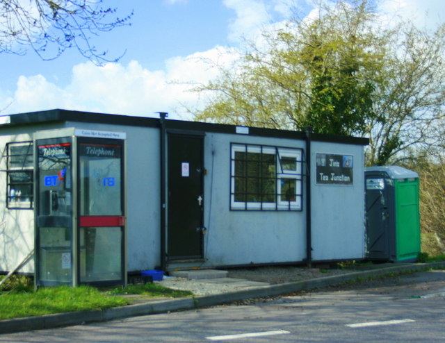
Campsites · South West England
West Wiltshire Scouts Jubilee Wood Campsite
West Wiltshire Scouts Jubilee Wood Campsite — a campsite in england south east.
 📷 7
📷 7Hotels · South West England
The Woolpack Inn
The Woolpack Inn — a hotel in england south east.
 📷 5
📷 5Hotels · South West England
The Bishopstrow Hotel & Spa
The Bishopstrow Hotel & Spa — a hotel in england south east.
 📷 5
📷 5Campsites · South West England
Botany Camping & Glamping
Botany Camping & Glamping — a campsite in england south east.
Places to eat & drink
📷 6Restaurants · South West England
New China Cottage
New China Cottage — a restaurant in england south east.
 📷 5
📷 5Historic pubs · South West England
The Old Bell Public House
The Old Bell Public House in England South West, United Kingdom.
 📷 7
📷 7Historic pubs · South West England
The Bell And Crown Public House
The Bell And Crown Public House in England South West, United Kingdom.
 📷 5
📷 5Historic pubs · South West England
The Castle Public House
The Castle Public House in England South West, United Kingdom.
 📷 7
📷 7Historic pubs · South West England
The Stallards Public House
The Stallards Public House in England South West, United Kingdom.
 📷 5
📷 5More natural landmarks in this region
 📷 5
📷 5Natural landmarks · South West England
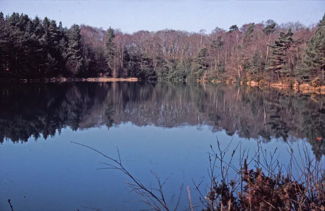
Blue Pool
Blue Pool — lake in Dorset, England, UK.
 📷 5
📷 5Natural landmarks · South West England
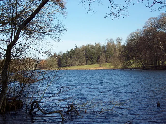
Fonthill Lake
Fonthill Lake — lake in Wiltshire, England, UK.
 📷 5
📷 5 📷 5
📷 5Natural landmarks · South West England
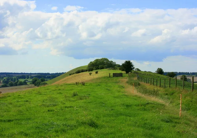
Orchardleigh Lake
Orchardleigh Lake — lake in the United Kingdom.
Frequently asked questions
- Where is Matravers School?
- Matravers School is in South-East England, United Kingdom (postcode BA13 3QH), in the parish of Westbury.
- What is Matravers School?
- Matravers School — a school heritage in england-south-east, United Kingdom.
- How do I get to Matravers School?
- The nearest railway station is Westbury, about 1.3 km away. Drivers can use postcode BA13 3QH.
- When was Matravers School built?
- Built or established in 1814.
- Is Matravers School a protected site?
- Yes — Matravers School is part of the River Avon System SSSI Site of Special Scientific Interest.
- Is Matravers School free to visit?
- Yes, Matravers School is free to enter.
- How do I get to Matravers School?
- The nearest railway station is Westbury, about 1.3 km away. Drivers can navigate to postcode BA13 3QH.