
Natural landmarks · East Midlands
Tresham College of Further and Higher Education
In or near Isham.
Tresham College of Further and Higher Education — a school heritage in england-west-midlands, United Kingdom.

Michael Trolove — CC BY-SA 2.0 via Wikimedia Commons licence

Plan your visit
- Typical visit
- 1 h–2 h
- Nearest railway station
- Wicksteed Park · 0.5 km
- Free entry
- Dog-friendly
About
Tresham College of Further and Higher Education is a school heritage located in england-west-midlands, United Kingdom. Catalogued from Wikidata's UK heritage register; see the Wikipedia article for further historical and visitor details.
Photo gallery
Official information
Tresham College of Further and Higher Education is part of The Bedford College Group, offering a range of courses from GCSEs to degree level across various subjects. The college serves the communities in Bedfordshire, Northamptonshire, and the South East Midlands, providing educational opportunities for students of all ages.
Protected designations
- Site of Special Scientific Interest: Upper Nene Valley Gravel Pits SSSI
Designations sourced from Natural England open data under OGL v3.
Place summary
Tresham College of Further and Higher Education is located in the West Midlands. It serves as an educational institution offering a range of further and higher education courses. The college is known for its commitment to vocational training and skills development.
AI-generated from the structured facts on this page (operator, designation, listing, era). Not a substitute for visiting.
Background
History
The college opened in 1978 when Kettering and Corby further education colleges merged. When Wellingborough College merged on 1 April 1992, the college became Tresham Institute of Further and Higher Education. It took over the site of Kettering Boys' School in 1993, which became its headquarters in September 1994. The college is named after the Northamptonshire dynasty and lineage of Tresham. Rutland College merged with Tresham Institute in 2000. On 8 July 2009 'Tresham Institute' became 'Tresham College of Further and Higher Education'.
Sourced from Wikipedia under CC BY-SA 4.0.
- Coordinates
- 52.3889, -0.7109
- District
- North Northamptonshire
- Parish
- Kettering Town
- Postcode
- NN15 6ER
- Parliamentary constituency
- Kettering
- Established
- 1978
- Nearest railway station
- Wicksteed Park — 0.5 km
- Official site
- www.tresham.ac.uk
Sources
- wikidata: Q7838771 (CC0)
- wikipedia: Tresham College of Further and Higher Education (CC BY-SA 4.0)
Other places nearby
Wicksteed Park Main Entrance
Parks · 0.3 km

Statue of Jerry (Charles Wicksteed's dog)
Public art & sculpture · 0.5 km
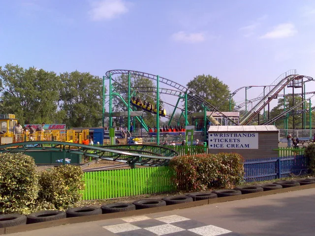
Wicksteed Park
Theme parks · 0.7 km
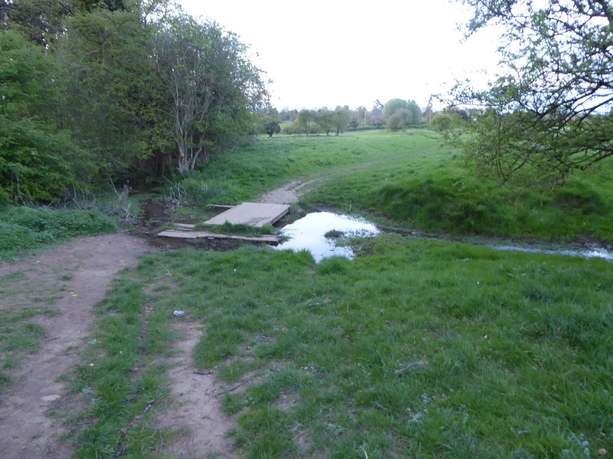
Wicksteed Park Nature Reserve
Wildlife reserves · 0.7 km

Orangery At Barton Seagrave Hall
Historic houses · 0.9 km

Barton Seagrave Castle
Castles · 0.9 km

Kettering
Museums · 0.9 km

Barton Seagrave Castle
Literary houses · 0.9 km

Wicksteed Park Camping
Campsites · 1.0 km
Church of Saint Botolph
Historic churches · 1.1 km

Kettering Muslim Association
Historic churches · 1.1 km

Kettering Savoy
Theatres · 1.2 km
Nearby
📷 3Parks · East Midlands
Wicksteed Park Main Entrance
Wicksteed Park Main Entrance — a other in england-west-midlands, United Kingdom.
📷 3Public art & sculpture · East Midlands
Statue of Jerry (Charles Wicksteed's dog)
Statue of Jerry (Charles Wicksteed's dog) — a public art in england-west-midlands, United Kingdom.
📷 3Theme parks · East Midlands
Wicksteed Park
Wicksteed Park — amusement park in Kettering, Northamptonshire, England, UK.
📷 5Wildlife reserves · East Midlands
Wicksteed Park Nature Reserve
Wicksteed Park Nature Reserve — nature reserve in the United Kingdom.
📷 3Historic houses · East Midlands
Orangery At Barton Seagrave Hall
Orangery At Barton Seagrave Hall — a Grade I-listed historic house in england-west-midlands, United Kingdom.
📷 3Castles · East Midlands
Barton Seagrave Castle
Barton Seagrave Castle — a castle in england-west-midlands, United Kingdom.
Where to eat & stay near Tresham College of Further and Higher Education
Places to stay
📷 5Campsites · East Midlands
Wicksteed Park Camping
Wicksteed Park Camping — a campsite in england west midlands.
 📷 5
📷 5 📷 5
📷 5 📷 5
📷 5 📷 5
📷 5 📷 7
📷 7Hotels · East Midlands
The Hind Hotel
The Hind Hotel — a hotel in england west midlands.
Places to eat & drink
 📷 5
📷 5Historic pubs · East Midlands
Thornhill Arms Public House
Thornhill Arms Public House in England East Midlands, United Kingdom.
 📷 5
📷 5Historic pubs · East Midlands
The Bell Inn Public House
The Bell Inn Public House in England East, United Kingdom.
 📷 5
📷 5Historic pubs · East Midlands
67 and 69 High Street
67 and 69 High Street in England East, United Kingdom.
📷 5Historic pubs · East Midlands
Mulso Arms Public House And Barns Attached To North West And South West
Mulso Arms Public House And Barns Attached To North West And South West in England East, United Kingdom.
 📷 5
📷 5Historic pubs · East Midlands
Rothwell House Hotel
Rothwell House Hotel in England East Midlands, United Kingdom.
 📷 5
📷 5Historic pubs · East Midlands
Rowell Charter Inn
Rowell Charter Inn in England East Midlands, United Kingdom.
More natural landmarks in this region
 📷 5
📷 5Natural landmarks · East Midlands
The Cage
The Cage — a other in england-london, United Kingdom.
 📷 5
📷 5Natural landmarks · East Midlands
Roman Sea Bank
Roman Sea Bank — a other in england-london, United Kingdom.
 📷 5
📷 5Natural landmarks · East Midlands
The Stamford Spa
The Stamford Spa — a other in england-london, United Kingdom.
 📷 5
📷 5Natural landmarks · East Midlands
John Clare's grave
John Clare's grave — a other in england-london, United Kingdom.
Frequently asked questions
- Where is Tresham College of Further and Higher Education?
- Tresham College of Further and Higher Education is in the West Midlands, United Kingdom (postcode NN15 6ER), in the parish of Kettering Town.
- What is Tresham College of Further and Higher Education?
- Tresham College of Further and Higher Education — a school heritage in england-west-midlands, United Kingdom.
- How do I get to Tresham College of Further and Higher Education?
- The nearest railway station is Wicksteed Park, about 0.5 km away. Drivers can use postcode NN15 6ER.
- When was Tresham College of Further and Higher Education built?
- Built or established in 1978.
- Is Tresham College of Further and Higher Education a protected site?
- Yes — Tresham College of Further and Higher Education is part of the Upper Nene Valley Gravel Pits SSSI Site of Special Scientific Interest.
- Is Tresham College of Further and Higher Education free to visit?
- Yes, Tresham College of Further and Higher Education is free to enter.
- How do I get to Tresham College of Further and Higher Education?
- The nearest railway station is Wicksteed Park, about 0.5 km away. Drivers can navigate to postcode NN15 6ER.