
Natural landmarks · East Midlands
Trent Aegir
In or near East Stockwith.
The Trent Aegir, also known as the Eagre, is a tidal bore on the River Trent in England. At certain times of the year, the lower tidal reaches of the Trent experience a moderately large bore (up to fi

Alan Murray-Rust — CC BY-SA 2.0 via Wikimedia Commons licence

Plan your visit
- Typical visit
- 1 h–2 h
- Nearest railway station
- Gainsborough Central · 5.8 km
- Dog-friendly
Getting there & planning your visit
To visit Trent Aegir, the nearest railway station is Gainsborough Central, located 5.8 km away. The postcode for the area is DN10 4HB. Entry to the site is free, and accessibility details are not specified.
About
The Trent Aegir, also known as the Eagre, is a tidal bore on the River Trent in England. At certain times of the year, the lower tidal reaches of the Trent experience a moderately large bore (up to five feet (1.5m) high). It is said to take its name from Ægir, a personification of the sea in Norse mythology, although this is disputed. A more likely derivation is from Old English ēagor (“flood, stream, water”). The Aegir occurs when a high spring tide meets the downstream flow of the river. The funnel shape of the river mouth exaggerates this effect, causing a large wave to travel upstream as far as Gainsborough, Lincolnshire, and sometimes beyond. The Aegir cannot travel much beyond Gainsborough as the shape of the river reduces the Aegir to little more than a ripple, and weirs north of Newark-on-Trent, Nottinghamshire stop its path completely. The Aegir can be seen at Gainsborough, Morton, East Stockwith, West Stockwith and Owston Ferry. The Environment Agency used to publish predictions for the occurrence of the bore, but now no longer provide these. The United Kingdom Hydrographic Office (UKHO) provides useful tidal prediction information. The UKHO have a free tidal prediction service which provides tidal times for the forthcoming week. A private prediction of the Aegir is regularly updated on an informational site about the neighbouring community of Crowle, Lincolnshire. It is alleged that King Cnut performed his purposely unsuccessful attempt to turn the tide back in…
Photo gallery
Protected designations
- Site of Special Scientific Interest: Humber Estuary - 2000480 SSSI
- Ramsar wetland: Humber Estuary
Designations sourced from Natural England open data under OGL v3.
From the Wikipedia article
The Trent Aegir, also known as the Eagre, is a tidal bore on the River Trent in England. At certain times of the year, the lower tidal reaches of the Trent experience a moderately large bore (up to five feet (1.5m) high). It is said to take its name from Ægir, a personification of the sea in Norse mythology, although this is disputed. A more likely derivation is from Old English ēagor (“flood, stream, water”). The Aegir occurs when a high spring tide meets the downstream flow of the river. The funnel shape of the river mouth exaggerates this effect, causing a large wave to travel upstream as far as Gainsborough, Lincolnshire, and sometimes beyond. The Aegir cannot travel much beyond Gainsborough as the shape of the river reduces the Aegir to little more than a ripple, and weirs north of Newark-on-Trent, Nottinghamshire stop its path completely. The Aegir can be seen at Gainsborough, Morton, East Stockwith, West Stockwith and Owston Ferry. The Environment Agency used to publish predictions for the occurrence of the bore, but now no longer provide these. The United Kingdom Hydrographic Office (UKHO) provides useful tidal prediction information. The UKHO have a free tidal prediction service which provides tidal times for the forthcoming week. A private prediction of the Aegir is regularly updated on an informational site about the neighbouring community of Crowle, Lincolnshire. It is alleged that King Cnut performed his purposely unsuccessful attempt to turn the tide back in the River Trent at Gainsborough. If this is the case, it is highly probable that Cnut was attempting to turn the Aegir tide. The Aegir features in Chapter 5 of George Eliot's The Mill on the Floss (1860): "Above all, the great Floss, along which they wandered with a sense of travel, to see the rushing spring-tide, the awful Eagre, come up like a hungry monster." Thomas Cooper references the Aegir (spelled 'Heygre') in his autobiography: "The 'Heygre' was our great excitement on the Trent. It used…
Excerpt from Wikipedia under CC BY-SA 4.0. See the source article linked in Sources below.
- Coordinates
- 53.4456, -0.8071
- County
- Nottinghamshire
- District
- Bassetlaw
- Parish
- West Stockwith
- Postcode
- DN10 4HB
- Parliamentary constituency
- Bassetlaw
- Nearest railway station
- Gainsborough Central — 5.8 km
Sources
- wikipedia: Trent Aegir (CC BY-SA 4.0)
Other places nearby
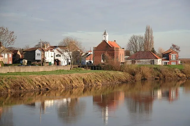
St Mary the Virgin's Church, West Stockwith
Historic churches · 0.4 km

West Stockwith
Villages · 0.5 km

East Stockwith
Towns & cities · 0.6 km

East Stockwith
Villages · 0.7 km

Waterfront Country Park
Campsites · 0.9 km

Walkerith
Historic churches · 2.1 km

Swallow Bridge, Chesterfield Canal
Historic bridges · 2.2 km

Haxey Quays
Campsites · 2.6 km

Misterton War Memorial
Memorials & monuments · 2.8 km
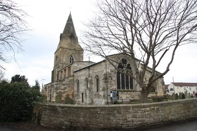
All Saints' Church, Misterton
Historic churches · 2.9 km

Misterton
Villages · 2.9 km

White House Farm Camping and Caravanning
Campsites · 2.9 km
Nearby
📷 3Historic churches · East Midlands
St Mary the Virgin's Church, West Stockwith
St Mary the Virgin's Church, West Stockwith — church in West Stockwith, Bassetlaw, Nottinghamshire, England, UK.
📷 5📷 3Towns & cities · East Midlands
East Stockwith
East Stockwith — village and civil parish in Lincolnshire, UK.
📷 5📷 5Campsites · East Midlands
Waterfront Country Park
Waterfront Country Park — a campsite in england east midlands.
📷 5Historic churches · East Midlands
Walkerith
Walkerith — a church in england-east-midlands, United Kingdom.
Where to eat & stay near Trent Aegir
Places to stay
📷 5Campsites · East Midlands
Waterfront Country Park
Waterfront Country Park — a campsite in england east midlands.
📷 5📷 5Campsites · East Midlands
White House Farm Camping and Caravanning
White House Farm Camping and Caravanning — a campsite in england east midlands.
 📷 5
📷 5Campsites · East Midlands
Willow Fields
Willow Fields — a campsite in england east midlands.
 📷 5
📷 5Campsites · East Midlands
Sunflower Park
Sunflower Park — a campsite in england east midlands.
 📷 4
📷 4Caravan parks · East Midlands
Epworth Fields Holiday Park
Epworth Fields Holiday Park — a caravan park in england yorkshire.
Places to eat & drink
 📷 5
📷 5Historic pubs · East Midlands
Ingelby Arms Public House
Ingelby Arms Public House in England Yorkshire, United Kingdom.
 📷 7
📷 7Historic pubs · East Midlands
Black Boy Public House
Black Boy Public House in England Yorkshire, United Kingdom.
 📷 5
📷 5 📷 5
📷 5Historic pubs · East Midlands
Newcastle Arms Public House
Newcastle Arms Public House in England Yorkshire, United Kingdom.
 📷 7
📷 7Restaurants · East Midlands
Miller & Carter
Miller & Carter — a restaurant in england east midlands. Cuisine: steak. Brand: Miller & Carter.
 📷 5
📷 5Historic pubs · East Midlands
New Inn Public House
New Inn Public House in England Yorkshire, United Kingdom.
More natural landmarks in this region
 📷 5
📷 5Natural landmarks · East Midlands
The Cage
The Cage — a other in england-london, United Kingdom.
 📷 5
📷 5Natural landmarks · East Midlands
Roman Sea Bank
Roman Sea Bank — a other in england-london, United Kingdom.
 📷 5
📷 5Natural landmarks · East Midlands
The Stamford Spa
The Stamford Spa — a other in england-london, United Kingdom.
 📷 5
📷 5Natural landmarks · East Midlands
John Clare's grave
John Clare's grave — a other in england-london, United Kingdom.
Frequently asked questions
- Where is Trent Aegir?
- Trent Aegir is in Nottinghamshire, Yorkshire, United Kingdom (postcode DN10 4HB), in the parish of West Stockwith.
- What is Trent Aegir?
- The Trent Aegir, also known as the Eagre, is a tidal bore on the River Trent in England. At certain times of the year, the lower tidal reaches of the Trent experience a moderately large bore (up to fi
- How do I get to Trent Aegir?
- The nearest railway station is Gainsborough Central, about 5.8 km away. Drivers can use postcode DN10 4HB.
- Is Trent Aegir a protected site?
- Yes — Trent Aegir is part of the Humber Estuary - 2000480 SSSI Site of Special Scientific Interest and the Humber Estuary Ramsar wetland.
- How do I get to Trent Aegir?
- The nearest railway station is Gainsborough Central, about 5.8 km away. Drivers can navigate to postcode DN10 4HB.