Mountains & hills · Scottish Lowlands
Torpenhow Hill
Torpenhow Hill — mountain in scotland lowlands. Elevation: 205 m.

Adrian Taylor — CC BY-SA 2.0 via Wikimedia Commons licence
Plan your visit
- Typical visit
- 3 h–8 h
- Best time of year
- Late spring – early autumn (May–Oct)
About
Torpenhow Hill is a mountain located in scotland lowlands. Elevation: 205 m. A named British peak recorded in OpenStreetMap. Peaks are typically named on Ordnance Survey 1:50k mapping.
Photo gallery
Place summary
Torpenhow Hill is a mountain located in the Scottish Lowlands. It is known for its distinctive shape and prominence in the landscape. Visitors can expect a range of walking trails that offer varying levels of difficulty and scenic views of the surrounding area. The hill is a notable feature for outdoor enthusiasts and those exploring the natural beauty of the region.
AI-generated from the structured facts on this page (operator, designation, listing, era). Not a substitute for visiting.
- Coordinates
- 54.7397, -3.2348
Sources
- osm: n8384467985 (ODbL)
- wikidata: Q7826754 (CC0)
Other places nearby
Loading nearby places…
Nearby
 📷 3
📷 3Memorials & monuments · Scottish Lowlands
Torpenhow War Memorial
Torpenhow War Memorial — Grade II listed building-listed memorial in scotland-lowlands, United Kingdom.
 📷 5
📷 5Villages · Scottish Lowlands
Torpenhow
Torpenhow — a village in scotland lowlands.
 📷 3
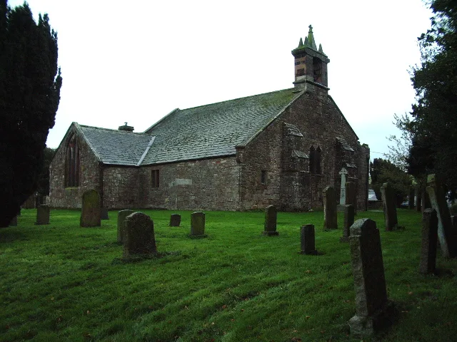
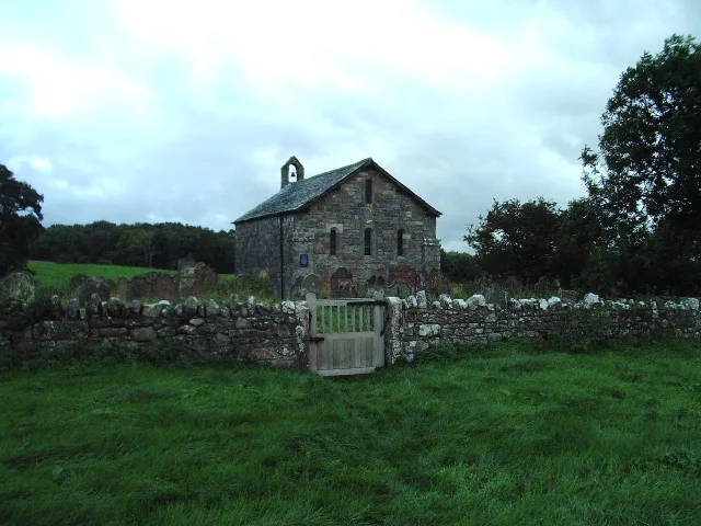
📷 3Historic churches · Scottish Lowlands
St Michael's Church, Torpenhow
St Michael's Church, Torpenhow — Grade I listed church in Blennerhasset and Torpenhow, Cumberland, Cumbria , England, UK.
 📷 3
📷 3Archaeological sites · Scottish Lowlands
Caer Mote Enclosure
Caer Mote Enclosure — a archaeological in scotland-lowlands, United Kingdom.
 📷 5
📷 5Mountains & hills · Scottish Lowlands
Caer Mot
Caer Mot — mountain in scotland lowlands. Elevation: 285 m.
 📷 5
📷 5Historic churches · Scottish Lowlands
Ireby Old Church
Ireby Old Church — church in Ireby, Cumbria, England, UK.
Where to eat & stay near Torpenhow Hill
Places to stay
 📷 3
📷 3Caravan parks · Scottish Lowlands
Larches Caravan Park
Larches Caravan Park — a caravan park in scotland lowlands.
 📷 4
📷 4Caravan parks · Scottish Lowlands
Skiddaw View Holiday Park
Skiddaw View Holiday Park — a caravan park in scotland lowlands.

Caravan parks · Scottish Lowlands
Keswick Lodge Retreat
Keswick Lodge Retreat — a caravan park in scotland lowlands.

Caravan parks · Scottish Lowlands
Threapland Park
Threapland Park — a caravan park in scotland lowlands.
 📷 5
📷 5Campsites · Scottish Lowlands
Linskeldfield Farm Camping
Linskeldfield Farm Camping — a campsite in scotland lowlands.
 📷 5
📷 5Caravan parks · Scottish Lowlands
Coal Beck Caravan Park
Coal Beck Caravan Park — a caravan park in scotland lowlands.
Places to eat & drink
 📷 5
📷 5Historic pubs · Scottish Lowlands
The Pheasant Inn
The Pheasant Inn in Scotland Lowlands, United Kingdom.
 📷 5
📷 5Historic pubs · Scottish Lowlands
Kings Arms Walter Willsons
Kings Arms Walter Willsons in Scotland Lowlands, United Kingdom.
 📷 4
📷 4Historic pubs · Scottish Lowlands
Oddfellows Arms
Oddfellows Arms — Historic pub — listed building or notable heritage status.
 📷 5
📷 5Cafés · Scottish Lowlands
YHA Cafe
YHA Cafe — a café in scotland lowlands.
 📷 5
📷 5Cafés · Scottish Lowlands
Crumbs
Crumbs — a café in scotland lowlands.
📷 5Historic pubs · Scottish Lowlands
The Blue Bell
The Blue Bell in Scotland Lowlands, United Kingdom.
More mountains in this region
 📷 3
📷 3Mountains & hills · Scottish Lowlands
Andrewhinney Hill
Andrewhinney Hill — Named summit at 677 m.
 📷 3
📷 3Mountains & hills · Scottish Lowlands
Arbory Hill
Arbory Hill — Named summit at 429 m.
 📷 3
📷 3Mountains & hills · Scottish Lowlands
Auchenton Hill ( East Mount Lowther)
Auchenton Hill ( East Mount Lowther) — Named summit at 631 m.
 📷 3
📷 3Mountains & hills · Scottish Lowlands
Bakestall
Bakestall — Named summit at 673.5 m.
Frequently asked questions
- Where is Torpenhow Hill?
- Torpenhow Hill is in the Scottish Lowlands, United Kingdom.
- What is Torpenhow Hill?
- Torpenhow Hill — mountain in scotland lowlands. Elevation: 205 m.
- How do I get to Torpenhow Hill?
- Its coordinates are 54.7397°, -3.2348°.