
Memorials & monuments · North East England
Tom Smith's Stone
In or near Alston.
Tom Smith's Stone — a memorial in scotland-lowlands, United Kingdom.

shikari — CC BY-SA 2.0 via Wikimedia Commons licence

Plan your visit
- Typical visit
- 15 min–45 min
- Nearest railway station
- Kirkhaugh · 5.4 km
- Free entry
- Dog-friendly
Getting there & planning your visit
To visit Tom Smith's Stone, the nearest railway station is Kirkhaugh, which is 5.4 km away. Entry is free. Please note that there are no specific accessibility details provided.
About
Tom Smith's Stone is a memorial located in scotland-lowlands, United Kingdom. Sourced from OpenStreetMap (ODbL licence); see local listings for visitor information, opening hours and admission details.
Photo gallery
Protected designations
- Site of Special Scientific Interest: River Eden and Tributaries SSSI
- Area of Outstanding Natural Beauty: North Pennines
Designations sourced from Natural England open data under OGL v3.
From the Wikipedia article
Black Fell is a hill in the North Pennines, England. It is located just north of the A686 road, west of Alston and is one of the most northerly parts of the Pennines. It has a height of 664 m (2,178 ft) and a prominence of 87 m (285 ft), and is classed as a Simm, Hewitt, Nuttall, Buxton & Lewis, Bridge, and Clem. It is on the Pennine watershed: streams on its eastern slopes drain into the River South Tyne and towards the North Sea, while streams on the western slopes drain into the River Eden which flows into the Solway Firth. The book Mountain Days in the Pennines recommends a "strenuous" circular walk of 18 km (11 mi) over Thack Moor and Black Fell, starting from Renwick, and describes the area as "the soft grassy fells that gather north of the A 686 ... only rarely visited by walkers".
Excerpt from Wikipedia under CC BY-SA 4.0. See the source article linked in Sources below.
- Coordinates
- 54.8121, -2.5433
- Nearest railway station
- Kirkhaugh — 5.4 km
Sources
- osm: node/9502174597 (ODbL)
- wikipedia: Tom Smith's Stone Top (CC BY-SA 4.0)
Other places nearby

Tom Smith's Stone Top
Mountains & hills · 0.4 km

Grey Nag
Mountains & hills · 1.7 km
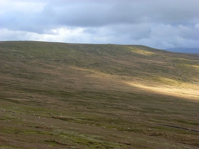
Black Fell
Mountains & hills · 2.1 km

Farlam Currick
Mountains & hills · 2.1 km
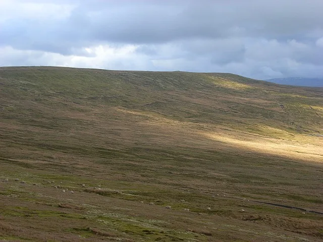
Black Fell
Natural landmarks · 2.1 km
De Havilland DH.112 Venom FB Mk 4
Museums · 2.2 km

Watcher's Hill
Mountains & hills · 2.4 km

Watch Hill
Mountains & hills · 2.5 km

Woldgill Force
Waterfalls · 2.6 km

Daffenside Beacon
Mountains & hills · 2.8 km

Black Hill
Mountains & hills · 2.9 km

Stouthard
Mountains & hills · 3.8 km
Nearby
📷 5Mountains & hills · North East England
Tom Smith's Stone Top
Tom Smith's Stone Top — mountain in scotland lowlands. Elevation: 637 m.
📷 5Mountains & hills · North East England
Grey Nag
Grey Nag — mountain in scotland lowlands. Elevation: 656 m.
📷 3📷 5Mountains & hills · North East England
Farlam Currick
Farlam Currick — mountain in scotland lowlands. Elevation: 589.5 m.
📷 3Natural landmarks · North East England
Black Fell
Black Fell — mountain in the North Pennines, England.
📷 5Museums · North East England
De Havilland DH.112 Venom FB Mk 4
De Havilland DH.112 Venom FB Mk 4 — a museum in scotland-lowlands, United Kingdom.
Where to eat & stay near Tom Smith's Stone
Places to stay
 📷 5
📷 5Caravan parks · North East England
Fell View Lake House Caravan Park
Fell View Lake House Caravan Park — a caravan park in scotland lowlands.
 📷 5
📷 5 📷 5
📷 5 📷 5📷 5
 📷 7
📷 7B&Bs · North East England
Lowbyer Manor Country House
Lowbyer Manor Country House — a bed-and-breakfast in scotland lowlands.
Places to eat & drink
 📷 4
📷 4Historic pubs · North West England
Hallbankgate
Hallbankgate in England North East, United Kingdom.
 📷 3
📷 3 📷 5
📷 5Historic pubs · North West England
Graham Arms (West Of Gelt Bridge)
Graham Arms (West Of Gelt Bridge) in Scotland Lowlands, United Kingdom.
 📷 5
📷 5 📷 7
📷 7Cafés · North West England
Narrowbar Cafe
Narrowbar Cafe — a café in scotland lowlands.
 📷 7
📷 7Historic pubs · North West England
Two Lions public house and integral stables
Two Lions public house and integral stables in Scotland Lowlands, United Kingdom.
More memorials in this region
 📷 3
📷 3Memorials & monuments · North East England
Hurworth and Neasham War Memorial
Hurworth and Neasham War Memorial — Grade II listed building-listed memorial in england-yorkshire, United Kingdom.
 📷 3
📷 3Memorials & monuments · North East England
Fryingpan Stone
Fryingpan Stone — a memorial in england-yorkshire, United Kingdom.
 📷 3
📷 3Memorials & monuments · North East England
Yoak Stone
Yoak Stone — a memorial in england-yorkshire, United Kingdom.
 📷 3
📷 3Memorials & monuments · North East England
Pump Cottage 1680
Pump Cottage 1680 — a memorial in england-yorkshire, United Kingdom.
Frequently asked questions
- Where is Tom Smith's Stone?
- Tom Smith's Stone is in the Scottish Lowlands, United Kingdom.
- What is Tom Smith's Stone?
- Tom Smith's Stone — a memorial in scotland-lowlands, United Kingdom.
- How do I get to Tom Smith's Stone?
- The nearest railway station is Kirkhaugh, about 5.4 km away. Its coordinates are 54.8121°, -2.5433°.
- Is Tom Smith's Stone a protected site?
- Yes — Tom Smith's Stone is part of the River Eden and Tributaries SSSI Site of Special Scientific Interest and the North Pennines National Landscape (AONB).
- Is Tom Smith's Stone free to visit?
- Yes, Tom Smith's Stone is free to enter.
- How do I get to Tom Smith's Stone?
- The nearest railway station is Kirkhaugh, about 5.4 km away.