Forests & woodlands · Yorkshire & the Humber
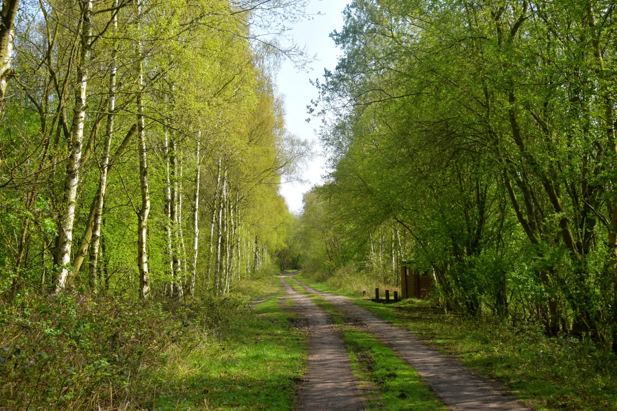
Thorpe Marsh Nature Reserve
Thorpe Marsh Nature Reserve is a forest or woodland in the United Kingdom.
.jpg?width=1200)
Wikimedia Commons contributors — see linked file page for photographer and licence licence
.jpg)
Plan your visit
- Typical visit
- 1 h–3 h
- Nearest railway station
- Kirk Sandall · 3.2 km
- Free entry
- Family-friendly
- Dog-friendly
About
Thorpe Marsh Nature Reserve is a named forest, woodland or nature reserve in the United Kingdom. Records date its origin to 1980. Coordinates: 53.5787°, -1.1165°.
Photo gallery
From the Wikipedia article
Thorpe Marsh Nature Reserve is a 77-hectare (190-acre) nature reserve located south-west of Thorpe in Balne, north of Doncaster in South Yorkshire, England. The reserve is managed and maintained by a team of volunteers under the Yorkshire Wildlife Trust as well as Doncaster Metropolitan Borough Council. The reserve shares its name with the coal-fired power station which occupied the adjacent land prior to its closure in 1994 and the demolition of its remaining cooling towers in 2012. The site is on an area of lowland susceptible to flooding (floodplain) by the River Don, thus creating an area of marshland on which the reserve sits (hence the appended "marsh").
Excerpt from Wikipedia under CC BY-SA 4.0. See the source article linked in Sources below.
- Coordinates
- 53.5787, -1.1165
- District
- Doncaster
- Parish
- Thorpe in Balne
- Postcode
- DN6 0EA
- Parliamentary constituency
- Doncaster North
- Established
- 1980
- Nearest railway station
- Kirk Sandall — 3.2 km
Sources
- osm: w306105456 (ODbL)
- wikipedia: Thorpe Marsh Nature Reserve (CC BY-SA 4.0)
- commons: Main Embankment at NMH (Thorpe Marsh Nature Reserve).jpg (CC BY-SA 4.0)
Other places nearby
Loading nearby places…
Nearby
 Flagship📷 3
Wildlife reserves · Yorkshire & the Humber
Thorpe Marsh Nature Reserve
Thorpe Marsh Nature Reserve — Nature reserve in South Yorkshire.
Caravan parks · Yorkshire & the Humber
Tilts Farm Caravan Site
Tilts Farm Caravan Site — a caravan park in england yorkshire.
Caravan parks · Yorkshire & the Humber
The Pony Paddock
The Pony Paddock — a caravan park in england yorkshire.
 📷 3
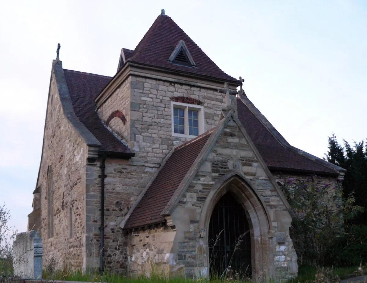
📷 3Historic churches · Yorkshire & the Humber
St Oswald's Church, Kirk Sandall
St Oswald's Church, Kirk Sandall — church in Kirk Sandall, South Yorkshire, England, UK.
 📷 3
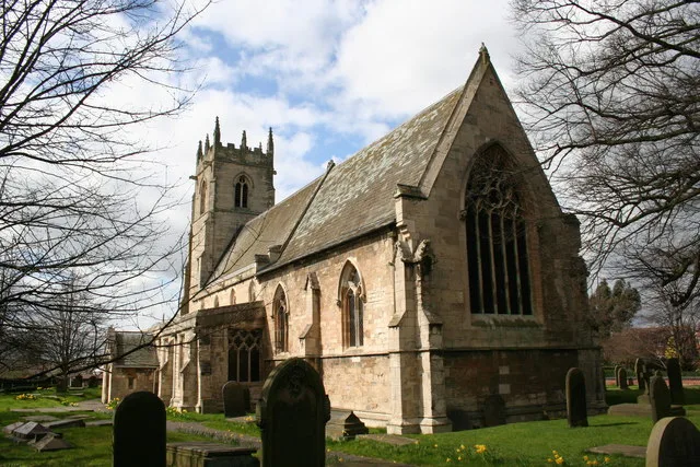
📷 3Historic churches · Yorkshire & the Humber
Church of St Peter and St Paul
Church of St Peter and St Paul — church in Barnby Dun, South Yorkshire, England, UK.
 📷 3
📷 3Memorials & monuments · Yorkshire & the Humber
Asda Price Promise Stone
Asda Price Promise Stone — a memorial in england-yorkshire, United Kingdom.
Other forests from this era
 📷 5
📷 5Forests & woodlands · London
Angel's Wings
Angel's Wings — Public artwork by Thomas Heatherwick.
 📷 5
📷 5Forests & woodlands · London
Bedford Purlieus National Nature Reserve
Bedford Purlieus National Nature Reserve is a forest or woodland in the United Kingdom.
 📷 5
📷 5Forests & woodlands · London
RSPB Fowlmere Nature Reserve
RSPB Fowlmere Nature Reserve is a forest or woodland in the United Kingdom.
 📷 5
📷 5Forests & woodlands · London
RSPB The Lodge nature reserve
RSPB The Lodge nature reserve is a forest or woodland in the United Kingdom.
More forests in this region
.JPG?width=1200) 📷 4
📷 4Forests & woodlands · Yorkshire & the Humber
Acaster South Ings SSSI
Acaster South Ings SSSI is a forest or woodland in the United Kingdom.
 📷 3
📷 3Forests & woodlands · Yorkshire & the Humber
Allerthorpe Common
Allerthorpe Common is a forest or woodland in the United Kingdom.
.jpg?width=1200) 📷 5
📷 5Forests & woodlands · Yorkshire & the Humber
Askham Bog
Askham Bog is a forest or woodland in the United Kingdom.
 📷 3
📷 3Forests & woodlands · Yorkshire & the Humber
Beckhead Plantation SSSI
Beckhead Plantation SSSI is a forest or woodland in the United Kingdom.
Frequently asked questions
- Where is Thorpe Marsh Nature Reserve?
- Thorpe Marsh Nature Reserve is in Yorkshire, United Kingdom (postcode DN6 0EA), in the parish of Thorpe in Balne.
- When was Thorpe Marsh Nature Reserve built?
- Built or established in 1980.
- Who owns Thorpe Marsh Nature Reserve?
- Thorpe Marsh Nature Reserve is owned by Yorkshire Wildlife Trust.
- Is Thorpe Marsh Nature Reserve free to visit?
- Yes, Thorpe Marsh Nature Reserve is free to enter.
- How do I get to Thorpe Marsh Nature Reserve?
- The nearest railway station is Kirk Sandall, about 3.2 km away. Drivers can navigate to postcode DN6 0EA.