
Forests & woodlands · Yorkshire & the Humber
Acaster South Ings SSSI
In or near Cawood.
Acaster South Ings SSSI is a forest or woodland in the United Kingdom.
.JPG?width=1200)
Wikimedia Commons contributors — see linked file page for photographer and licence licence
.JPG)
Plan your visit
- Typical visit
- 1 h–3 h
- Nearest railway station
- Erskine Halt · 6.6 km
- Free entry
- Family-friendly
- Dog-friendly
About
Acaster South Ings SSSI is a named forest, woodland or nature reserve in the United Kingdom. Coordinates: 53.8854°, -1.0975°. This entry is part of The Great Britain Guide, a free, ad-free, open-data tourist directory.
Photo gallery
Protected designations
- Site of Special Scientific Interest: Acaster South Ings SSSI
Designations sourced from Natural England open data under OGL v3.
From the Wikipedia article
Acaster South Ings is a Site of Special Scientific Interest, or SSSI, near York, England. It consists of two alluvial flood-meadows, and was designated in 1988 because it supports diverse fauna and flora, some of which is rare in the Vale of York area. One of the rarities is the tansy beetle, which feeds on the leaves of the tansy plant.
Excerpt from Wikipedia under CC BY-SA 4.0. See the source article linked in Sources below.
Background
Architecture
Acaster South Ings is a 38.3 ha biological Site of Special Scientific Interest (SSSI), The meadows are adjacent to the River Ouse and approximately 4 mi south of York. Such wet grasslands are considered rare in the United Kingdom due to contemporary "drainage and agricultural improvement." The site is accessed on foot via a public footpath along the Ouse riverbank, from Acaster Malbis via Acaster Marine. The SSSI was first notified in 1988, and is classified under a wildlife enhancement scheme, due to the presence of grasslands containing rare plant and insect life. It is one of nine wildlife SSSIs in the Greater York area, the other designated sites being Strensall Common, Heslington…
Sourced from Wikipedia under CC BY-SA 4.0.
- Coordinates
- 53.8854, -1.0975
- District
- North Yorkshire
- Parish
- Stillingfleet
- Postcode
- YO19 6FR
- Parliamentary constituency
- Selby
- Nearest railway station
- Erskine Halt — 6.6 km
Sources
- osm: r17906486 (ODbL)
- wikipedia: Acaster South Ings (CC BY-SA 4.0)
- commons: Acaster South Ings 9 December 2019 (18).JPG (CC BY-SA 4.0)
Other places nearby

Moreby Hall
Historic houses · 0.4 km

Bell Hall
Historic houses · 0.6 km

Home Farm
Campsites · 1.0 km

Naburn Lock Caravan Park
Caravan parks · 1.1 km

Uranus
Public art & sculpture · 1.7 km

Poplar Farm Caravan SIte
Caravan parks · 2.0 km

Naburn
Villages · 2.0 km

Chestnut Farm Holiday Park
Caravan parks · 2.0 km
Moor End Farm, Caravan & Camping Site
Campsites · 2.2 km

Millbridge Farm Camping and Caravan Park
Caravan parks · 2.4 km

Naburn Station
Hostels · 2.6 km
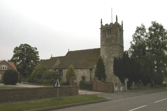
Church of St Helen
Historic churches · 2.6 km
Nearby
📷 5Historic houses · Yorkshire & the Humber
Moreby Hall
Moreby Hall — country house in North Yorkshire, England, UK.
📷 3Historic houses · Yorkshire & the Humber
Bell Hall
Bell Hall — Grade I listed building in Naburn, York, England, UK.
📷 5Campsites · Yorkshire & the Humber
Home Farm
Home Farm — a campsite in england yorkshire.
📷 5Caravan parks · Yorkshire & the Humber
Naburn Lock Caravan Park
Naburn Lock Caravan Park — a caravan park in england yorkshire.
📷 4Public art & sculpture · Yorkshire & the Humber
Uranus
Uranus — a public art in england-yorkshire, United Kingdom.
📷 5Caravan parks · Yorkshire & the Humber
Poplar Farm Caravan SIte
Poplar Farm Caravan SIte — a caravan park in england yorkshire.
Where to eat & stay near Acaster South Ings SSSI
Places to stay
📷 5Campsites · Yorkshire & the Humber
Home Farm
Home Farm — a campsite in england yorkshire.
📷 5Caravan parks · Yorkshire & the Humber
Naburn Lock Caravan Park
Naburn Lock Caravan Park — a caravan park in england yorkshire.
📷 5Caravan parks · Yorkshire & the Humber
Poplar Farm Caravan SIte
Poplar Farm Caravan SIte — a caravan park in england yorkshire.
📷 5Caravan parks · Yorkshire & the Humber
Chestnut Farm Holiday Park
Chestnut Farm Holiday Park — a caravan park in england yorkshire.
📷 5Campsites · Yorkshire & the Humber
Moor End Farm, Caravan & Camping Site
Moor End Farm, Caravan & Camping Site — a campsite in england yorkshire.
📷 5Caravan parks · Yorkshire & the Humber
Millbridge Farm Camping and Caravan Park
Millbridge Farm Camping and Caravan Park — a caravan park in england yorkshire.
Places to eat & drink
 📷 5
📷 5Cafés · Yorkshire & the Humber
Rowntree Park Reading Café
Rowntree Park Reading Café — a café in england yorkshire.
 📷 5
📷 5Historic pubs · Yorkshire & the Humber
Golden Fleece Inn, York
Golden Fleece Inn, York in England Yorkshire, United Kingdom.
 📷 7
📷 7Historic pubs · Yorkshire & the Humber
The Roman Bath Public House
The Roman Bath Public House in England Yorkshire, United Kingdom.
 📷 5
📷 5Historic pubs · Yorkshire & the Humber
The Black Swan Public House
The Black Swan Public House in England Yorkshire, United Kingdom.
 📷 5
📷 5Restaurants · Yorkshire & the Humber
La Vecchia Scuola
La Vecchia Scuola — a restaurant in england yorkshire.
 📷 7
📷 7More forests in this region
 📷 3
📷 3Forests & woodlands · Yorkshire & the Humber
Broadhurstedge Plantation
Broadhurstedge Plantation is a forest or woodland in the United Kingdom.
 📷 3
📷 3Forests & woodlands · Yorkshire & the Humber
Allerthorpe Common
Allerthorpe Common is a forest or woodland in the United Kingdom.
.jpg?width=1200) 📷 5
📷 5Forests & woodlands · Yorkshire & the Humber
Askham Bog
Askham Bog is a forest or woodland in the United Kingdom.
 📷 3
📷 3Forests & woodlands · Yorkshire & the Humber
Beckhead Plantation SSSI
Beckhead Plantation SSSI is a forest or woodland in the United Kingdom.
Frequently asked questions
- Where is Acaster South Ings SSSI?
- Acaster South Ings SSSI is in Yorkshire, United Kingdom (postcode YO19 6FR), in the parish of Stillingfleet.
- What is Acaster South Ings SSSI?
- Acaster South Ings SSSI is a forest or woodland in the United Kingdom.
- How do I get to Acaster South Ings SSSI?
- The nearest railway station is Erskine Halt, about 6.6 km away. Drivers can use postcode YO19 6FR.
- Is Acaster South Ings SSSI a protected site?
- Yes — Acaster South Ings SSSI is part of the Acaster South Ings SSSI Site of Special Scientific Interest.
- Is Acaster South Ings SSSI free to visit?
- Yes, Acaster South Ings SSSI is free to enter.
- How do I get to Acaster South Ings SSSI?
- The nearest railway station is Erskine Halt, about 6.6 km away. Drivers can navigate to postcode YO19 6FR.