
Historic churches · East Midlands
Thorpe in the Fallows
In or near Aisthorpe.
Thorpe in the Fallows, also known as Thorpe le Fallows is a small hamlet and civil parish in the West Lindsey district of Lincolnshire, England, approximately 6 miles (10 km) north from the city and c

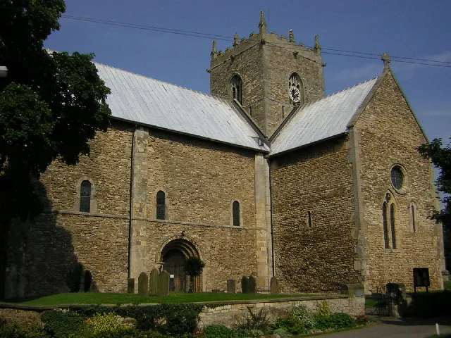
Jonathan Thacker — CC BY-SA 2.0 via Wikimedia Commons licence

Plan your visit
- Typical visit
- 30 min–1 h
- Nearest railway station
- Saxilby · 5.7 km
- Free entry
Getting there & planning your visit
To visit Thorpe in the Fallows, the nearest railway station is Saxilby, located 5.7 km away. The postcode for the church is LN1 2DR, which you can use for sat-nav coordinates. Entry is free.
About
Thorpe in the Fallows, also known as Thorpe le Fallows is a small hamlet and civil parish in the West Lindsey district of Lincolnshire, England, approximately 6 miles (10 km) north from the city and county town of Lincoln. It has sometimes been called "West Thorpe", with the nearby parish of Aisthorpe known as "East Thorpe". The population of the hamlet is included in the civil parish of Stow. The area surrounding the existing hamlet is scheduled and includes the earthwork remains of the larger medieval village, which was established before the late 11th century. Documentary evidence for a church first occurs in the mid-12th century. Following the Dissolution in the 16th century, the parish came under the ownership of the Dean of Lincoln, and in the 17th and 18th centuries the village gradually became depopulated. The church, which was dedicated to Saint Mary Magdalen, was demolished early in the 17th century. A war memorial marks the site of the church, located within a rectangular enclosure representing the churchyard, the remains of the church survive as buried building foundations.
Photo gallery
From the Wikipedia article
Thorpe in the Fallows, also known as Thorpe le Fallows is a small hamlet and civil parish in the West Lindsey district of Lincolnshire, England, approximately 6 miles (10 km) north from the city and county town of Lincoln. It has sometimes been called "West Thorpe", with the nearby parish of Aisthorpe known as "East Thorpe". The population of the hamlet is included in the civil parish of Stow. The area surrounding the existing hamlet is scheduled and includes the earthwork remains of the larger medieval village, which was established before the late 11th century. Documentary evidence for a church first occurs in the mid-12th century. Following the Dissolution in the 16th century, the parish came under the ownership of the Dean of Lincoln, and in the 17th and 18th centuries the village gradually became depopulated. The church, which was dedicated to Saint Mary Magdalen, was demolished early in the 17th century. A war memorial marks the site of the church, located within a rectangular enclosure representing the churchyard, the remains of the church survive as buried building foundations.
Excerpt from Wikipedia under CC BY-SA 4.0. See the source article linked in Sources below.
- Coordinates
- 53.3149, -0.6325
- County
- Lincolnshire
- District
- West Lindsey
- Parish
- Thorpe in the Fallows
- Postcode
- LN1 2DR
- Parliamentary constituency
- Gainsborough
- Nearest railway station
- Saxilby — 5.7 km
Sources
- wikipedia: Thorpe in the Fallows (CC BY-SA 4.0)
Other places nearby

Sturton
Villages · 2.0 km

Sturton by Stow
Historic churches · 2.2 km

Sturton by Stow Village Sign
Public art & sculpture · 2.2 km

Broxholme
Historic churches · 2.4 km

Monument 3 yards south of Church of St Edith
Memorials & monuments · 2.5 km

Stow
Villages · 3.2 km
Stow Minster
Historic churches · 3.3 km

Brattleby
Historic churches · 3.6 km
Brattleby Village Sign
Public art & sculpture · 3.6 km

Aisthorpe
Towns & cities · 3.7 km

Cammeringham
Historic churches · 3.9 km

Scampton
Museums · 4.0 km
Nearby
📷 5📷 5Historic churches · East Midlands
Sturton by Stow
Sturton by Stow — a church in england-east-midlands, United Kingdom.
📷 3Public art & sculpture · East Midlands
Sturton by Stow Village Sign
Sturton by Stow Village Sign — a public art in england-east-midlands, United Kingdom.
📷 5Historic churches · East Midlands
Broxholme
Broxholme — a church in england-east-midlands, United Kingdom.
📷 3Memorials & monuments · East Midlands
Monument 3 yards south of Church of St Edith
Monument 3 yards south of Church of St Edith — Grade II listed building-listed memorial in england-east-midlands, United Kingdom.
📷 5Where to eat & stay near Thorpe in the Fallows
Places to stay
 📷 5
📷 5 📷 5
📷 5Caravan parks · East Midlands
Little London Park
Little London Park — a caravan park in england east midlands.
 📷 5
📷 5Caravan parks · East Midlands
Stonecliff Park
Stonecliff Park — a caravan park in england east midlands.
 📷 5
📷 5Campsites · East Midlands
Decoy Farm Campsite
Decoy Farm Campsite — a campsite in england east midlands.
 📷 5
📷 5Campsites · East Midlands
Trentfield Farm
Trentfield Farm — a campsite in england east midlands.
 📷 5
📷 5Campsites · East Midlands
Welton Manor Camp Site
Welton Manor Camp Site — a campsite in england east midlands.
Places to eat & drink
 📷 5
📷 5Historic pubs · East Midlands
Ingelby Arms Public House
Ingelby Arms Public House in England Yorkshire, United Kingdom.
 📷 5
📷 5 📷 5
📷 5 📷 5
📷 5Restaurants · East Midlands
Cafe Zoot
Cafe Zoot — a restaurant in england east midlands.
 📷 7
📷 7 📷 5
📷 5Historic pubs · East Midlands
268, High Street
268, High Street in England East Midlands, United Kingdom.
More places in this region
 📷 5
📷 5Historic churches · East Midlands
All Saints' Church, Stamford
All Saints' Church, Stamford — church in Stamford, Lincolnshire, England, UK.
 📷 5
📷 5Historic churches · East Midlands
Church of All Saints
Church of All Saints — church in Little Casterton, Rutland, United Kingdom.
 📷 5
📷 5Historic churches · East Midlands
Church of All Saints
Church of All Saints — church in Fenland, UK.
 📷 5
📷 5Historic churches · East Midlands
Church of St Leonard
Church of St Leonard — church in Fenland, UK.
Frequently asked questions
- Where is Thorpe in the Fallows?
- Thorpe in the Fallows is in Lincolnshire, the East Midlands, United Kingdom (postcode LN1 2DR), in the parish of Thorpe in the Fallows.
- What is Thorpe in the Fallows?
- Thorpe in the Fallows, also known as Thorpe le Fallows is a small hamlet and civil parish in the West Lindsey district of Lincolnshire, England, approximately 6 miles (10 km) north from the city and c
- How do I get to Thorpe in the Fallows?
- The nearest railway station is Saxilby, about 5.7 km away. Drivers can use postcode LN1 2DR.
- Is Thorpe in the Fallows free to visit?
- Yes, Thorpe in the Fallows is free to enter.
- How do I get to Thorpe in the Fallows?
- The nearest railway station is Saxilby, about 5.7 km away. Drivers can navigate to postcode LN1 2DR.