
Historic bridges · East Midlands
Thorough Bridge
In or near Saxondale.
Thorough Bridge — Grade II listed building-listed bridge in england-east-midlands, United Kingdom.

JThomas — CC BY-SA 2.0 via Wikimedia Commons licence

Plan your visit
- Typical visit
- 15 min–30 min
- Nearest railway station
- Aslockton · 1.8 km
- Free entry
- Dog-friendly
Getting there & planning your visit
To visit Thorough Bridge, the nearest railway station is Aslockton, located 1.8 km away. The postcode for navigation is NG13 9AJ, and entry to the bridge is free.
About
Thorough Bridge is a Grade II listed building-listed bridge in england-east-midlands, United Kingdom, registered on the National Heritage List for England (NHLE entry 1393529). Listed status protects buildings and structures of special architectural or historic interest. See the linked Wikipedia article for further details.
Photo gallery
Heritage listing
Details 1778/0/10011 28-APR-06 WHATTON GRANBY LANE Thorough Bridge II Bridge. Mid C18 with later repairs. Red brick with stone cutwaters and parapet copings. Larger elliptical central arch with a smaller round arch either side. This well detailed and little altered triple-span bridge carries the road over the River Smite and appears on Chapman's map of Nottinghamshire, 1774. Legacy The contents of this record have been generated from a legacy data system. Legacy System number: 491534 Legacy System: LBS
From the Historic England List Entry under OGL v3.
Place summary
Thorough Bridge is a Grade II listed building located in the East Midlands. This bridge is notable for its architectural significance and historical value within the region.
AI-generated from the structured facts on this page (operator, designation, listing, era). Not a substitute for visiting.
- Coordinates
- 52.9406, -0.9173
- County
- Nottinghamshire
- District
- Rushcliffe
- Parish
- Aslockton
- Postcode
- NG13 9AJ
- Parliamentary constituency
- Newark
- Nearest railway station
- Aslockton — 1.8 km
Sources
- wikidata: Q26672685 (CC0)
Other places nearby

Windmill At Hillyside House
Windmills · 1.5 km

Aslockton railway station
Heritage railway stations · 1.8 km

Whatton
Villages · 1.8 km
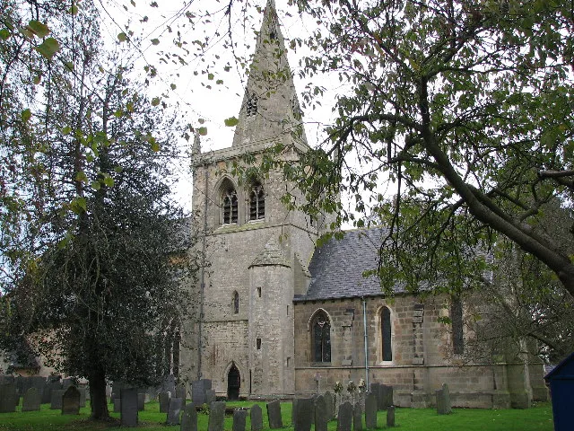
Church of St. John of Beverley, Whatton
Historic churches · 1.9 km

Crow Close
Archaeological sites · 2.0 km
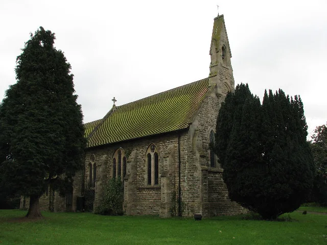
St. Thomas' Church, Aslockton
Historic churches · 2.0 km

Aslockton Cranmers Mound
Castles · 2.1 km

Cranmer's Mount
Historic houses · 2.1 km
Aslockton Castle
Castles · 2.2 km
Aslockton Castle
Literary houses · 2.2 km
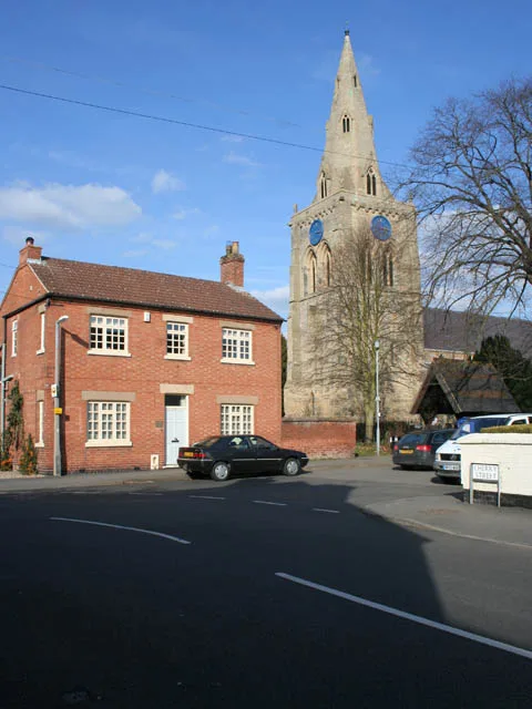
Church of St. Mary and All Saints, Bingham
Historic churches · 2.5 km

Bingham, Nottinghamshire
Museums · 2.7 km
Nearby
📷 3Windmills · East Midlands
Windmill At Hillyside House
Windmill At Hillyside House — Grade II listed building-listed windmill in england-east-midlands, United Kingdom.
📷 4Heritage railway stations · East Midlands
Aslockton railway station
Aslockton railway station — a Grade II*-listed railway station in england-east-midlands, United Kingdom.
📷 5📷 3Historic churches · East Midlands
Church of St. John of Beverley, Whatton
Church of St. John of Beverley, Whatton — church in Whatton-in-the-Vale, Rushcliffe, Nottinghamshire, England, UK.
📷 3Archaeological sites · East Midlands
Crow Close
Crow Close — a archaeological in england-east-midlands, United Kingdom.
📷 3Historic churches · East Midlands
St. Thomas' Church, Aslockton
St. Thomas' Church, Aslockton — grade II listed church in Aslockton, Rushcliffe, Nottinghamshire, England, UK.
Where to eat & stay near Thorough Bridge
Places to stay
 📷 5
📷 5 📷 5
📷 5Caravan parks · East Midlands
The Landings at Langar
The Landings at Langar — a caravan park in england east midlands.
 📷 5
📷 5B&Bs · East Midlands
East Bridgford Hill
East Bridgford Hill — a bed-and-breakfast in england east midlands.
 📷 5
📷 5Campsites · East Midlands
Gunthorpe Camping
Gunthorpe Camping — a campsite in england east midlands.
 📷 5
📷 5Caravan parks · East Midlands
Riverdale Caravan Park
Riverdale Caravan Park — a caravan park in england east midlands.
 📷 5
📷 5Campsites · East Midlands
Oddhouse Farm Glamping
Oddhouse Farm Glamping — a campsite in england east midlands.
Places to eat & drink
 📷 5
📷 5 📷 5
📷 5Historic pubs · East Midlands
The Nags Head Public (number 20) House And Attached Walls, Railings, Gate And Overthrow
The Nags Head Public (number 20) House And Attached Walls, Railings, Gate And Overthrow in England East Midlands, United Kingdom.
 📷 5
📷 5Historic pubs · East Midlands
Manvers Arms Public House
Manvers Arms Public House in England East Midlands, United Kingdom.
 📷 7
📷 7Historic pubs · East Midlands
The Muston Gap Public House
The Muston Gap Public House in England East Midlands, United Kingdom.
 📷 7
📷 7Historic pubs · East Midlands
Test Match Hotel
Test Match Hotel in England East Midlands, United Kingdom.
 📷 7
📷 7Historic pubs · East Midlands
Trent Bridge Inn
Trent Bridge Inn in England East Midlands, United Kingdom.
More bridges in this region
 📷 5
📷 5Historic bridges · East Midlands
Mill Race Bridge To Market Deeping Mill
Mill Race Bridge To Market Deeping Mill — Grade II listed building-listed bridge in england-london, United Kingdom.
 📷 5
📷 5Historic bridges · East Midlands
Bridge Over West Glen River
Bridge Over West Glen River — Grade II listed building-listed bridge in england-london, United Kingdom.
 📷 5
📷 5Historic bridges · East Midlands
Bridge And Sluices
Bridge And Sluices — Grade II listed building-listed bridge in england-london, United Kingdom.
 📷 5
📷 5Historic bridges · East Midlands
Bridge Over River Gwash
Bridge Over River Gwash — Grade II listed building-listed bridge in england-london, United Kingdom.
Frequently asked questions
- Where is Thorough Bridge?
- Thorough Bridge is in Nottinghamshire, the East Midlands, United Kingdom (postcode NG13 9AJ), in the parish of Aslockton.
- What is Thorough Bridge?
- Thorough Bridge — Grade II listed building-listed bridge in england-east-midlands, United Kingdom.
- How do I get to Thorough Bridge?
- The nearest railway station is Aslockton, about 1.8 km away. Drivers can use postcode NG13 9AJ.
- Is Thorough Bridge a listed building?
- Thorough Bridge is officially recognised as Grade II listed building listed.
- Is Thorough Bridge free to visit?
- Yes, Thorough Bridge is free to enter.
- How do I get to Thorough Bridge?
- The nearest railway station is Aslockton, about 1.8 km away. Drivers can navigate to postcode NG13 9AJ.