
Mountains & hills · Scottish Islands
The Ward
In or near Uyeasound.
The Ward — mountain in scotland islands. Elevation: 50 m.

Mike Pennington — CC BY-SA 2.0 via Wikimedia Commons licence

Plan your visit
- Typical visit
- 3 h–8 h
- Best time of year
- Late spring – early autumn (May–Oct)
- Dog-friendly
About
The Ward is a mountain located in scotland islands. Elevation: 50 m. A named British peak recorded in OpenStreetMap. Peaks are typically named on Ordnance Survey 1:50k mapping.
Photo gallery
Place summary
The Ward is a mountain located in the Scottish Islands. It is known for its rugged terrain and scenic views typical of the region. Visitors can expect a challenging environment suitable for experienced hikers and outdoor enthusiasts. The area offers a variety of walking trails that showcase the natural beauty of the Scottish landscape.
AI-generated from the structured facts on this page (operator, designation, listing, era). Not a substitute for visiting.
- Coordinates
- 60.6731, -0.9034
- District
- Shetland Islands
- Postcode
- ZE2 9EH
- Parliamentary constituency
- Orkney and Shetland
Sources
- osm: n1649497798 (ODbL)
Other places nearby
Knowe of Heogland, Chambered Cairn
Burial mounds & barrows · 0.2 km

Uyea
Islands · 0.7 km

West Beach
Beaches · 0.9 km

Saint Olaf's chapel
Historic houses · 1.2 km

Tur Ness, prehistoric houses and Norse settlement, Uyea
Vineyards · 1.3 km

South Sands
Beaches · 1.3 km

Uyea Breck Standing Stone
Windmills · 1.5 km

Clivocast
Stone circles · 1.7 km
Uyeasound Church, Unst
Historic churches · 1.7 km
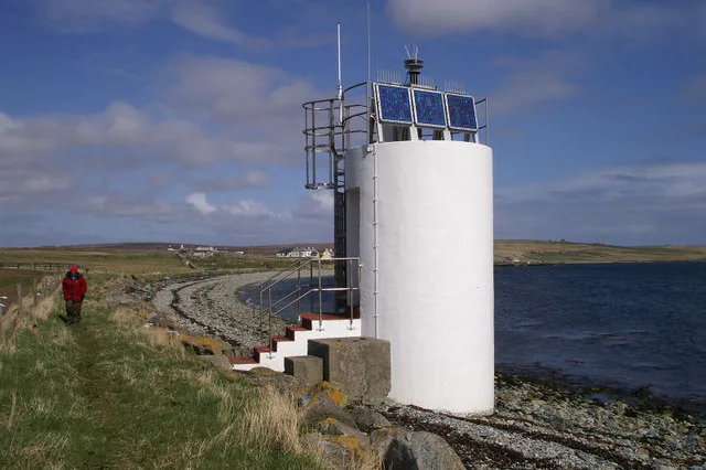
Uyea Sound Lighthouse
Lighthouses · 1.8 km

Musselbrough Harbour
Harbours & ports · 1.8 km

Gardiesfauld Caravan Park
Caravan parks · 1.9 km
Nearby
📷 5Burial mounds & barrows · Scottish Islands
Knowe of Heogland, Chambered Cairn
Knowe of Heogland, Chambered Cairn — a burial mound in scotland-islands, United Kingdom.
📷 3Islands · Scottish Islands
Uyea
Uyea — island to the south of Unst, Shetland Islands, Scotland, UK.
📷 3Historic houses · Scottish Islands
Saint Olaf's chapel
Saint Olaf's chapel — a historic house in scotland-islands, United Kingdom.
📷 5Vineyards · Scottish Islands
Tur Ness, prehistoric houses and Norse settlement, Uyea
Tur Ness, prehistoric houses and Norse settlement, Uyea — a UK vineyard in scotland islands, producing English or Welsh wine from cool-climate grape varieties.
📷 3Where to eat & stay near The Ward
Places to stay
📷 5Caravan parks · Scottish Islands
Gardiesfauld Caravan Park
Gardiesfauld Caravan Park — a caravan park in scotland islands.
 📷 5
📷 5Campsites · Scottish Islands
Gardiesfauld Campsite
Gardiesfauld Campsite — a campsite in scotland islands.
 📷 5
📷 5 📷 5
📷 5Hostels · Scottish Islands
Aithbank Camping Böd
Aithbank Camping Böd — a hostel in scotland islands.
 📷 5
📷 5 📷 5
📷 5Hostels · Scottish Islands
Saxa Vord resort
Saxa Vord resort — a hostel in scotland islands.
More mountains in this region
 📷 3
📷 3Mountains & hills · Scottish Islands
Acairseid Mhor
Acairseid Mhor — bay in Outer Hebrides, Scotland, UK.
 📷 3
📷 3Mountains & hills · Scottish Islands
Ainshval
Ainshval — Named summit at 781 m.
 📷 3
📷 3 📷 5
📷 5Mountains & hills · Scottish Islands
An Cliseam
An Cliseam — Named summit at 799 m.
Frequently asked questions
- Where is The Ward?
- The Ward is in the Scottish Islands, United Kingdom (postcode ZE2 9EH).
- What is The Ward?
- The Ward — mountain in scotland islands. Elevation: 50 m.
- How do I get to The Ward?
- Drivers can use postcode ZE2 9EH.
- How do I get to The Ward?
- Drivers can navigate to postcode ZE2 9EH. It sits within the Orkney and Shetland parliamentary constituency.