
Historic houses · North East England
The Town Hall
In or near Mitford.
The Town Hall in England North East, United Kingdom.

N Chadwick — CC BY-SA 2.0 via Wikimedia Commons licence

Plan your visit
- Typical visit
- 1 h–2 h
- Nearest railway station
- Morpeth · 0.7 km
- Family-friendly
- Limited wheelchair access
About
The Town Hall is a place of interest in England North East, United Kingdom — drawn from open-data sources for visitor reference. See the linked Wikipedia article for the full description.
Photo gallery
See it from the streetimagery from 2025
Imagery © Mapillary contributors, CC BY-SA 4.0
Official information
Northumberland's Premier Live Escape Games offers immersive escape room experiences where teams solve puzzles to escape themed rooms within 60 minutes. The venue features unique games like 'The Matter of the Hatter' and 'Murder on the Morpeth Express,' suitable for families and groups.
Protected designations
- Site of Special Scientific Interest: Northumberland Shore SSSI
Designations sourced from Natural England open data under OGL v3.
From the Wikipedia article
Morpeth Town Hall is a municipal building in the Market Place, Morpeth, Northumberland, England. The structure, which was the meeting place of Morpeth Borough Council, is a Grade II listed building.
Excerpt from Wikipedia under CC BY-SA 4.0. See the source article linked in Sources below.
Background
History
The building was commissioned in the early 18th century by the lord of the manor, the 3rd Earl of Carlisle. It was designed by John Vanbrugh in the Baroque style, built in rusticated ashlar stone and was completed in 1714. The design involved a symmetrical main frontage with five bays facing onto the Market Place with the end bays projected forward as towers with voussoirs and open pediments in the top stage. and the assembly hall on the first floor. In the early 19th century theatrical events took place in the town hall with Macbeth being performed there. After significant population growth, largely associated with Morpeth's status as a market town, the area became a municipal borough,…
Sourced from Wikipedia under CC BY-SA 4.0.
- Coordinates
- 55.1673, -1.6906
- District
- Northumberland
- Parish
- Morpeth
- Postcode
- NE61 1PY
- Parliamentary constituency
- North Northumberland
- Phone
- +441670 631439
- Established
- 1714
- Nearest railway station
- Morpeth — 0.7 km
- Official site
- www.northumberlandescaperooms.co.uk
Sources
- wikidata: Q26294642 (CC0)
- wikipedia: Morpeth Town Hall (CC BY-SA 4.0)
Other places nearby

Morpeth
Archaeological sites · 0.0 km
Northumberland Escape Rooms Morpeth
Escape rooms · 0.0 km
Morpeth Clock Tower
Historic houses · 0.0 km

Micah's Tea Rooms
Cafés · 0.1 km
.jpg?width=1200)
Collingwood House
Historic houses · 0.1 km

Roman Catholic Church of St Robert
Cathedrals · 0.2 km
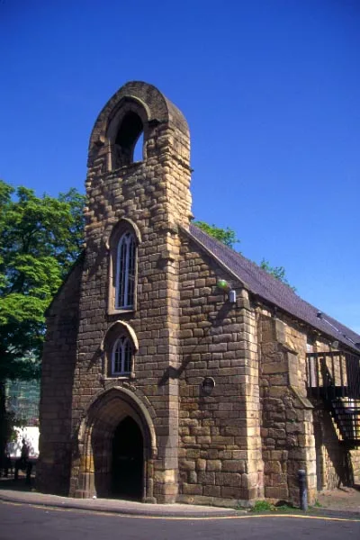
Morpeth Chantry
Historic churches · 0.2 km
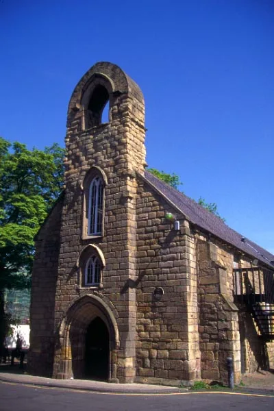
Morpeth Chantry Bagpipe Museum
Museums · 0.2 km

Telford Bridge
Historic bridges · 0.3 km

St James the Great, Morpeth
Cemeteries · 0.3 km
_63.jpg?width=1200)
Ha' Hill
Viewpoints · 0.3 km

Haw Hill
Castles · 0.3 km
Nearby
📷 4Archaeological sites · North East England
Morpeth
Morpeth in England North East, United Kingdom.
📷 3Escape rooms · North East England
Northumberland Escape Rooms Morpeth
Northumberland Escape Rooms Morpeth — a escape room in scotland-lowlands, United Kingdom.
📷 4Historic houses · North East England
Morpeth Clock Tower
Morpeth Clock Tower in England North East, United Kingdom.
📷 5📷 3Historic houses · North East England
Collingwood House
Collingwood House — house in Morpeth, Northumberland, England, UK.
📷 4Cathedrals · North East England
Roman Catholic Church of St Robert
Roman Catholic Church of St Robert in England North East, United Kingdom.
Where to eat & stay near The Town Hall
Places to stay
 📷 5
📷 5Campsites · North East England
Tranwell Farm Camp Site
Tranwell Farm Camp Site — a campsite in scotland lowlands.
 📷 5
📷 5Campsites · North East England
Selby Woods Scout Campsite
Selby Woods Scout Campsite — a campsite in scotland lowlands.
 📷 5
📷 5Caravan parks · North East England
Ellington Caravan Park
Ellington Caravan Park — a caravan park in scotland lowlands.
 📷 5
📷 5 📷 5
📷 5Caravan parks · North East England
Felmoor Park
Felmoor Park — a caravan park in scotland lowlands.
 📷 5
📷 5Places to eat & drink
📷 5 📷 5
📷 5Historic pubs · North East England
The Seven Stars Public House
The Seven Stars Public House in Scotland Lowlands, United Kingdom.
 📷 5
📷 5Historic pubs · North East England
The Anglers Arms
The Anglers Arms in Scotland Lowlands, United Kingdom.
 📷 5
📷 5Historic pubs · North East England
Northumberland Arms
Northumberland Arms in Scotland Lowlands, United Kingdom.
 📷 5
📷 5Historic pubs · North East England
Border Minstrel
Border Minstrel in Scotland Lowlands, United Kingdom.
 📷 3
📷 3Historic pubs · North East England
Red House Farm
Red House Farm in England North East, United Kingdom.
More historic houses in this region
 📷 3
📷 3Historic houses · North East England
Wayside cross known as Jenny Bradley 1000m north west of Bloworth Crossing on Greenhow Moor
Wayside cross known as Jenny Bradley 1000m north west of Bloworth Crossing on Greenhow Moor — a Grade II*-listed historic house in england-yorkshire, United Kingdom.
 📷 3
📷 3Historic houses · North East England
Crackpot Hall
Crackpot Hall — a historic house in england-north-west, United Kingdom.
 📷 3
📷 3Historic houses · North East England
Bunton Mine shop
Bunton Mine shop — a historic house in england-north-west, United Kingdom.
 📷 3
📷 3Historic houses · North East England
Blakethwaite Mine
Blakethwaite Mine — a historic house in england-north-west, United Kingdom.
Frequently asked questions
- Where is The Town Hall?
- The Town Hall is in North-East England, United Kingdom (postcode NE61 1PY), in the parish of Morpeth.
- What is The Town Hall?
- The Town Hall in England North East, United Kingdom.
- How do I get to The Town Hall?
- The nearest railway station is Morpeth, about 0.7 km away. Drivers can use postcode NE61 1PY.
- When was The Town Hall built?
- Built or established in 1714.
- Is The Town Hall a protected site?
- Yes — The Town Hall is part of the Northumberland Shore SSSI Site of Special Scientific Interest.
- How do I get to The Town Hall?
- The nearest railway station is Morpeth, about 0.7 km away. Drivers can navigate to postcode NE61 1PY.